Chelle Fisher rated Wansbrough Walk, Porongurup NP a 3 out of 5
A beautiful leisurely walk through one of the oldest national parks in the world


Trails WA supports the seven principles recommended by Leave No Trace Australia for minimising your impacts when using the trails.
Learn moreThe spectacular seasonal wildflowers and the variety of outdoor activities draw thousands of visitors to the Porongurup National Park each year.
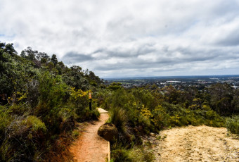
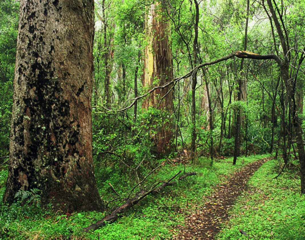
The Wansbrough Walk takes you along a track through the gully of Devil's Slide and Nancy's Peak. You will pass through both karri forests in the higher slopes and open jarrah/marri forests in the lower slopes.
Some walkers leave a car at Millingup Road the trail end, instead of walking back to the picnic area.
The Park covers an area of 2620ha, with the range extending for 12 kilometres. The area has one of the richest concentrations of plant species in Australia, with over 700 native plant species.
Information on local flora and fauna projects
Guide to the Porongurup area and walk trails. Great map
Guide to Porongurup Walks
Comprehensive information on the South West region including destinations, things to see and do, accommodation and tours.
Here is everything you need to know before visiting this trail.
Allow 2 - 4 hours return
8km return
Group B - Hiking & Long Distance Trails (Bushwalks and/or longer trails) required.
Group B - Hiking & Long Distance Trails (Bushwalks and/or longer trails)
Karri boya-k (Tree in the Rock) picnic area. 366km from Perth to Mt Barker via bus or car, then 15 minute drive to Porongurup National Park

Class 4
Difficult trail with rough surface that may have very steep hills or extensive rock hopping. Directional signage may be limited. Bushwalking experience, navigation and emergency first aid skills, and good fitness required.
Visit Trail Tips for further information.
All year round, late August to November for wildflower season
National Park Fees
Bus or car to Mt Barker. Car 2WD to Porongurup National Park


Earn points and badges and become a "TrailsWA Expert" by completing trails and leaving reviews.
Earn 2 points towards
your TrailsWA level


We love to hear from people who've been on our Western Australian trails, so it would be most appreciated it if you wanted to leave a review.


Trails are free and bring so many benefits to our community by providing opportunities to have fun, get fit, socialise, explore and challenge yourself. But they also have to be managed and maintained which only is made possible through terrific sponsors, donations and/or volunteering.


View 2 Photos of Wansbrough Walk, Porongurup NP
You are reporting a problem for Wansbrough Walk, Porongurup NP. Please be as detailed as possible to help us appropriately identify and address the issue.

Join trails wa to add this trail to your favourite. By joining you will also be able to rate and review trails and share your photos with other trail goers!
Sign in to your account to add this trail to your list of favourites, and much more.