Chelle Fisher rated The Horsepower Highway a 4 out of 5
Such an amazing drive trail, well put together and adds to the fun of roadtripping
2WD in South West

Trails WA supports the seven principles recommended by Leave No Trace Australia for minimising your impacts when using the trails.
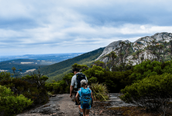
Learn moreStarting 5km south of the tiny rural town of Broomehill, the trail follows the sealed Broomehill-Gnowangerup Rd all the way through the lovely Gnowangerup township, passing through open farmland along the way, to the majestic Stirling Range National Park. This approach to the Stirlings is one of Australia's most beautiful drives.
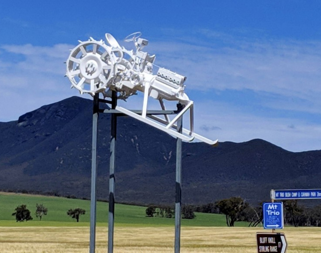
The tractors on The Horsepower Highway are examples of real-life machines that established the agricultural regions around the township of Gnowangerup. Some are displayed in their original, working state, and others have been restored to reflect the fabric and personalities that make up our local community. Each has a name, and story to tell.
Gnowangerup is a Noongar word meaning "place of the Malleefowl". We are known for this icon, the wildlflowers, and streetscape artwork. Stop for a picnic in our lovely Noborach Park (BBQs avaliable), check out the "Ned Kelly" sculpture or the superb mural featuring a rare bird from the Stirling Range National Park, the Yellow-Crested Shrike Tit.
(08) 9831 0500
Comprehensive information on the South West region including destinations, things to see and do, accommodation and tours.
Here is everything you need to know before visiting this trail.
Will depend on time taken to stop. Drive time only 45 mins.
75km
Group D - Drive Trails (Drive trails: 2WD & 4WD) required.
Group D - Drive Trails (Drive trails: 2WD & 4WD)
At the Railway crossing 5 km out of the township of Broomehill on the Broomehill-Gnowangerup Road
Public toilets are available at the Gnowangerup Township Shire Offices, behind "Lizzy", also at the Community Resource Centre in the Main Street, and at the local playground opposite the Post Office.
Anytime. September and October are Wildflower season, November & December are Harvest season
None
3.5 hours South East of Perth


Earn points and badges and become a "TrailsWA Expert" by completing trails and leaving reviews.
Earn 1 point towards
your TrailsWA level


We love to hear from people who've been on our Western Australian trails, so it would be most appreciated it if you wanted to leave a review.


Trails are free and bring so many benefits to our community by providing opportunities to have fun, get fit, socialise, explore and challenge yourself. But they also have to be managed and maintained which only is made possible through terrific sponsors, donations and/or volunteering.


View 8 Photos of The Horsepower Highway
You are reporting a problem for The Horsepower Highway. Please be as detailed as possible to help us appropriately identify and address the issue.

Join trails wa to add this trail to your favourite. By joining you will also be able to rate and review trails and share your photos with other trail goers!
Sign in to your account to add this trail to your list of favourites, and much more.