Ngank Yira Bidi, Rottnest Island Ngank Yira Bidi, Rottnest Island


Trails WA supports the seven principles recommended by Leave No Trace Australia for minimising your impacts when using the trails.
Learn moreAbout Ngank Yira Bidi, Rottnest Island
Ngank Yira Bidi is part of the greater Rottnest Island ‘Wadjemup Bidi' that involves a ~45km network of trails that will provide an exploratory narrative of the Island’s environment, connecting you with the beautiful natural features, abundance of wildlife and rich cultural history that the island has to offer. There are five primary walks linking facets of the islands diversity. The alignment of the trail was designed to allow walkers to hop on and off of the Islands bus services between sections.
Ngank Yira Bidi explores many significant historic military sites as well as diverse landscapes from coastal headlands and bays, to woodlands and inland lakes.
Ngank Yira Bidi starts in The Settlement, Thompson Bay (where the ferry arrives at the main jetty) and meanders through the south west corner of the Island through Bickley Battery and up to Oliver Hill. Traversing the Defense Heritage Trail out at Kingstown, the walk ventures west towards the picturesque Henrietta Rocks, where there is an old ship wreck that is easily accessible from shore.
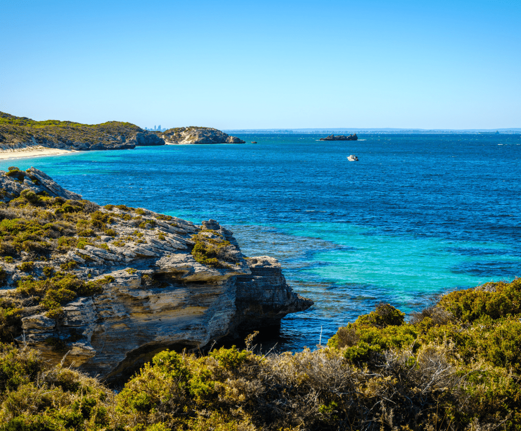
The Henrietta Rocks beach access structure, installed in 2012, gives easy access to walkers and beach goers and acts as a perfect vantage point to view the striking turquoise surrounding ocean and the snorkelers exploring around the wreck.
At this point the walk continues on along the beach and then takes a inland turn heading north into the centre of the Island. You will pass the Rottnest Island air strip and arrive at the beautiful Serpentine Salt Lake where you can expect to experience a diverse range of birdlife, both resident and migratory.
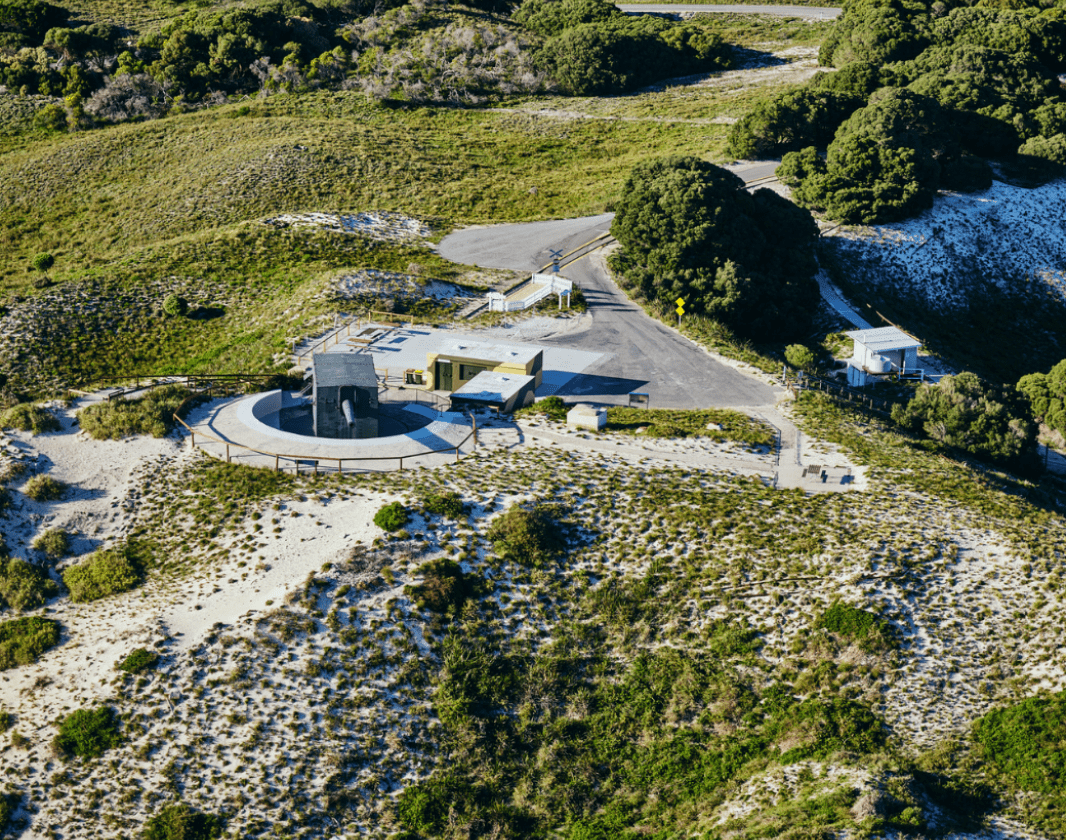
The peaceful walk along the lakes edge will take you up to Oliver Hill, where you can explore the 9.2inch Word War II gun. There are Rottnest Voluntary Guides on duty 364 days of the year; for a small fee guides can lead you through the underground tunnels, divulging the mesmerizing history that the deep dark depths of the shafts contain.
After you have completed your tour, or had a spot of lunch taking in the 360 degrees view, you may wish to relax on your journey back to the Settlement on the Rottnest Island train "Captain Hussey" (check the train schedule before you leave the settlement, as it may be on a restricted service in off peak times. Also be aware that the train can be busy during peak periods and it is recommended you get your ticket before you set off). Or you may wish to continue your adventure, heading back to the coast through the woodland heath, to uncover the splendor of Salmon Bay.
Other Links
- Wadjemup Bidi - Rottnest Island
-
Destination Perth
Comprehensive information on the Perth region including destinations, things to see and do, accommodation and tours.
Downloads
Be trail ready for Ngank Yira Bidi, Rottnest Island
Here is everything you need to know before visiting this trail.
Time / Duration
3 - 4hrs
Length
9.4km from start, Thomson Bay, to finish, Oliver Hill. This trail links to Wardan Nara Bidi at Porposie Bay and Oliver Hill.
What To Pack
Group B - Hiking & Long Distance Trails (Bushwalks and/or longer trails) required.
What To Pack
Group B - Hiking & Long Distance Trails (Bushwalks and/or longer trails)
- Sun protection: hat, sunglasses, and sunscreen (SPF 30+)
- Insect repellent
- Plenty of drinking water (as a minimum carry and drink 1 litre of water per hour of walking, per person).
- PLB or satellite phone
- Clothing to suit the activity, environment and weather conditions.
- Map/ Compass, do not rely on your phone in remote locations.
- Snacks/ Meals to keep your energy levels up on longer walks
- Extra food and water in case of unexpected delays
- Rubbish bag to remove all your rubbish
- Reference material such as wildflower wildlife guides.
- Whistle (for emergencies, six short blasts per minute)
- Small trowel for toilet emergencies, and a few sheets of toilet paper in a small waterproof bag.
- Personal first aid kit (check that items are clean, properly sealed, have not exceeded expiry dates and that used items have been replaced).
- Torch/ Headlamp
- Binoculars and camera (optional)
Additional Useful Items
+water+snorkelling equipment
+food
Trail Start
Rottnest Island Fuel Jetty (70 metres south of Visitors Centre), Rottnest Island, 18km from Western Australia Mainland.

Bush Walk
Class 4
Difficult trail with rough surface that may have very steep hills or extensive rock hopping. Directional signage may be limited. Bushwalking experience, navigation and emergency first aid skills, and good fitness required.
Visit Trail Tips for further information.
Difficulty Notes
Hazards & Warnings
Be aware there are poisonous snakes on Rottnest Island. The Dugite (Pseudonaja affinis) is a timid creature, but may bite if trod on or harrassed. Seek immediate medical assistance. Be aware of unstable rocky outcrops; always stick to the trail.Facilities
Bike hire is available at Pedal and Flipper in the settlement. There are lots of bike racks situated specifically to allow you to hop off, lock up, and enjoy the walk trail.Water available ONLY in Thomson Bay - ensure you fill up water bottles before leaving Thomson Bay. The Voluntary Guides sell bottled water at Oliver Hill and Wadjemup Lighthouse (cash only), but it may not be cold on a warm summer day!
Toilets available in Thomson Bay, The Army Jetty, Kingstown, Oliver Hill.
Shops are situated in the Settlement, Thomson Bay.
Bins and recycling points are situated at bus stops; please take all litter with you.
- BBQ Facilities
- Bicycle Rack
- Cafe
- Camping
- Lockers
- Lookouts
- Picnic Area
- Public Telephone
- Public Toilet
- Shaded Area
- Sheltered Area
- Shop
- Visitor Information Centre
- Water Access Points
Best time of year
All year round
Fees
Visitor Fees are included in ferry travel. If you are travelling by private vessel you can pay online at www.rottnestisland.com or come in to the visitors centre at the Main Jetty on the Island.
Trail Access
Ferry - Departing Perth/Fremantle (www.rottnestexpress.com.au or www.sealinkrottnest.com.au) or Hillarys Boat Harbour (www.rottnestfastferries.com.au)
Prohibited Items
No pets. No bikes on trail (Bikes are encouraged on the Island, but not on the walking trails). No Camping or open fires.

Complete Ngank Yira Bidi, Rottnest Island to earn badges and points!
Earn points and badges and become a "TrailsWA Expert" by completing trails and leaving reviews.

Earn 2 points towards
your TrailsWA level


2 trail goers have rated Ngank Yira Bidi, Rottnest Island as 4.5 out of 5!
We love to hear from people who've been on our Western Australian trails, so it would be most appreciated it if you wanted to leave a review.
Add your review of Ngank Yira Bidi, Rottnest Island
Like this trail? Explore others nearby
More around Perth & SurroundsSupported by great organisations
Trails are free and bring so many benefits to our community by providing opportunities to have fun, get fit, socialise, explore and challenge yourself. But they also have to be managed and maintained which only is made possible through terrific sponsors, donations and/or volunteering.
-(1680-×-200-px).jpeg)

View 7 Photos of Ngank Yira Bidi, Rottnest Island
Upload your photo of Ngank Yira Bidi, Rottnest Island
Report a Problem
You are reporting a problem for Ngank Yira Bidi, Rottnest Island. Please be as detailed as possible to help us appropriately identify and address the issue.


