Jandakot Regional Park Bridle Trails Jandakot Regional Park Bridle Trails


Trails WA supports the seven principles recommended by Leave No Trace Australia for minimising your impacts when using the trails.
Learn moreAbout Jandakot Regional Park Bridle Trails
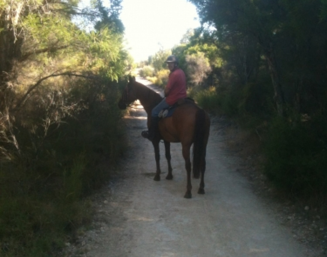
This trail network is great place to start out on your trail riding experience, as it is fenced and you cannot get totally lost.
Trails are sand and limestone so depending on where you go horses do not have to be shod. The trails get very dusty in summer and the area can be quite wet in some places in winter. There are stepovers to access the trails to stop motorbikes getting in. The Southern boundary of the park does go along a moderately busy road so you may encounter traffic, but there is a fence between you and the road. Please be courteous at all times to other users of the park, which can include walkers and dogs.
ATHRA rating - Intermediate
There is float parking at the Magenup Equestrian Centre on the western side of the park. No other facilities, unless the Magenup Equestrian Centre gates are unlocked. Entering the reserves can be difficult, but both Denis De Young and Modong reserves have multiple entry points.
Please clean up all your manure and hay before leaving.
Fremantle Visitor Centre
(08) 9431 7878
- [email protected]
- Visit website
- Walyalup Koort, 155 High Street, Fremantle WA 6160
Other Links
- Magenup Riding club
-
Destination Perth
Comprehensive information on the Perth region including destinations, things to see and do, accommodation and tours.
Be trail ready for Jandakot Regional Park Bridle Trails
Here is everything you need to know before visiting this trail.
Time / Duration
Time depends on how many trails you ride
Length
14km total length of the trails
What To Pack
Group H - Equestrian Trails (Equestrian and Horse Trekking trails) required.
What To Pack
Group H - Equestrian Trails (Equestrian and Horse Trekking trails)
- Minimum 2 litres of water per person per day
- Riding helmet (Riders under the age of 18 must wear helmets when riding in parks. It is strongly recommended that all other riders also wear helmets.)
- Appropriate riding footwear
- Additional personal protective equipment may be considered e.g. gloves, high visibility vest
- Sunglasses, sunscreen (30+) and insect repellent
- Map(s)
- Snacks
- Clothing to suit the activity, environment and weather conditions.
- Personal first aid kit and equine first aid kit for longer trails
- Binoculars and camera (optional)
- Please see further information on the Trail Tips page.
Trail End
Facilities
- Car Park
Best time of year
April to November
Trail Access
Drive to Wandi (suburb of Perth)


Complete Jandakot Regional Park Bridle Trails to earn badges and points!
Earn points and badges and become a "TrailsWA Expert" by completing trails and leaving reviews.

Earn 2 points towards
your TrailsWA level

Earn the Equestrian badge when you complete this trail.


1 trail goers have rated Jandakot Regional Park Bridle Trails as 3 out of 5!
We love to hear from people who've been on our Western Australian trails, so it would be most appreciated it if you wanted to leave a review.
Add your review of Jandakot Regional Park Bridle Trails
Like this trail? Explore others nearby
More around Perth & SurroundsSupported by great organisations
Trails are free and bring so many benefits to our community by providing opportunities to have fun, get fit, socialise, explore and challenge yourself. But they also have to be managed and maintained which only is made possible through terrific sponsors, donations and/or volunteering.
-(1680-×-200-px).jpeg)

View 4 Photos of Jandakot Regional Park Bridle Trails
Upload your photo of Jandakot Regional Park Bridle Trails
Report a Problem
You are reporting a problem for Jandakot Regional Park Bridle Trails. Please be as detailed as possible to help us appropriately identify and address the issue.


