
The Old Stock Route Trail The Old Stock Route Trail
2WD in Coral Coast

Trails WA supports the seven principles recommended by Leave No Trace Australia for minimising your impacts when using the trails.
Learn moreAbout The Old Stock Route Trail
The Old Stock Route Trail commences at the tourist pull-off bay on the Geraldton-Mount Magnet Road, Mullewa. The trail is a 102km (return) drive which retraces a portion of Stock Route (No. 9701). It includes some gravel tracks.
Features include three of the original Government wells, two natural rockholes, a nature reserve, seasonal wildflowers and ancient river beds.
Travelled at a leisurely pace it offers a half-day excursion with opportunities for picnicking and rock-climbing. In 1866 E.T. Hooley had pioneered this pathway through to the north. By the late 1890s this route was in full use as Government well-sinkers established reliable wells. In 1905 the entire network of northern and eastern stock routes became gazetted as A Class Reserves.
Please be mindful of wildlife, take rubbish with you and observe fire restrictions.
The City of Greater Geraldton respectfully acknowledges the Southern Yamatji Peoples who are the Traditional Owners and First Peoples of this land.
Geraldton Visitor Centre
(08) 9956 6670
- [email protected]
- Visit website
- 24 Chapman Road, Geraldton WA 6530
Other Links
-
The Old Stock Route Trail brochure
Download and print the brochure
-
Australia’s Coral Coast
Comprehensive information on the Coral Coast region including destinations, things to see and do, accommodation and tours.
Be trail ready for The Old Stock Route Trail
Here is everything you need to know before visiting this trail.
Time / Duration
3-4 hours
Length
102km return
What To Pack
Group D - Drive Trails (Drive trails: 2WD & 4WD) required.
What To Pack
Group D - Drive Trails (Drive trails: 2WD & 4WD)
- Ample fuel, water and non-perishable food
- Maps
- Recovery gear, spare tyres and parts
- Two-way communication
- First Aid Kit (check that items are clean, properly sealed, have not exceeded expiry dates and that used items have been replaced).
- Extra fuel and water in case you get lost or your vehicle breaks down
- Consider taking a PLB or satellite phone
- Park entry fees may apply, check the trail information on each trail to find out more
Additional Useful Items
Carry ample water,Trail Start
Tourist pull-off bay, Geraldton-Mount Magnet Road, Mullewa which is 472km (5 hours) north of Perth, or 100km east of Geraldton
Difficulty Notes
Access to some sites along the trail is rough.
Hazards & Warnings
Take into account weather conditions, Road may be closed due to flooding. Check conditions before travelling.Facilities
There are no facilities along the trail. The country is rough and quite rugged. Public toilets, visitor information, public phone, fuel and other supplies available at start of trail from Mullewa.- Camping
Best time of year
July to October
Fees
No fees
Trail Access
Road to Mullewa and Trail.


Complete The Old Stock Route Trail to earn badges and points!
Earn points and badges and become a "TrailsWA Expert" by completing trails and leaving reviews.
Earn 2 points towards
your TrailsWA level


Be the first to review The Old Stock Route Trail
We love to hear from people who've been on our Western Australian trails, so it would be most appreciated it if you wanted to leave a review.
Add your review of The Old Stock Route Trail
Like this trail? Explore others nearby
More around Coral Coast


Supported by great organisations
Trails are free and bring so many benefits to our community by providing opportunities to have fun, get fit, socialise, explore and challenge yourself. But they also have to be managed and maintained which only is made possible through terrific sponsors, donations and/or volunteering.


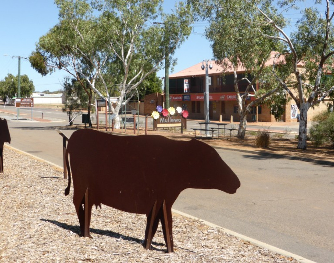
Start of Old Stock Route Trail
The Old Stock Route Trail starts in Mullewa - 100kms east of Geraldton.
Perkins No. 2 Government Well
Government wells for water supply were built along the Stock Route.
Waterfall picnic area: rugged beauty
Waterfall was used as a resting and watering place on the Stock Route
Remnants of surveyors blaze on old tree at White Well.

Wildflowers along the Trail.
The best time of year for wildflowers is between late July and October.
Tallering Peak.
Access to Tallering Peak is via Wandina Station. Contact the Station Manager on 9963 7999 for more information.View 6 Photos of The Old Stock Route Trail
Upload your photo of The Old Stock Route Trail
Report a Problem
You are reporting a problem for The Old Stock Route Trail. Please be as detailed as possible to help us appropriately identify and address the issue.
