
Wanamalu Trail, Cape Peron, Shark Bay Wanamalu Trail, Cape Peron, Shark Bay

Trails WA supports the seven principles recommended by Leave No Trace Australia for minimising your impacts when using the trails.
Learn moreAbout Wanamalu Trail, Cape Peron, Shark Bay
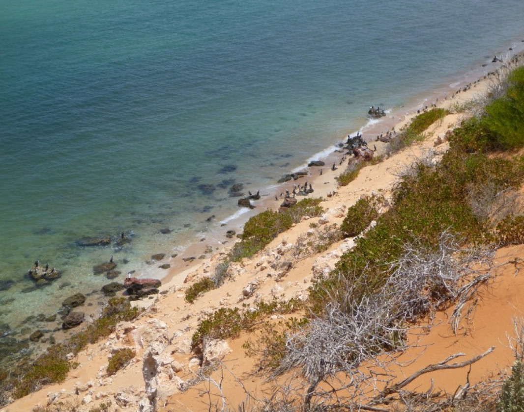
The drive to the northern tip of Francois Peron National Park goes through sections of very soft sand and requires a high clearance 4WD with low range capabiity. Cape Peron with its vivid red dunes, white beaches combined with blues seas and blue skies make a great end point. To really appreciate the raw natural beauty of this special place, there is a short walk through dunes to a couple of lookouts.
In spring, wildflowers paint the dunes in colour and the air is full of birdsong. If the wind is not whipping up whitecaps, you have a great chance of seeing a passing parade of marine life. The whole terrestrial and maritime combination makes a breathtaking sight, well worth the effort of getting there.
Shark Bay World Heritage Discovery Centre
1300 367 072
- [email protected]
- Visit website
- 53 Knight Tce, Denham WA 6537
Other Links
-
Australia’s Coral Coast
Comprehensive information on the Coral Coast region including destinations, things to see and do, accommodation and tours.
Downloads
Be trail ready for Wanamalu Trail, Cape Peron, Shark Bay
Here is everything you need to know before visiting this trail.
Time / Duration
1 hour
Length
3.6km return
What To Pack
Group B - Hiking & Long Distance Trails (Bushwalks and/or longer trails) required.
What To Pack
Group B - Hiking & Long Distance Trails (Bushwalks and/or longer trails)
- Sun protection: hat, sunglasses, and sunscreen (SPF 30+)
- Insect repellent
- Plenty of drinking water (as a minimum carry and drink 1 litre of water per hour of walking, per person).
- PLB or satellite phone
- Clothing to suit the activity, environment and weather conditions.
- Map/ Compass, do not rely on your phone in remote locations.
- Snacks/ Meals to keep your energy levels up on longer walks
- Extra food and water in case of unexpected delays
- Rubbish bag to remove all your rubbish
- Reference material such as wildflower wildlife guides.
- Whistle (for emergencies, six short blasts per minute)
- Small trowel for toilet emergencies, and a few sheets of toilet paper in a small waterproof bag.
- Personal first aid kit (check that items are clean, properly sealed, have not exceeded expiry dates and that used items have been replaced).
- Torch/ Headlamp
- Binoculars and camera (optional)
Trail End
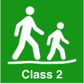
Bush Walk
Class 2
Easy trail with modified or hardened surface, and gentle hills or occasional steps. Clear directional signage. No bushwalking experience required. May be suitable for assisted wheelchair users (if ramps are provided at steps).
Visit Trail Tips for further information.
Difficulty Notes
Easy to moderate – soft sand can make it hard going in summer
Facilities
Bush Camping nearby. Full facilities in Denham and Monkey Mia- Camping
- Car Park
- Public Toilet
Best time of year
May to November
Fees
National Park Fees
Trail Access
Drive, Bus or fly to Monkey Mia. 4WD to Francois Peron National Park.


Complete Wanamalu Trail, Cape Peron, Shark Bay to earn badges and points!
Earn points and badges and become a "TrailsWA Expert" by completing trails and leaving reviews.
Earn 1 point towards
your TrailsWA level


Be the first to review Wanamalu Trail, Cape Peron, Shark Bay
We love to hear from people who've been on our Western Australian trails, so it would be most appreciated it if you wanted to leave a review.
Add your review of Wanamalu Trail, Cape Peron, Shark Bay
Like this trail? Explore others nearby
More around Coral Coast


Supported by great organisations
Trails are free and bring so many benefits to our community by providing opportunities to have fun, get fit, socialise, explore and challenge yourself. But they also have to be managed and maintained which only is made possible through terrific sponsors, donations and/or volunteering.


Skipjack Point - Lookout (East)
Pied Cormorants along the coast

Cape Peron
Cape Peron looking east
Skipjack Point - Lookout (North)
Skipjack Point heading westView 3 Photos of Wanamalu Trail, Cape Peron, Shark Bay
Upload your photo of Wanamalu Trail, Cape Peron, Shark Bay
Report a Problem
You are reporting a problem for Wanamalu Trail, Cape Peron, Shark Bay. Please be as detailed as possible to help us appropriately identify and address the issue.
