Skip to Content Skip to Navigation Show Trail Map Show About the Trail Show Important Trail Details Read Trail Reviews

Your bookings

Mt Trio, Stirling Range NP

Trail difficulty
Trail difficulty
  • Length 3.5km
  • Est. time 1-3 hours
  • Return
Today

19°C

24°

13°

Earn badges and points by completing this trail.

Earn 3 Points Stirling Range Peaks Tall Peak Wildflower Wanderer

Trails WA supports the seven principles recommended by Leave No Trace Australia for minimising your impacts when using the trails.

Learn more

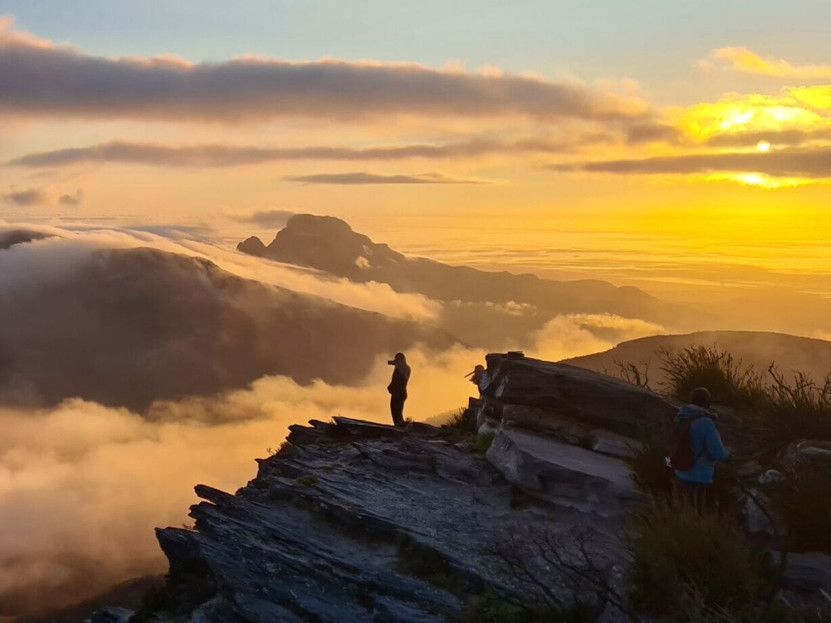
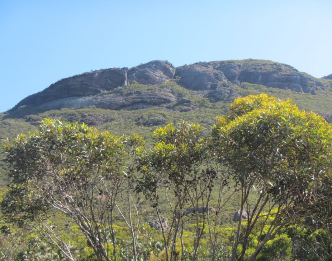
Mt Trio comprises three peaks and was once known by its Aboriginal name Warrungup, meaning "three become". The trail ascends steeply from the parking area via many steps to a saddle between the east peak and the north peak. The track then follows a more gentle slope to the highest (northern) point at 856 metres. There are excellent views from the top when the weather is clear.

More than 1500 species of flowering plants exist in the Stirling Ranges,representing almost 40 percent of the known flora of the south west. Approximately 80 species grow nowhere else in the world. Mt Trio is known for its bright red mountain bell, Darwinia lejostyla.

Albany Visitor Centre

(08) 6820 3700

Other Links

Expand your trip Browse and book with great businesses nearby.

With many businesses in the local area, planning your trip has never been easier.

Off The Beaten Track WA

Serpentine

Off The Beaten Track WA (OTBT) is Perth’s leading premier Hiking Experience & Adventure Tour operator, providing guests with over 70 safe, fun, inclusive experiences in a fully supported environment.
Want your business featured here?

We’re always looking to support local businesses and enrich the trailgoer experience.

Be trail ready

Here is everything you need to know before visiting this trail.

Time / Duration

2 - 3 hours

Length

3.5km return

Fees

National Park fees

Trail Access

Road 2WD

Trail Start

Formby South Road, Stirling Range National Park, 430 km (5 hours) south of Perth

Get directions

Trail End

Get directions

When to go

April to November

What’s the weather like?

Bush Walk

Class 4

Difficult trail with rough surface that may have very steep hills or extensive rock hopping. Directional signage may be limited. Bushwalking experience, navigation and emergency first aid skills, and good fitness required.

What To Pack

Hazards & Warnings

Not suitable to walk in wet and windy conditions. Stay on the path. Be prepared for sudden cold changes that cause the temperature todrop and rain or hail to set in.

Prohibited items

No pets; No fires in National Parks

Safety

Walk safely. All walks in the Stirling Range are steep and have uneven surfaces. Wear boots or sturdy footwear, weatherproof clothing and sun protection. Take plenty of food and carry two to three litres of drinking water per person for half to full day walks. 
Please take all your rubbish out with you.

Biodiversity

The Department of Biodiversity, Conservation and Attractions undertakes 1080 baiting at this location to reduce the impacts of feral cats and foxes on native wildlife. 

Meat baits containing 1080 poison are laid in or around this area on an ongoing basis. 1080 is poisonous to humans and will kill domestic cats and dogs. Please leave your pets at home or prevent them from entering this area.

For further information contact your local Parks and Wildlife Service office or visit Western Shield.

Facilities

  • Car Park

Trail information updated
7th May 2026

Today May 13, 6:33pm

19°C

Feels like 19°C

Max 24°

Min 13°

Precipitation: 29%

Visibility: 10km

Wind: 4.41km/h NW

Weather data provided by:

Complete this trail to earn badges and points!

Earn points and badges and become a "TrailsWA Expert" by completing trails and leaving reviews.

Earn 3 Points

Earn 3 points towards
your TrailsWA level

Tall Peak Wildflower Wanderer Stirling Range Peaks

Earn the Tall Peak , and Wildflower Wanderer badges when you complete this trail.

This trail is part of the Stirling Range Peaks badge.

8 trail goers have rated this trail as 4.12 out of 5!

We love to hear from people who've been on our Western Australian trails, so it would be most appreciated it if you wanted to leave a review.

Profile photo for Jacinta Irvine
Jacinta Irvine

Reviewed 2 May 2024, 3:31pm

Challenging but doable. Great views !
Charlene Dorelag

Reviewed 23 Apr 2023, 8:09pm

Its a beautiful 360 degrees view overlooking to golden fields its spectacular to spent sunrise you just need to be early though cause it can be very hot no trees around but overall its very full filling when you see the view
Profile photo for Jeremy Price
Jeremy Price

Reviewed 15 Apr 2023, 11:38am

Challenging walk, particularly the high steps; coming down is brutal with jelly legs. I consider myself quite fit and it tested me a bit. Stunning views, even with the foul weather.
Amy Nelson

Reviewed 6 Dec 2022, 6:58pm

Was probably one of the harder hikes ive ever done. As soon as you start the trail it is quite literally straight up for 1km and very tough. Although after the saddle it is less of an incline, it is still very steep. Took me around 1hr 30 to get up and around 45min back down. The views were good but I preferred Mt Hassel. Poles will most likely be needed as im sure if I didn't have mine I would have busted a knee
Chelle Fisher

Reviewed 27 Jul 2022, 5:53pm

Those stairs are a killer with absolutely no build up to get you warmed up but once you are up on the saddle it is a much nicer ascent to the summit. Don't forget your poles as they really do help with the knees/legs both up & down.
Steve McBride

Reviewed 20 Jul 2022, 7:35pm

Often described as an easy peak, however it’s quite a steep ascent straight up from the car park, which appears to discourage some visitors. However once you reach the saddle it’s a pleasant walk along the ridge and the views from the top along the ranges were outstanding (circa 3pm to 4pm) on a very clear day. Took us exactly an hour to ascend and we spent 30 mins at the peak absorbing the magnificent scenery. Worth it.
Wally Holding

Reviewed 4 Nov 2017, 5:30pm

A very good walk, although the first 500 m is not for the fainthearted. A good alt name would Mt ManySteps. The initial climb is very steep and should not be accomplished too fast as you WILL tire before you reach the saddle. The last portion of the walk is quite comfortable towards the peak. As with most summits, a rock cairn marks the summit. This time of the year the flowers and the views are absolutely wonderful. We wanted to hike to the second and third peaks and we found a path leading off south just at the top of the climb. It was quite hard to follow, very overgrown but does take you to the other peaks, one is a huge rock and one a summit similar to the main peak. All in all, this hike is a very good one and as with all Stirling Range walks, very satisfying to complete.
Sue Hastie

Reviewed 9 Jan 2017, 4:27pm

Great views from the the top. Recommend walking sticks as some of the steps are rather high for vertically chanllenged people like myself.

Like this trail? Explore others nearby

More around South West

Supporters & Partners

Trails are free and offer countless benefits to our community, from fostering fun and fitness to encouraging social connection, exploration, and personal challenges. These exceptional trail experiences are made possible through the support and collaboration of these great organisations and initiatives: