
Leanne Heggie rated Mt Nameless Walk Trail, Tom Price a 4 out of 5
Great morning jog, took Miss 6 too, beautiful walk, clearly marked and great views over Tom Price from top!



Trails WA supports the seven principles recommended by Leave No Trace Australia for minimising your impacts when using the trails.
Learn moreThe start of the trail can be found off Nameless Valley Drive, about 4 km from Tom Price town site, just past the speedway. There is a small gravel parking area at the start of the trail.
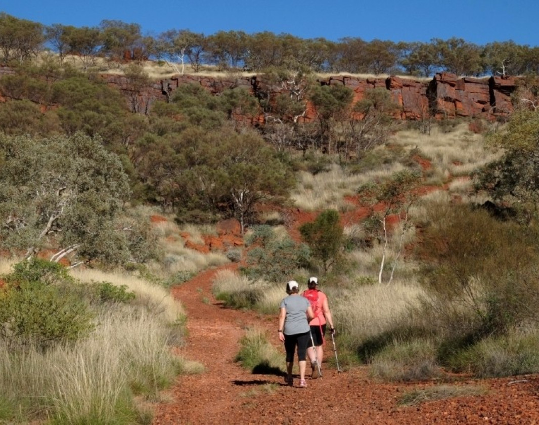
The first part of the trail requires some steep climbing and scrambling over rocks, but the latter section is a long steep path following the ridge of the hill.
From the top you can see for miles out over the Hamersley Ranges, the town of Tom Price and the Rio Tinto iron ore mine. If you are lucky you may see one of the iron ore trains winding its way into the mine to be reloaded with ore, bound for the port at Dampier.
After good rains, the hill is covered with colourful wildflowers.
This trail is best attempted in the cooler months of May to August and in the cooler part of the day. Always let someone know where you are going, wear a hat and carry plenty of drinking water.
Here is everything you need to know before visiting this trail.
4.5km return
Group B - Hiking & Long Distance Trails (Bushwalks and/or longer trails) required.
Group B - Hiking & Long Distance Trails (Bushwalks and/or longer trails)
Tom Price Tourist Park, or at base of Mt Nameless for the walk. Tom Price is 1,455km (16 hours) north of Perth

Class 4
Difficult trail with rough surface that may have very steep hills or extensive rock hopping. Directional signage may be limited. Bushwalking experience, navigation and emergency first aid skills, and good fitness required.
Visit Trail Tips for further information.
More Difficult
Low Range 4WD vehicles required with standard clearance. 4WD experience or training required.
Visit Trail Tips for further information.
May to August and early morning
No fees apply
Drive from Tom Price


Earn points and badges and become a "TrailsWA Expert" by completing trails and leaving reviews.
Earn 3 points towards
your TrailsWA level
Earn the Tall Peak badge when you complete this trail.


We love to hear from people who've been on our Western Australian trails, so it would be most appreciated it if you wanted to leave a review.


 Less than 1 hour
 0.75km
 Half day
5.1km
Half day
5.1km


Trails are free and bring so many benefits to our community by providing opportunities to have fun, get fit, socialise, explore and challenge yourself. But they also have to be managed and maintained which only is made possible through terrific sponsors, donations and/or volunteering.
-(1680-×-200-px).jpeg)


View 4 Photos of Mt Nameless Walk Trail, Tom Price
You are reporting a problem for Mt Nameless Walk Trail, Tom Price. Please be as detailed as possible to help us appropriately identify and address the issue.

Join trails wa to add this trail to your favourite. By joining you will also be able to rate and review trails and share your photos with other trail goers!
Sign in to your account to add this trail to your list of favourites, and much more.
