

Kurrajong Campground Trail, Purnululu NP Kurrajong Campground Trail, Purnululu NP

Trails WA supports the seven principles recommended by Leave No Trace Australia for minimising your impacts when using the trails.
Learn moreAbout Kurrajong Campground Trail, Purnululu NP
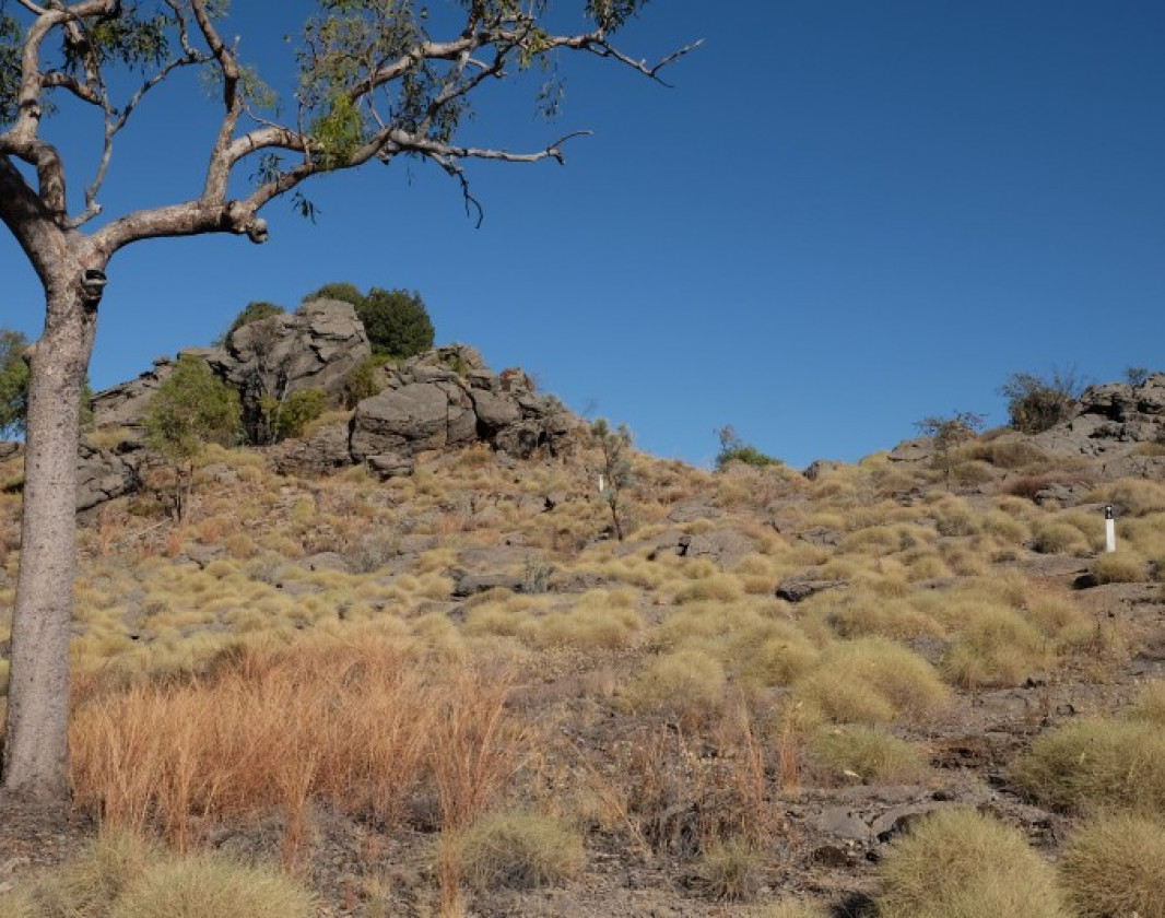
The vast plains feature typical Kimberley savannah woodland. The bright yellow flowers of the kapok stand out during the dry season. There are trailside interpretive signs of the various plant communities found in the area.
The trail gently goes up a limestone ridge with excellent views to the Bungle Bungle Range. The range was formed some 350 million years ago during the Devonian period. As it is close to the campground, the view from here is easily accessible to photographers looking for sunset shots.
Downloads
Be trail ready for Kurrajong Campground Trail, Purnululu NP
Here is everything you need to know before visiting this trail.
Time / Duration
30 minutes plus gazing time
Length
1.4km loop
What To Pack
Group A - Urban Trails (Urban trails or short trails near facilities) required.
What To Pack
Group A - Urban Trails (Urban trails or short trails near facilities)
- Full large water bottle per person
- Sun protection: hat, sunglasses, and sunscreen (SPF 30+)
- Bike helmet (compulsory in WA)
- Clothing to suit the activity, environment, and weather conditions.
- Binoculars and camera (optional)
- Daypack with comfortable shoulder straps
Additional Useful Items
See Group D items on Trail Tips page.Roads may be closed after heavy rain, check conditions before travelling.
Trail End

Bush Walk
Class 3
Moderate trail that may have short steep hills, rough surface, many steps or some rock hopping. Directional signage. Some bushwalking experience and moderate fitness required.
Visit Trail Tips for further information.
Hazards & Warnings
Temperatures can get very hot (up to 50 degrees), walk in the early morning or late afternoonFacilities
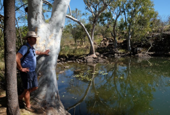
- Camping
- Car Park
- Lookouts
- Public Toilet
Best time of year
May to October. The dry season in the Kimberley
Fees
National Park Fees apply
Trail Access
2WD, Air or Bus to Halls Creek or Kununurra. 4WD track into National Park.
Prohibited Items
No pets

Complete Kurrajong Campground Trail, Purnululu NP to earn badges and points!
Earn points and badges and become a "TrailsWA Expert" by completing trails and leaving reviews.
Earn 2 points towards
your TrailsWA level


Be the first to review Kurrajong Campground Trail, Purnululu NP
We love to hear from people who've been on our Western Australian trails, so it would be most appreciated it if you wanted to leave a review.
Add your review of Kurrajong Campground Trail, Purnululu NP
Like this trail? Explore others nearby
More around North West


Savannah Trail, Mornington Wilderness Camp, Kimberley
-
 Less than 1 hour
-
1.6km

Sir John Gorge, Mornington Wilderness Camp, Kimberley
-
Less than 1 hour
-
0.3km
Seasonal Closure

Supported by great organisations
Trails are free and bring so many benefits to our community by providing opportunities to have fun, get fit, socialise, explore and challenge yourself. But they also have to be managed and maintained which only is made possible through terrific sponsors, donations and/or volunteering.


Kurrajong trail
Markers lead up the escarpment
Interpretive signage along the trail
You can join this trail at any place in the loop
Kurrajong trail high point
View of the Bungle Bungle range
Kurrajong trail escarpment
Great spot for sunset overlooking the Bungle Bungle range
Kurrajong trail escarpment
Overlooking campsite and Bungle Bungle range in the distanceView 5 Photos of Kurrajong Campground Trail, Purnululu NP
Upload your photo of Kurrajong Campground Trail, Purnululu NP
Report a Problem
You are reporting a problem for Kurrajong Campground Trail, Purnululu NP. Please be as detailed as possible to help us appropriately identify and address the issue.
