
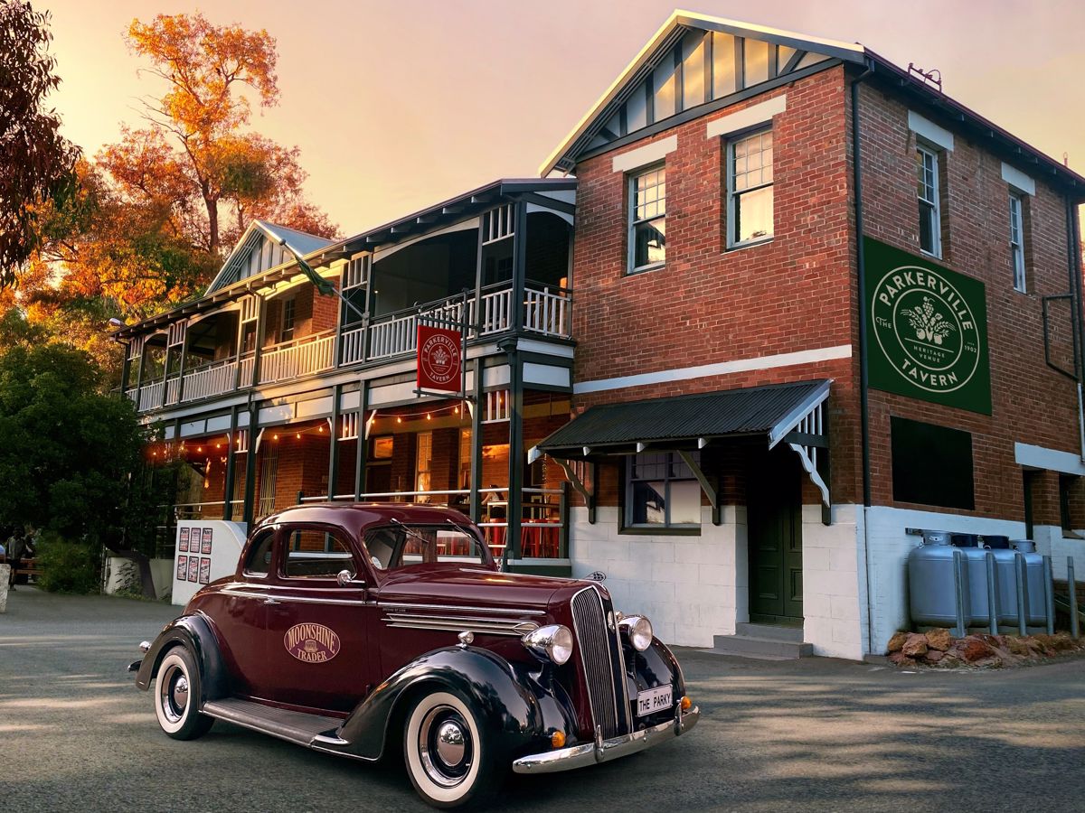
Parkerville Tavern
Situated in the Perth Hills, on the doorstep of John Forrest National Park, The Parkerville Tavern is a great Western Australian favourite. Enjoy the ambience of Perth's best beer garden.

Trails WA supports the seven principles recommended by Leave No Trace Australia for minimising your impacts when using the trails.
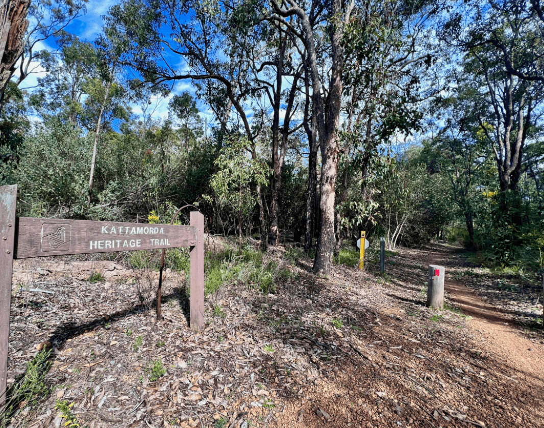
Learn moreThe Kattamorda Heritage Trail has its southern terminus at Hardinge Park, Orange Grove and the northern terminus at Mundaring Sculpture Park. Sections of quiet woodlands cause one to forget how close to amenities the trail is in many places.
The trail passes through a few parks, crosses several roads and intersects several other trails. Thus, it is easy to walk the trail in sections. However, an experienced trail runner or hiker can complete the trail in one day. Expect a few steep hills.
This 1988 bicentennial trail was re-marked between 2020 and 2022. There are a few benches to rest at and a picnic table at the original Dell crossing, which is the approximate halfway point. Some of the historic signage remains on the trail, which tells of some of the European history in the area.
Simple yellow triangles remain high in trees, but the new symbol is the paw print of the now extinct broad-faced potoroo (Noongar: 'moorda'/'morda')
(08) 9290 6645
Comprehensive information on the Perth region including destinations, things to see and do, accommodation and tours.
Situated in the Perth Hills, on the doorstep of John Forrest National Park, The Parkerville Tavern is a great Western Australian favourite. Enjoy the ambience of Perth's best beer garden.
Here is everything you need to know before visiting this trail.
4 hours trail running to 10 hours hiking
31km one way
South to North elevation gain is 760m and loss is 540m. Travelling the opposite direction will be reverse, with a net downhill
Group B - Hiking & Long Distance Trails (Bushwalks and/or longer trails) required.
Group B - Hiking & Long Distance Trails (Bushwalks and/or longer trails)
Extra water will likely be needed. Drinking water from fountains should be available at Mundaring Weir. Supplies including water might be available to purchase from a cafe/shop very near the trail in Pickering Brook at Canning Road. There is no reliable source of untreated water to collect and filter.

Class 3
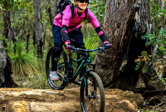
Moderate trail that may have short steep hills, rough surface, many steps or some rock hopping. Directional signage. Some bushwalking experience and moderate fitness required.
Visit Trail Tips for further information.
Easy to moderate depending on length and section of trail. One difficult climb/descent (depending on direction of travel).
Facilities on the trail vary between areas, which include Hardinge Park, The Dell, Fred Jacoby Park, Mundaring Weir, Mundaring Sculpture Park.
Extra water will likely be needed. Drinking water from fountains should be available at Mundaring Weir. Supplies including water might be available to purchase from a cafe/shop very near the trail in Pickering Brook at Canning Road. There is no reliable source of untreated water to collect and filter.
Late March through early December to avoid the hot season
Sealed 2WD Road
Dogs are permitted only in sections outside of national parks.


Earn points and badges and become a "TrailsWA Expert" by completing trails and leaving reviews.
Earn 2 points towards
your TrailsWA level


We love to hear from people who've been on our Western Australian trails, so it would be most appreciated it if you wanted to leave a review.


Trails are free and bring so many benefits to our community by providing opportunities to have fun, get fit, socialise, explore and challenge yourself. But they also have to be managed and maintained which only is made possible through terrific sponsors, donations and/or volunteering.


View 8 Photos of Kattamorda Heritage Trail
You are reporting a problem for Kattamorda Heritage Trail. Please be as detailed as possible to help us appropriately identify and address the issue.

Join trails wa to add this trail to your favourite. By joining you will also be able to rate and review trails and share your photos with other trail goers!
Sign in to your account to add this trail to your list of favourites, and much more.