Heritage Walk Trail, Carnarvon Heritage Walk Trail, Carnarvon


Trails WA supports the seven principles recommended by Leave No Trace Australia for minimising your impacts when using the trails.
Learn moreAbout Heritage Walk Trail, Carnarvon
Carnarvon's traditional owners are the Aboriginal Yinggarda people, who named this area long ago, Gwoonwardu, meaning 'neck of water'. The region's Aboriginal history is captured in the national award-winning, Gwoonwardu Mia, Aboriginal Heritage and Cultural Centre.
The first European settlement was established in 1876 setting up the pastoral station known as “Brickhouse Station”, then it was known as Mungarra Squatting Co.
By 1881 there were several pastoral stations set up, including the well-known Brown’s Range station and the Brockman Station, which led to the region being declared a municipality. Following many requests by the pastoralists for an active port out of the region and better ways to ship their products the Gascoyne Roads Board was set up in 1882 and quickly began plans to develop the economy of the region. Then in 1883 the townsite of Carnarvon was gazetted, taking its name from Henry Howard Molyneux, Fourth Earl of Carnarvon and Colonial Secretary.
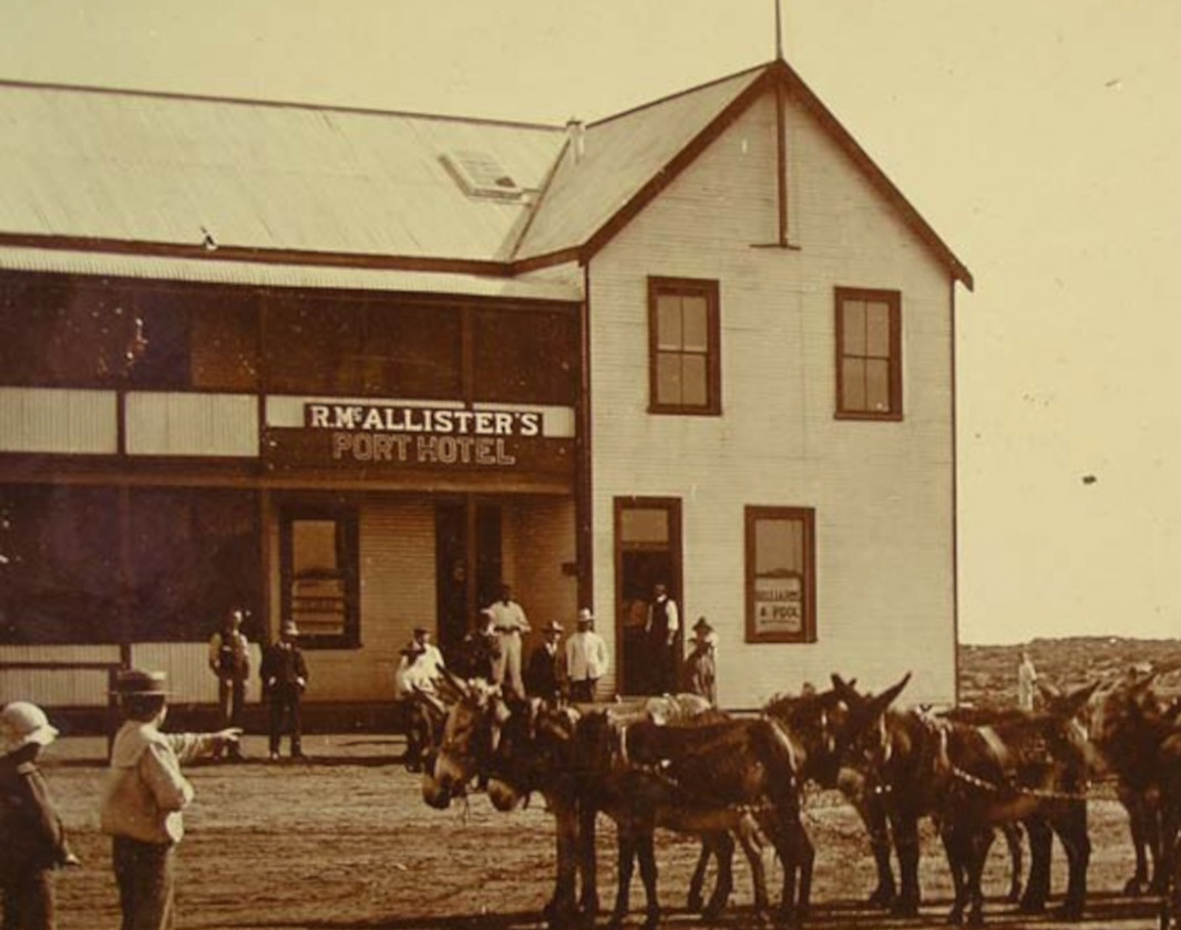
The townsite then continued to grow throughout the 1880’s adding additional services and landmarks such as the first postal/telegram service in 1884, the Port Hotel in 1885 and the first school in 1886.
The town and its population would really take off however at the turn of the century with the completion of the Carnarvon Jetty in 1899 and then the gold rush in the early 1900s would see Carnarvon boom into a centre of activity in the region.
In 1904 after the construction of additional tramway bridges, connecting the townsite to the jetty, Carnarvon’s “Mile Jetty” was opened making Carnarvon the boom port town of the area.
With the conclusion of World War 1 there was a shift of focus in the region's industries. With the incoming settlers of the soldier relocation scheme came a boom in horticultural practices including the growing of the now famous bananas and tomatoes all along newly plotted out lands on the banks of the Gascoyne River.
Throughout the first half of the twentieth century this trend would continue which the horticultural growers continued to thrive and grow while the traditional pastoralist and whaling industries would suffer under the effects of the great depression, which would continue in the region until the 1940’s.
In 1941 Carnarvon was put onto the nations map with the sinking of the German raiding vessel “Kormoran” after an engagement with the HMAS Sydney off the coast of the Gascoyne. Many German sailors managed to make it to the shoreline of Quobba Station and were rescued and taken to Carnarvon while they awaited transportation to Fremantle.
In the second half of the century the region began to modernise and develop. In the 1960’s the roads to Geraldton were bituminised which opened up the region to both economic and population booms.
The 1960’s also brought the Space Race to Carnarvon with the construction of the Overseas Telecommunications Commission (OTC) dish which was used throughout the Apollo program to relay messages from space across the world back to mission control in Florida. This was the first of its kind for Australia and the first major landmark for the people of Carnarvon. The station was eventually closed in 1976 and still serves today as a historical site and museum for the town.
Carnarvon Visitor Centre
(08) 9941 1146
- [email protected]
- Visit website
- 21 Robinson Street, Carnarvon WA 6701
Other Links
-
Australia’s Coral Coast
Comprehensive information on the Coral Coast region including destinations, things to see and do, accommodation and tours.
Be trail ready for Heritage Walk Trail, Carnarvon
Here is everything you need to know before visiting this trail.
Time / Duration
Up to 1 hour
Length
1.4km
Facilities
- Cafe
- Car Park
- Dog Friendly
- Picnic Area
- Public Toilet
- Shaded Area
- Sheltered Area
- Shop
- All accessible toilet facilities
- Visitor Information Centre
- Water Access Points
- All accessible parking
Best time of year
This trail can be completed all year round.


Complete Heritage Walk Trail, Carnarvon to earn badges and points!
Earn points and badges and become a "TrailsWA Expert" by completing trails and leaving reviews.

Earn 1 point towards
your TrailsWA level


Be the first to review Heritage Walk Trail, Carnarvon
We love to hear from people who've been on our Western Australian trails, so it would be most appreciated it if you wanted to leave a review.
Add your review of Heritage Walk Trail, Carnarvon
Like this trail? Explore others nearby
More around Coral CoastSupported by great organisations
Trails are free and bring so many benefits to our community by providing opportunities to have fun, get fit, socialise, explore and challenge yourself. But they also have to be managed and maintained which only is made possible through terrific sponsors, donations and/or volunteering.
-(1680-×-200-px).jpeg)

View 6 Photos of Heritage Walk Trail, Carnarvon
Upload your photo of Heritage Walk Trail, Carnarvon
Report a Problem
You are reporting a problem for Heritage Walk Trail, Carnarvon. Please be as detailed as possible to help us appropriately identify and address the issue.


