Skip to Content Skip to Navigation Show Trail Map Show About the Trail Show Important Trail Details Read Trail Reviews
Support Our Trails

The Western Shield wildlife recovery program is working to reduce feral animal populations to protect our unique native wildlife.

Baiting occurs on a regular basis within areas of State Forest. Part of the Rail Trail passes through this area. 1080 Baits are poisonous and will kill cats and dogs. Do not take your pets into areas baited with 1080. Check the Department of Biodiversity, Conservation and Attractions website for locations.

Collie Darkan Rail Trail Collie Darkan Rail Trail

Bush Walk

(+3)
Equestrian, Rail Trail, Adaptive
 in South West
(+1)
Bunbury Geographe & Collie, Wheatbelt & Wave Rock

  • Multiple day
  • 61.5 km
    • Bush Walk Class 2

      Easy trail with modified or hardened surface, and gentle hills or occasional steps. Clear directional signage. No bushwalking experience required. May be suitable for assisted wheelchair users (if ramps are provided at steps).

    • Mountain Bike Easy

      Recommended for beginner riders with basic mountain bike skills. Typically flowing, open trails on firm terrain with gentle gradients. Surface may be uneven, loose or muddy at times. Riders may encounter small rollable obstacles and technical trail features.

We look forward to seeing you on the second longest rail trail in the state.  The 61.5 kilometre Collie to Darkan Rail Trail passes through bush and picturesque farmlands. In springtime the area is carpeted in wildflowers. The multi-use trail is a pleasant two-day journey suitable for horse and bike riders or longer if you choose to walk.

Collie Darkan Rail Trail Darkan Trail Head K Chia
Earn 1 Point Overnight Hike Wildflower Wanderer
Logo for Leave no Trace Initiative

Trails WA supports the seven principles recommended by Leave No Trace Australia for minimising your impacts when using the trails.

Learn more

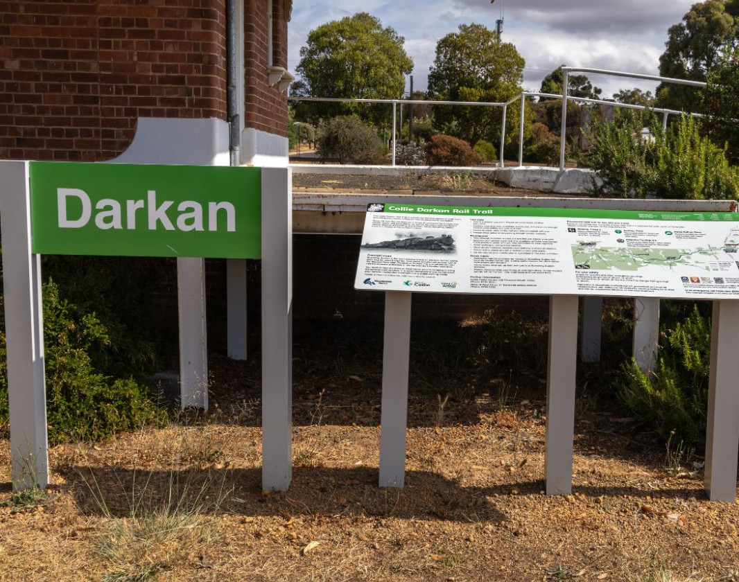
The Collie Darkan Rail Trail retraces the Collie to Narrogin railway, starting east of Collie, through the town of Darkan and beyond to Dardadine.

Being an old railway line, the Collie to Darkan trail is a relatively flat walk, cycle or horseride. The trail features a series of renovated rail bridges over creeks and rivers, farmlands, forests, an abundance of spring wildflowers, as well as the preserved railway stations of Bowelling and Darkan.  

There are two overnight stopover points - Bowelling Station (with a watertank and bench seating but no ablutions) and the Darkan Townsite where you will find camping or cabin style accommodation available in the Shire run caravan park or there are a number of private accommodation providers in town. Other siding sites along the route may be used if required. Supplies are available only in Collie and Darkan. It’s important to carry sufficient food and water for two to three days and arrange pickup at either trailhead. Interpretative signage along the trail provides information about the railway's history.

The western trailhead at Buckingham is a 18 kilometre drive from Collie, at the corner of Shotts River Road and the Coalfields Highway. The eastern end is located at Dardadine Siding.

Coalfields Road to Buckingham 1km

Buckingham to Bowelling 18km

Bowelling to Darkan 28.5km

Darkan to Dardadine 15km


Visit Collie

Experience adventure exploring the network of diverse trails, pristine lakes, waterways and river pools. Reconnect with nature in the magnificent national park or relax and soak up Collie’s rich cultural and historical heritage.

Explore Collie
Visit Collie

Shire of West Arthur

(08) 9736 2222

Collie Visitor Centre

(08) 9734 2051

Other Links

Be trail ready for Collie Darkan Rail Trail

Contact the Collie Visitor Centre for services that offer transfers to and from the trailheads. 

Shire of West Arthur (Darkan) can be contacted for information https://www.westarthur.wa.gov.au/

Time / Duration

2 days ride, longer if you walk

Length

61.5 km one way

What To Pack

Group B (Bushwalks and/or longer trails) required.

Trail Start

Buckingham - on the Coalfields Highway, 18km east of Collie (219kms southeast of Perth)

Get directions

Trail End

Dardadine interpretive sign

Get directions

Bush Walk

Class 2

Easy trail with modified or hardened surface, and gentle hills or occasional steps. Clear directional signage. No bushwalking experience required. May be suitable for assisted wheelchair users (if ramps are provided at steps).

Visit Trail Tips for further information.

Mountain Bike

Easy

Recommended for beginner riders with basic mountain bike skills. Typically flowing, open trails on firm terrain with gentle gradients. Surface may be uneven, loose or muddy at times. Riders may encounter small rollable obstacles and technical trail features.

Visit Trail Tips for further information.

Difficulty Notes

Being an old railway line, the Rail Trail is a relatively flat walk, cycle or horse ride. 

Please consider and plan for the long distances. 

Hazards & Warnings

Baiting occurs on a regular basis within areas of State Forest. Part of the Rail Trail passes through this area. 1080 Baits are poisonous and will kill cats and dogs. Do not take your pets into areas baited with 1080. 

Facilities

Overnight camping is permitted at Bowelling Station or if necessary, other sidings. Rainwater is seasonally available at Bowelling but not guaranteed, and must be treated before use. 

  • Camping
  • Car Park
  • Picnic Area
  • Public Toilet
  • Sheltered Area
  • All accessible toilet facilities
  • Visitor Information Centre

Best time of year

April to November

Fees

No fees apply

Trail Access

2WD. Approximately 200km (2 hours, 10 minutes) from Perth.

Edge shaped like mountain horizon
topography pattern

Complete Collie Darkan Rail Trail to earn badges and points!

Earn points and badges and become a "TrailsWA Expert" by completing trails and leaving reviews.

Earn 1 Point

Earn 1 point towards
your TrailsWA level

Overnight Hike Wildflower Wanderer

Earn the Overnight Hike , and Wildflower Wanderer badges when you complete this trail.

Edge shaped like mountain horizon
Alt text

7 trail goers have rated Collie Darkan Rail Trail as 4.43 out of 5!

We love to hear from people who've been on our Western Australian trails, so it would be most appreciated it if you wanted to leave a review.

Alison Melvin

Reviewed 30 Aug 2022, 8:13pm

A combination of historical significances, regional farming, natural reserves with a large array of flora and fauna. A flat rail formation for all to enjoy.
Rob Alman

Reviewed 1 Mar 2021, 10:33pm

With all but the start (Collie End) well signposted it was a pleasant ride...
Be sure to take plenty of water and snacks and let someone know when you plan to return as mobile coverage is minimal.
Robin Lonsdale

Reviewed 13 Oct 2020, 8:34pm

Well marked and easy horse trail. Stay with your horse at the caravan park, enjoy a lovely morning tea at Rarebits on Burrowes and a great dinner at the Darkan pub - you can even tie your horse up at the back of the pub while you eat (with prior permission).
Alison Kidman

Reviewed 7 Sep 2020, 6:34pm

A bit of a hidden gem. Very nice flat, well compacted trail ideal for an easy walk or cycle with children. Trail markers needed at the fork a few hundred metres from the start at the western end (go left) and at the intersection of the old and new highways (cross to the southern side).
Anita Britza

Reviewed 10 Aug 2020, 9:43pm

Fabulous scenic riding with spots to sit for lunch
Anita Britza

Reviewed 10 Aug 2020, 7:51pm

Amazing place to stay with horses at the caravan park/old pony club grounds and you ride straight out to the track. Brilliant dinner at the pub when you finish
Beryl Eatts

Reviewed 12 Feb 2017, 6:50am

Great riding trail

Like this trail? Explore others nearby

More around South West

Supported by great organisations

Trails are free and bring so many benefits to our community by providing opportunities to have fun, get fit, socialise, explore and challenge yourself. But they also have to be managed and maintained which only is made possible through terrific sponsors, donations and/or volunteering.

topography pattern