
Rest Point to Deep River, Kapagup Nornalup Paddle Network Rest Point to Deep River, Kapagup Nornalup Paddle Network
Paddle in South West
Part of
Kapagup Nornalup Paddle Trail Network
network

Trails WA supports the seven principles recommended by Leave No Trace Australia for minimising your impacts when using the trails.
Learn moreAbout Rest Point to Deep River, Kapagup Nornalup Paddle Network
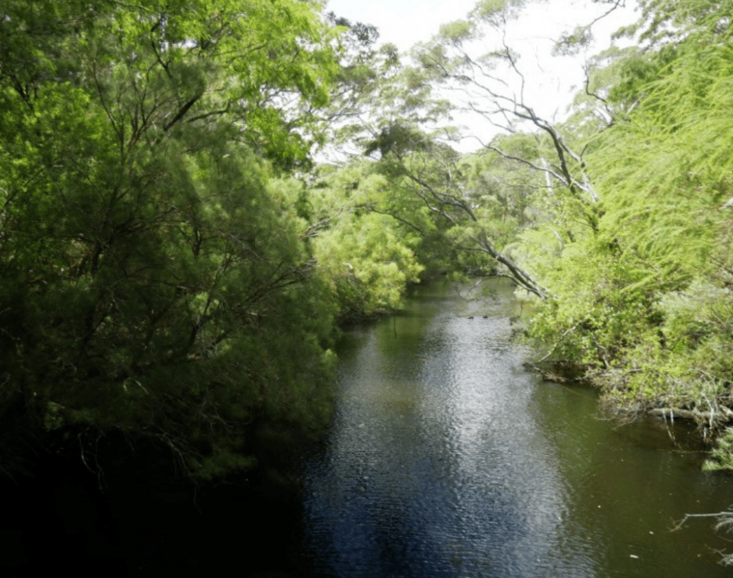
The Deep River narrows as you paddle upstream through the Walpole Nornalup National Park. This area is home to many native species such as possums, quokkas and rakali.
It flows through state forest and national parks and its 'Wild River' status was bestowed by the Australian Heritage Commission in recognition of its pristine condition.
Start your paddle at Rest Point and head through the Channel between the Knolls. Skirt around the western edge of the Nornalup Inlet and enter the Deep River. The suspension bridge high above the water marks the end of the navigable section of the Deep River.
This trail is 9.5km one way. There is no access to the water from the road at the Deep River suspension bridge. You will need to paddle back to Rest Point making it a 19km paddle.
If you would like to experience the Deep River but do a shorter paddle, you can launch at Isle Road for a 5.5km one way trip up the river to the suspension bridge.
Offering protection from the wind, the Deep River is generally classified as easy with slow to medium moving water and few obstacles.
The Nornalup Inlet is exposed to wind, waves and tidal currents and is appropriate for medium to advanced paddlers. Weather conditions can change quickly and paddlers need to ensure that their skills are sufficient to manage the trip.
You can paddle to a range of destinations from Rest Point. Look for other suggestions in the Kapagup Nornalup Paddle Network on TrailsWA or on the trailhead signage at Rest Point.
Walpole-Nornalup Visitor Centre
(08) 9840 1111
- [email protected]
- Visit website
- Pioneer Park, South Coast Highway, Walpole WA 6398
Other Links
-
Australia’s South West
Comprehensive information on the South West region including destinations, things to see and do, accommodation and tours.
Be trail ready for Rest Point to Deep River, Kapagup Nornalup Paddle Network
Here is everything you need to know before visiting this trail.
Length
9.5km one way.
What To Pack
Group F - Paddling Trails (Paddling trails) required.
What To Pack
Group F - Paddling Trails (Paddling trails)
- Plenty of water and food for the duration of trip.
- Sun protection: hat, sunglasses and sunscreen (SPF 30+)
- Clothes to suit the activity and potential weather conditions
- Lifejacket or floatation device
- EPIRB, PLB or Flares
- Leg or paddle leash if paddling in the ocean
- A paddling helmet is recommended for paddling in whitewater and surf
- Always refer to the comprehensive safety guidelines found on the individual trail listings
Additional Useful Items
• Always let someone know of your trip plans.• Check the weather forecast, tide charts and be aware of strong south-easterly winds. Conditions can change rapidly.
• Plan your trip according to your ability and fitness level.
• Wear appropriate sun protection (hat, sunscreen, long sleeves).
• Wear a life jacket.
• Take adequate drinking water.
Trail End
Facilities
- Camping
- Car Park
- Picnic Area
- Water Access Points
Trail Access
Walpole is about 430km south of Perth. Rest Point is 5km west of Walpole via the South Western Highway and Rest Point Road


Complete Rest Point to Deep River, Kapagup Nornalup Paddle Network to earn badges and points!
Earn points and badges and become a "TrailsWA Expert" by completing trails and leaving reviews.
Earn 2 points towards
your TrailsWA level
Earn the Paddle badge when you complete this trail.


Be the first to review Rest Point to Deep River, Kapagup Nornalup Paddle Network
We love to hear from people who've been on our Western Australian trails, so it would be most appreciated it if you wanted to leave a review.
Add your review of Rest Point to Deep River, Kapagup Nornalup Paddle Network
Like this trail? Explore others nearby
More around South West


Slippery Gypsy, Nannup Tank 7 Mountain Bike Park
-
 Less than 1 hour
-
0.57km

Supported by great organisations
Trails are free and bring so many benefits to our community by providing opportunities to have fun, get fit, socialise, explore and challenge yourself. But they also have to be managed and maintained which only is made possible through terrific sponsors, donations and/or volunteering.


Deep River

Rest Point

Kapagup Nornalup Paddle Trail Network

Views of the forest from the water

Deep River

Deep River Suspension Bridge
View 6 Photos of Rest Point to Deep River, Kapagup Nornalup Paddle Network
Upload your photo of Rest Point to Deep River, Kapagup Nornalup Paddle Network
Report a Problem
You are reporting a problem for Rest Point to Deep River, Kapagup Nornalup Paddle Network. Please be as detailed as possible to help us appropriately identify and address the issue.
