
Deborah Hallows rated Mt Ragged Walk Trail, Cape Arid NP a 5 out of 5
One of the best hikes I’ve done! Spectacular!



Trails WA supports the seven principles recommended by Leave No Trace Australia for minimising your impacts when using the trails.
Learn moreStart the walk trail at the Mt Ragged car park and ascend the range to Mt Ragged (Tower Peak).
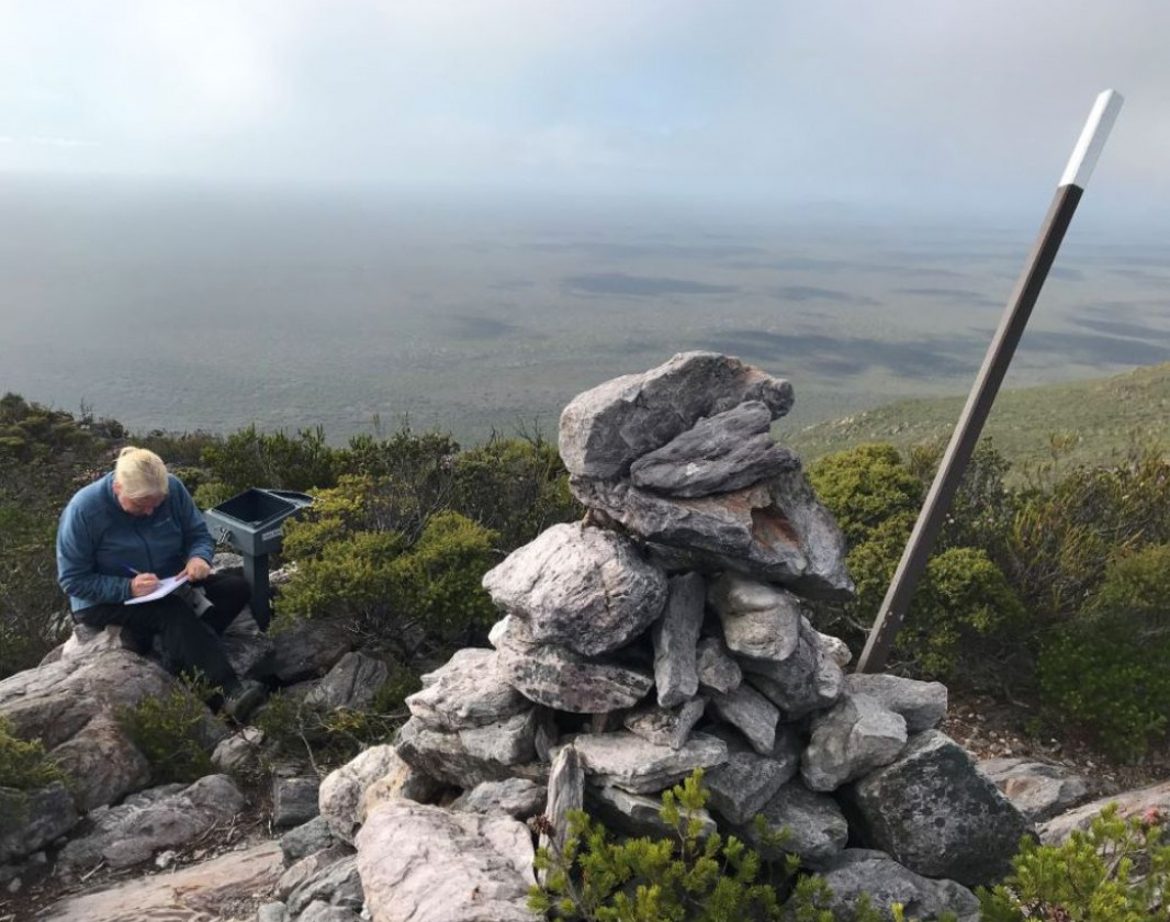
The walk to the summit of Tower Peak (594 metres) is a tough, steep ascent with the track overgrown in parts. Hoist yourself up some decent size rock faces and enjoy the adventure to climb within this spectacular scenery. The climb is rewarded with impressive views.
Mid-way up the mountain, the trail crosses a platform carved by wave action thousands of years ago when the sea level was much higher than present. Similar wave action is thought to have carved the caverns in the granitic hills of the south coast, for example, the hollow through the summit of Frenchman Peak in Cape Le Grand National Park.
Although challenging, the Mt Ragged Walk Trail also offers terrific opportunities for spotting birds. There are known to be around 160 bird species in Cape Arid National Park, several of which are threatened or endangered.
Camping is available at Mt Ragged, providing toilet and barbecue facilities. Campsites are not bookable and operate on a first come first served basis.
Approx 850km from Perth the trail is accessible by 4WD only. There are two ways to access Mt Ragged. From Balladonia on the Eyre Highway there is reasonable gravel road for the first 60km before changing to a rough, rocky sand track. From Fisheries Rd (Esperance access), the turnoff to Mt Ragged is 50km along the Balladonia road, this section of road is rough, sandy and rocky.
(08) 9038 1555
Comprehensive information on the South West region including destinations, things to see and do, accommodation and tours.
Here is everything you need to know before visiting this trail.
Allow 3 hours
3km return
Group B - Hiking & Long Distance Trails (Bushwalks and/or longer trails) required.
Group B - Hiking & Long Distance Trails (Bushwalks and/or longer trails)
Mt Ragged Car Park, which is approximately 130 km south of Eyre Hwy (Balladonia Roadhouse)
Mt Ragged Car Park
Class 5
Extreme trail with very rough surface, and may have very steep hills, arduous rock hopping or rock scrambling. Limited or no directional signage. For very experienced bushwalkers with navigation and emergency first aid skills, and high level of fitness.
Visit Trail Tips for further information.
No water at site.
Limitted shade when accessing the summit.
Check weather conditions as they can quickly change.
During the months of June until September the Wildflower season comes into full bloom
National Park fees
Car 4WD


Earn points and badges and become a "TrailsWA Expert" by completing trails and leaving reviews.
Earn 3 points towards
your TrailsWA level
Earn the Tall Peak badge when you complete this trail.


We love to hear from people who've been on our Western Australian trails, so it would be most appreciated it if you wanted to leave a review.



 Less than 1 hour
 1km
1km

 Less than 1 hour
1.5km
Less than 1 hour
1.5km


Trails are free and bring so many benefits to our community by providing opportunities to have fun, get fit, socialise, explore and challenge yourself. But they also have to be managed and maintained which only is made possible through terrific sponsors, donations and/or volunteering.
-(1680-×-200-px).jpeg)


View 7 Photos of Mt Ragged Walk Trail, Cape Arid NP
You are reporting a problem for Mt Ragged Walk Trail, Cape Arid NP. Please be as detailed as possible to help us appropriately identify and address the issue.
Join trails wa to add this trail to your favourite. By joining you will also be able to rate and review trails and share your photos with other trail goers!
Sign in to your account to add this trail to your list of favourites, and much more.
