Typically narrow trails with loose, soft, rocky or slippery sections and hills with short, steep sections. Riders will encounter obstacles and technical trail features. Recommended for intermediate riders with some technical mountain biking experience.
Trail difficulty
Recommended for moderate intermediate riders with some technical mountain biking experience. Typically narrow trails with loose, soft, rocky or slippery sections and hills with short steep sections. Riders will encounter obstacles and technical trail features.
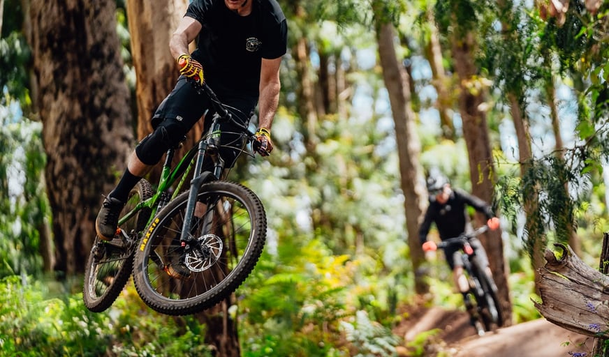
Bender is a longer, faster, more minamalist build than Pugsley. The lines are more subtle and complex . Swivel the hips and pump the compressions to unlock the best of this fast route down to the river. There are blue and black rock drops before you cross the fire road and continue on to a seamless transition into the outside loop. Watch this one. Some of those corners come up fast!
Recommended for moderate intermediate riders with some technical mountain biking experience. Typically narrow trails with loose, soft, rocky or slippery sections and hills with short steep sections. Riders will encounter obstacles and technical trail features.
Additional information
Typically narrow trails with loose, soft, rocky or slippery sections and hills with short, steep sections. Riders will encounter obstacles and technical trail features. Recommended for intermediate riders with some technical mountain biking experience.
What To Pack
What To Pack
Group C - Mountain Biking & Gravel
(Mountain bike, gravel and touring trails.)
Always ride with a buddy and ride within your skill level
Bike tools and spares (E.g. Mini bike-pump, spare tubes, puncture repair kit)
Helmet, consider a full-face helmet for more difficult trails
Water
Snacks/ food
Sun protection: sunglasses and sunscreen (SPF 50+)
Additional protective gear: gloves, body armour
For remote trails consider a PLB (Personal Locator Beacon) or satellite phone
For longer trails take extra food and water
Always have a first aid kit (vehicle nearby or on you for longer trails) and check that items are clean, properly sealed, have not exceeded expiry dates and that used items have been replaced
Extra food and water in case of unexpected delays
Prohibited items
No pets
Safety
Mountain biking is a potentially dangerous activity with inherent risks. Ride within your skills and abilities. It should only be undertaken with a full understanding of all the risks.
Trails are free and offer countless benefits to our community, from fostering fun and fitness to encouraging social connection, exploration, and personal challenges. These exceptional trail experiences are made possible through the support and collaboration of these great organisations and initiatives:
Wooditjup Mountain Bike Network
Credit:
@bydenzil
1 / 2
Wooditjup Mountain Bike Network
Credit:
@bydenzil
2 / 2
Download KML for this trail
A KML map file is available for all of our trails for use on your own mobile device.
To use these, you will need to already have a KML reader available, such as Strava.
Join trails wa to add this trail to your favourite. By joining you will also be able to rate and review trails and share your photos with other trail goers!











 Less than 1 hour
 0.47km