Skip to Content Skip to Navigation Show Trail Map Show About the Trail Show Important Trail Details Read Trail Reviews
Support Our Trails

Coastal Plain Walk Trail, Yanchep NP to Melaleuca CP Coastal Plain Walk Trail, Yanchep NP to Melaleuca CP

  • Multiple day
  • 52 km
    • Bush Walk Class 4

      Difficult trail with rough surface that may have very steep hills or extensive rock hopping. Directional signage may be limited. Bushwalking experience, navigation and emergency first aid skills, and good fitness required.

This three day, 52 kilometre walk between Yanchep National Park and Neaves Road, in the Melaleuca Conservation Park, traverses the National Park as well as the inland coastal plain.  There are three overnight campsites along the way.

Ridge's Campsite
Earn 3 Points Overnight Hike
Logo for Leave no Trace Initiative

Trails WA supports the seven principles recommended by Leave No Trace Australia for minimising your impacts when using the trails.

Learn more

The trail is marked with posts bearing either blue emus or emu footprint symbols.There are sections that overlap with the Ghost House Trail, the Rose Trail and the Cockatoo Trail.

The distances for the various sections are:

  • Neaves Road to Moitch Campsite: 10.4km
  • Moitch campsite to Perry Road; 6.0
  • Perry Road to Ridge's Campsite: 13.9km
  • Ridges Campsite to Shapcott's Campsite: 15.6km
  • Shapcott's Campsite to McNess House, Yanchep NP: 6.1km

The vegetation provides colourful wildflower displays over winter and spring. The track is sandy underfoot and has extensive sections without tree cover. Trail bike riders often use the track, contributing to its degradation and vigilance is required.

The overnight shelters are three sided, with a toilet and fire ring. There is no water available and walkers must bring their own.

Access trail at Yanchep National Park 50km north of Perth or Neaves Road, Carabooda, 60km (one hour) north of Perth.  Please register at the visitor centre.

McNess House Visitor Centre

(08) 9303 7759

Other Links

  • Destination Perth

    Comprehensive information on the Perth region including destinations, things to see and do, accommodation and tours.


Be trail ready for Coastal Plain Walk Trail, Yanchep NP to Melaleuca CP

Here is everything you need to know before visiting this trail.

Time / Duration

3-4 days

Length

52km one way

What To Pack

Group B (Bushwalks and/or longer trails) required.

Trail Start

McNess House Yanchep National Park, 60km (one hour) north of Perth

Get directions

Trail End

Neaves Road,

Get directions

Bush Walk

Class 4

Difficult trail with rough surface that may have very steep hills or extensive rock hopping. Directional signage may be limited. Bushwalking experience, navigation and emergency first aid skills, and good fitness required.

Visit Trail Tips for further information.

Difficulty Notes

Although flat, this trail is sandy underfoot and exposed. As it requires backpacking, it is rated as difficult.

Hazards & Warnings

Be alert to the presence of trail bikes. Register with Yanchep National Park (it has a walksafe register) before setting off. Not suited to summer walking. Ticks are prevalent.

Facilities

Currently there are three overnight campsites along the route, each with:
sleeping shelter (up to 12 people), tent sites, picnic table, unisex bush toilet and a fire ring are at two of the shelters. As this is a one-way route, a car shuffle or drop off is required. It may be possible to leave cars in Yanchep National Park if the route is walked south to north. It is not recommended to leave cars at other points.
  • Camping
  • Sheltered Area

Best time of year

May to October

Fees

National Park fees

Trail Access

Road

Prohibited Items

No pets
Edge shaped like mountain horizon
topography pattern

Complete Coastal Plain Walk Trail, Yanchep NP to Melaleuca CP to earn badges and points!

Earn points and badges and become a "TrailsWA Expert" by completing trails and leaving reviews.

Earn 3 Points

Earn 3 points towards
your TrailsWA level

Overnight Hike

Earn the Overnight Hike badge when you complete this trail.

Edge shaped like mountain horizon
Alt text

4 trail goers have rated Coastal Plain Walk Trail, Yanchep NP to Melaleuca CP as 3.5 out of 5!

We love to hear from people who've been on our Western Australian trails, so it would be most appreciated it if you wanted to leave a review.

james earl

Reviewed 4 Nov 2020, 7:11pm

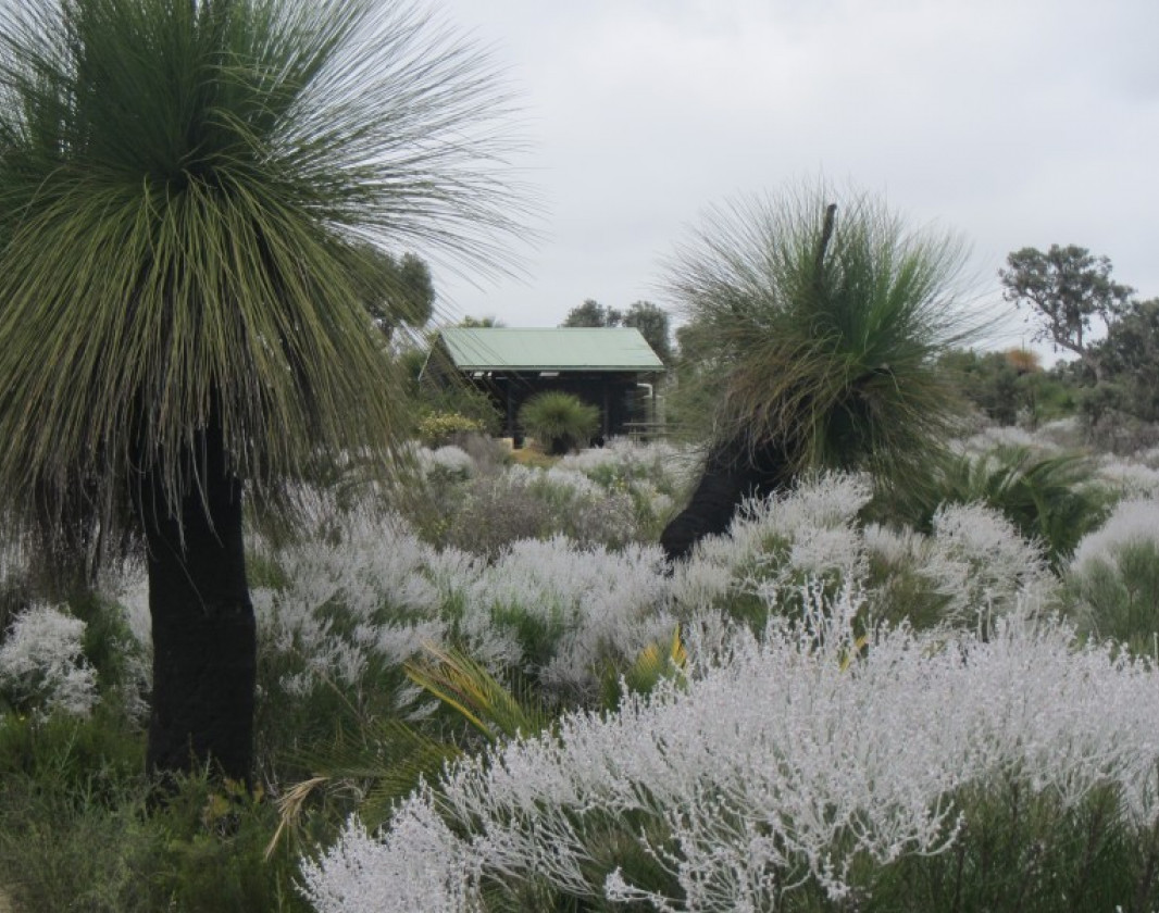
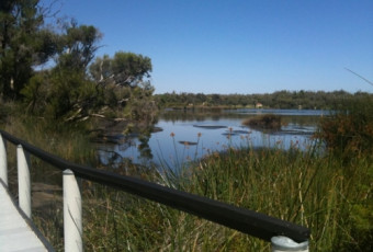
We did this trail as three day walks rather than a three day hike with backpack in October and early November. There were still a few wildflowers about but I think September and early October would have been a lot better. We used paths from Yanchep National Park to join the Coastal Plain and generally used the old 'Wild About Walking' map ( also available as a PDF ) for planning and to have a rough idea where we were and where we were going. The first section of the CPT from Shapcott's camp site to Ridge's campsite was well-signed and easy to follow but the track was very narrow in places with a lot of sharp, scratchy vegetation. Ridges campsite shelter was in a reasonable state but with no water tank. Even the picnic table had been removed! From Ridges campsite to the 2WD access point at Perry Road was also easy to follow with clear signage. Unfortunately the track itself is in a bad state having been repeatedly churned up by motor cycles. Again I think that walking earlier than October/November would have been a bit better as the sand may have been a little firmer but I don't really know. From Perry Road we actually walked along the road rather than the soft sand track that followed the fence line of the rifle range. At one point on the edge of the range where the track turned left we missed the turn. Up to this time the signage had been so good we didn't believe that such a turn would not be clearly marked so we continued straight ahead for two hundred metres before we realised our mistake. It is very easy to know exactly where you are here thanks to the rifle range boundary and the bends in Perry Road so rather than backtrack ( which we should have done ) we followed a parallel route which was again very soft sand churned up by 4WDs until we intersected with the CPT about one and a half kms later. It was then only a short walk to the Moitch campsite. This is in much better condition with a water tank that was nearly full ( thanks to recent rain ) and not one but two picnic tables. From Moitch campsite the signage is excellent being very frequent and obvious. We followed the signs vaguely aware that the track was not following the path shown on the map. This was confirmed when we reached a point where the powerlines almost touched Wandoo Road. The new path seems to have been re-routed to the south and west of Wandoo Road partially through an old pine plantation. I don't know if the old path to the east of Wandoo Road is still in existence but I suspect not. At Wandoo Road the signage diappeared completely or we couldn't find it. The obvious straight ahead path was another deep, soft sand 4WD track with no signs that we could find although we only walk along it for two or three hundred metres. Neither Maps.Me nor Google Maps were any good except to confirm that we were on Wandoo Road. As we had arranged to be picked up at a specific time we decided to follow Wandoo Road for about 5 kms back to Neaves Road rather than take our chances. We will go back when we have more time and see if we can follow the CPT from Wandoo Road to its terminus as shown on the map.
Sandri Jonker

Reviewed 30 Sep 2019, 11:25am

An awesome overnight hike (or 3 days), with beautiful wildflowers in Spring time and less than an hour away from Perth.
Honestly, would recommend doing this hike, just take care of your feet, the loose sand gave me some decent blisters.

Check out my blog for some more information on it , and ask me questions if you like.

https://hikingrite.wixsite.com/website/post/adventure-seekers-this-one-s-for-you
David Till

Reviewed 12 Dec 2018, 1:16pm

This trail was OK. The section from Neaves Rd to Ridges Shelter is easy to follow but quite overgrown in places, also motorbikes have made a real mess of the trail and there is no water at Ridges as the tank has been stolen so fill up at Moitch Shelter. From Ridges to Yanchep is probably the best section as you are in the Yanchep NP and control of the motorbikes seems better. I walked it comfortably in two days in mid August normally a bit early for flowers however there seemed to be a lot of wildflowers out already. I continued on down the Yabaroo Budjarra trail to Burns Beach Rd so day two was a big one finishing in the dark. Yanchep down the Yabaroo Budjarra trail wasnt good at all a nice trail for day walks or mountain bikes but a bit dul.
Louise Jorgensen

Reviewed 9 Dec 2017, 3:02pm

Loved this trail which I did over 2 days 28/29 October 2017. Best suited to Wildflower season and best avoided over summer due to lack of shade and water. It was a pleasant surprise. For a full write up see my first attempt at a blog https://lousadventuresblog.wordpress.com/

Like this trail? Explore others nearby

More around Perth & Surrounds

Supported by great organisations

Trails are free and bring so many benefits to our community by providing opportunities to have fun, get fit, socialise, explore and challenge yourself. But they also have to be managed and maintained which only is made possible through terrific sponsors, donations and/or volunteering.

topography pattern