Peel-Harvey Estuary Paddle Trail Network
Paddle network in Perth & Surrounds
About Peel-Harvey Estuary Paddle Trail Network
The Peel-Harvey catchment covers an area over 10,000 square kilometres, extending from the coastal town of Mandurah, 150 kilometres east to the farming communities of Williams and Popanyinning. Three rivers connect the catchment to the Peel-Harvey Estuary – the Serpentine, Murray and Harvey rivers. The Serpentine and Murray rivers flow from the north and east into the Peel Inlet and the Harvey River flows from the south-east into the Harvey Estuary. In the estuary, these fresh waters mix with the Indian Ocean’s salty water which flows in, particularly during summer, through either the natural mouth of the estuary in Mandurah or the Dawesville Cut – an artificial channel opened in 1994. The estuary is an important refuge for wildlife including many species of migratory birds. There are several nature conservation reserves which serve to protect the natural values of the estuary and the wildlife.
Launch Sites
There are 18 formal launch sites located around the estuary and along the Serpentine and Murray Rivers. Many sandy beaches also provide informal landing sites. Choose your own adventure - pick a start point and a destination and immerse yourself in the unique Peel-Harvey Estuary environment. The launch site guide at the link to the right outlines the formal launch points around the estuary and rivers and details amenities and ideal weather conditions. Details on the four formal launch sites can be found below:
Riverside Gardens Foreshore
Riverside Gardens Foreshore is a custom-built all-abilities and group paddle launch site, providing access to the Serpentine River and the Herron Trail.
Osprey Waters
Osprey Waters Foreshore Reserve is a general-use paddle launch site located near the Mandurah Estuary Bridge in Erskine. This launch site provides access to the Osprey Trail and the Pelican Trail.
Novara Foreshore Reserve
Novara Foreshore Reserve is a general-use paddle launch site located at Novara Boat Ramp in Falcon, providing access to the Osprey Trail and the Pelican Trail.
Dawesville Channel
Dawesville Channel is a general-use paddle launch site located on Estuary Road immediately south of the Dawesville Channel in Dawesville. This launch site provides access to the Pelican Trail.
Conditions and Safety
The Mandurah boating guide also contains useful information to help plan your trip.
Offering protection from the wind the Serpentine and Murray Rivers are generally classified as easy with slow to fast moving water and few obstacles suitable for novice and beginner paddlers in most conditions. On a calm day the estuary may be suitable for novice paddlers. However, the estuary is exposed to wind and in areas near the mouth and Dawesville Cut, tidal currents, and is more appropriate for medium to advanced paddlers.
The paddle trails outlined in this network were initially compiled by the Canoe Trail Friends of Mandurah and Pinjarra Inc.
Mandurah Visitor Centre
(08) 9550 3999
- [email protected]
- Visit website
- 75 Mandurah Tce, Mandurah WA 6210
Can’t find something you’re looking for?
Our Explore Map tool provides a lot of detail and filters to help explorers find the best and most suitable trails. Head on over to our Explore Map for greater search capacity.

Supported by great organisations
Trails are free and bring so many benefits to our community by providing opportunities to have fun, get fit, socialise, explore and challenge yourself. But they also have to be managed and maintained which only is made possible through terrific sponsors, donations and/or volunteering.


Goegrup Lake Nature Reserve, Peel Harvey Paddle Network

Mandurah Estuary
Coopers Mill, Darter Trail

Pelican Trail - Peel Estuary

Cooleenup Island, Darter Trail

Murray River, Darter Trail

Dolphins on the Osprey Trail, Peel Harvey Estuary

Barragup Bridge, Heron Trail

A dolphin on the Spoonbill Trail

Mandurah Venetian Canals

Cogrup Lake, Spoonbill Trail

Paddling on the Great Egret Trail

Paddlers on the Great Egret Trail in the Harvey River

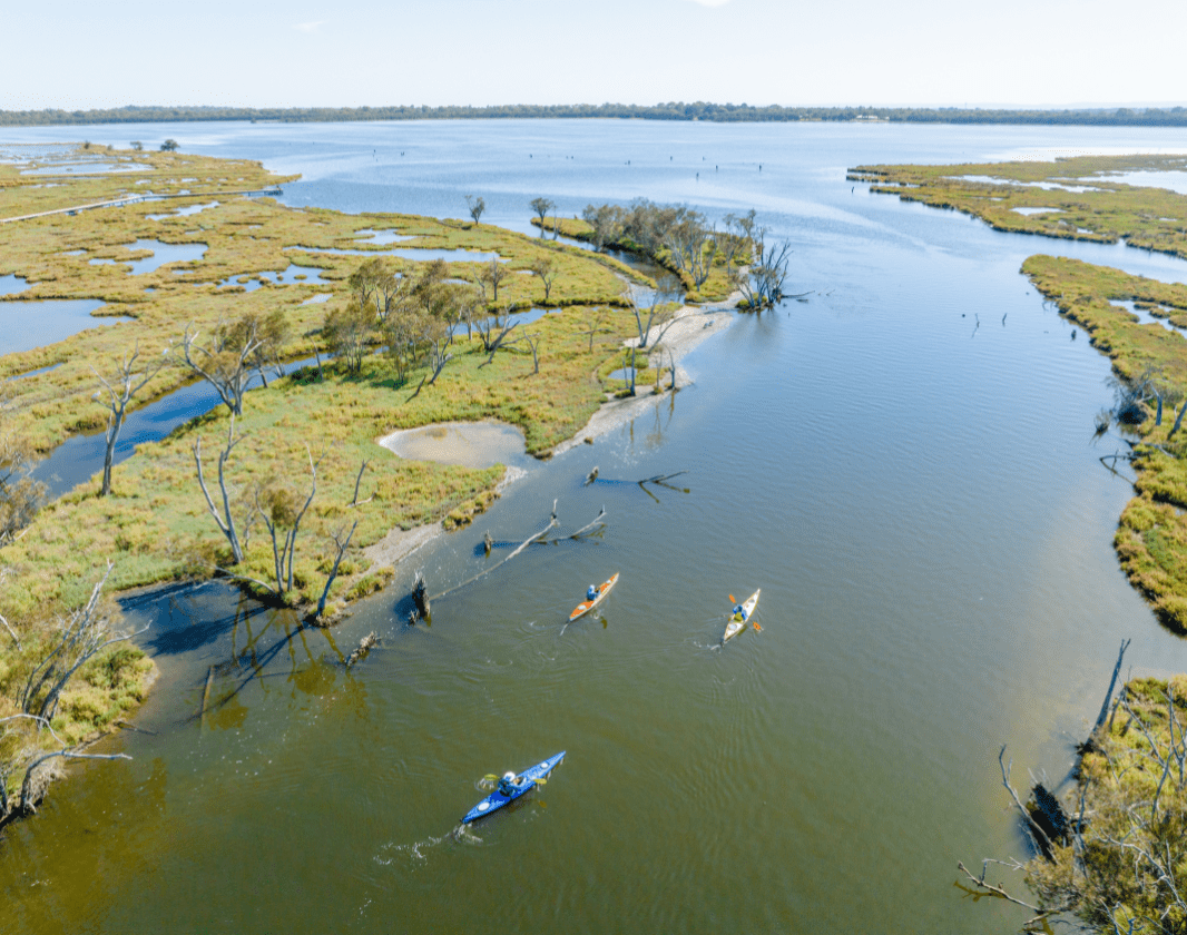
Kayakers on the Peel Harvey Estuary

Serpentine River, Darter Trail

Dolphins on the Pelican Trail

Harvey Estuary, Great Egret Trail

Island Point Reserve, Pelican Trail

Island Point, Great Egret Trail

Paddlers on the Mandurah Central Paddle Trail

Ospreys on the Osprey Trail, Peel Harvey Estuary

Dolphins on the Mountain Duck Trail

Kayakers on the Osprey Trail, Peel Harvey Estuary

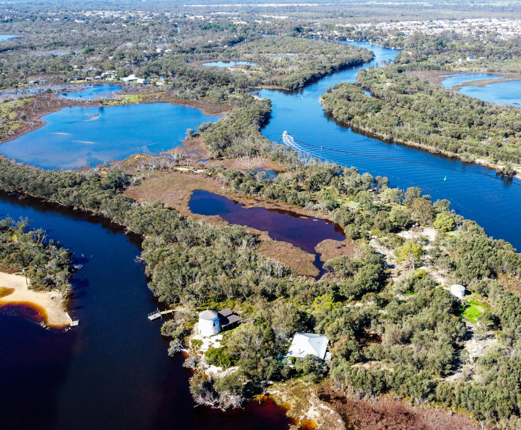
Lake Goegrup, Spoonbill Trail

Kayakers on the Spoonbill Trail

Paddling the Mountain Duck Trail

Kayakers on the Mountain Duck Trail

Heron Trail, Serpentine River

Birdlife on the Pelican Trail

Rest Stop on the Serpentine River

Dolphin on the Heron Trail

Birdlife on the Heron Trail

Osprey Waters Foreshore Reserve
View 33 Photos of Peel-Harvey Estuary Paddle Trail Network
