ZIA JASPER rated Wadandi Track, Margaret River a 4 out of 5
Lovely trail to take our dog with us, very peaceful and beautiful smelling flora


Trails WA supports the seven principles recommended by Leave No Trace Australia for minimising your impacts when using the trails.
Learn moreThe track currently begins or ends (depending where you start) at Cowaramup and finishes at Witchcliffe. Passing though peppermint, jarrah and young karri forest the trail provides a firsthand view of the abundant bird life.
The track offers the opportunity to experience the Margaret River region through its natural environment, Aboriginal heritage and the rich history of the industries and communities served by the railway from 1884 to 1957.
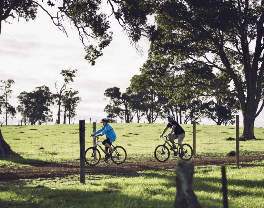
Along the 5 kilometres north of Margaret River there are numerous bridges crossing a major river and creeks and streams of varying sizes. The trail is easy to navigate with picnic areas along the way. The spectacular birdlife includes yellow robins, parrots and blue wrens and the wildflowers are stunning in Spring (September to December).
As it was a railway, the gradient is relatively flat, and the terrain is generally gentle. However, it can get moderate in some places and a mountain bike is recommended.
HISTORY
The railway line was built in the 1880s by prominent timber businessman M. C. Davies, who laid a number of lines to take timber from his mills to jetties at Hamelin Bay and Flinders Bay for export.
By 1916 the timber industry had declined and the railway from Augusta to Margaret River was bought by the WA Government.
It was extended to Busselton by 1925 to service the remaining timber industry, the original group settlements, farming and domestic passengers.
As the road network improved, more of the cartage was done by trucks and the Busselton to Flinders Bay branch railway eventually closed in 1957, after which most of the rail line and sleepers were salvaged for other uses. A handful of sleepers and rail line can still be spotted today and some major elements of the railway infrastructure remain in place. These include the original railway formation; cuttings; embankments; and many of the bridges and culverts.
Since the closure of the railway, several roads and some public facilities have been constructed on the trail reserve.
Some parts of the reserve were leased to adjoining landowners. While all of these leases have lapsed or were terminated, some of the activities that were permitted under the conditions of these leases are still taking place within the reserve – including grazing, plantations, dams and quarrying of local resources.
TRAIL SECTIONS AND DISTANCES
There are four discrete sections that can be traversed:
Cowaramup-Carters Road 11.0km
Carters Road-Margaret River 3.4km
Margaret River-Gnarawary Road 4.1km
Gnarawary Road-Witchcliffe 4.6km
Witchcliffe-Sebbes Road 8.2km
FACILITIES
Parking is available at the following locations:
• Cowaramup – next to the Fire Station
• Carters Road – formal car park
• Margaret River – off Clarke Road next to former Goods Shed
• Gnarawary Road – formal car park
Public toilets are located at the following locations:
• Cowaramup - next to the Fire Station, in Pioneer Park and Cowaramup Hall
• Margaret River – Rotary park, Old Settlement, Memorial Park, Fearn Avenue
• Witchcliffe – Bussell Hwy
(08) 9780 5911
Wadandi Track on Rails Trails Australia website
The WA MTB Guide Book covers over 50 locations from Kununurra to Esperance for all levels of Mountain Biking.
Comprehensive information on the South West region including destinations, things to see and do, accommodation and tours.
Here is everything you need to know before visiting this trail.
Half-day
31km one way
Group C - Mountain Biking & Gravel (Mountain bike, gravel and touring trails.) required.
Group C - Mountain Biking & Gravel (Mountain bike, gravel and touring trails.)

Class 2
Easy trail with modified or hardened surface, and gentle hills or occasional steps. Clear directional signage. No bushwalking experience required. May be suitable for assisted wheelchair users (if ramps are provided at steps).
Visit Trail Tips for further information.

Easy
Recommended for beginner riders with basic mountain bike skills. Typically flowing, open trails on firm terrain with gentle gradients. Surface may be uneven, loose or muddy at times. Riders may encounter small rollable obstacles and technical trail features.
Visit Trail Tips for further information.
Dogs must be on a leash.
Bike hire available in Margaret River.
April to October
Road or bus to Margaret River


Earn points and badges and become a "TrailsWA Expert" by completing trails and leaving reviews.

Earn 1 point towards
your TrailsWA level


We love to hear from people who've been on our Western Australian trails, so it would be most appreciated it if you wanted to leave a review.
Trails are free and bring so many benefits to our community by providing opportunities to have fun, get fit, socialise, explore and challenge yourself. But they also have to be managed and maintained which only is made possible through terrific sponsors, donations and/or volunteering.
-(1680-×-200-px).jpeg)

View 4 Photos of Wadandi Track, Margaret River
You are reporting a problem for Wadandi Track, Margaret River. Please be as detailed as possible to help us appropriately identify and address the issue.

Join trails wa to add this trail to your favourite. By joining you will also be able to rate and review trails and share your photos with other trail goers!
Sign in to your account to add this trail to your list of favourites, and much more.