Skip to Content Skip to Navigation Show Trail Map Show About the Trail Show Important Trail Details Read Trail Reviews

Your bookings

Yued Ponar Trail, Lesueur National Park

Yued Noongar Country

Trail difficulty
Trail difficulty
  • Length 6km
  • Est. time 1-3 hours
  • Circuit / loop
Today

25°C

25°

15°

Earn badges and points by completing this trail.

Earn 3 Points Popular Trail

Trails WA supports the seven principles recommended by Leave No Trace Australia for minimising your impacts when using the trails.

Learn more

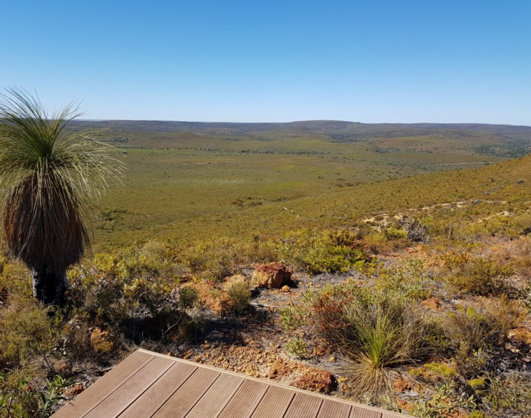
The Yued Ponar Trail features an ancient, highly eroded and weathered landscape with a vast diversity of plant life. Due to low soil nutrients, plants have developed highly specialised adaptions, creating vast diversity.

With over 900 species of plants, over 100 of which are only found in this area, the Lesueur NP is known as a global biodiversity hotspot.

The best time to appreciate the stunning variety of plant life is during wildlfower season from August to November.

Winding through low heathlands and Wandoo woodland the trail offers walkers an opportunity to discover the country through Yued Noongar eyes and learn about the seasonal resources they relied upon.

Other walks in the Lesueur NP include the Mount Lesueur and Gairdner Walk Trails that can be accessed from the Drummonds Recreation site car park.

Turquoise Coast Visitor Centre

(08) 9652 0870

National Parks

Other Links

  • Australia’s Coral Coast

    Comprehensive information on the Coral Coast region including destinations, things to see and do, accommodation and tours.


Be trail ready

Here is everything you need to know before visiting this trail.

Time / Duration

2 - 3 hours

Length

6km loop

Fees

National Park fees apply.

Trail Access

Lesueur National Park can be accessed by 2WD vehicle via Jurien Bay, 222km from Perth, via bus or car. The park is 30km north of Jurien Bay.

Trail Start

Cockleshell Gully Picnic Area

Get directions

Trail End

When to go

August to November for the wildflowers; Cooler months to avoid heat stress

What’s the weather like?

Bush Walk

Class 4

Difficult trail with rough surface that may have very steep hills or extensive rock hopping. Directional signage may be limited. Bushwalking experience, navigation and emergency first aid skills, and good fitness required.

Additional information

Some difficult sections and natural hazards including long steep climbs, water crossing, natural debris and unstable slippery surfaces. A good level of fitness and bushwalking experience is recommended.

What To Pack

Hazards & Warnings

Trail surface is gravel and rock with cliff edges, so caution advised. Summer months (December to April) can be extremely hot. On hot, windy days walking is not advised due to bushfire risk. Ticks are prevalent

Prohibited items

No pets permitted

Facilities

  • Car Park
  • Lookouts
  • Picnic Area
  • Public Toilet
  • All accessible parking
  • All accessible toilet facilities

Trail information updated
17th July 2026

Today Jul 18, 1:27pm

25°C

Feels like 24°C

Max 25°

Min 15°

Precipitation: 0%

Visibility: 10km

Wind: 4.21km/h N

Weather data provided by:

Complete this trail to earn badges and points!

Earn points and badges and become a "TrailsWA Expert" by completing trails and leaving reviews.

Earn 3 Points

Earn 3 points towards
your TrailsWA level

Popular Trail

Earn the Popular Trail badge when you complete this trail.

3 trail goers have rated this trail as 4.33 out of 5!

We love to hear from people who've been on our Western Australian trails, so it would be most appreciated it if you wanted to leave a review.

Jennifer Kessell

Reviewed 14 Jul 2026, 10:31pm

Stunning landscape with great diversity in soil - granite, shale, sand, clay, - and even more diversity in wildflowers. The view is spectacular and you truly feel like you are in the middle of nowhere.
Ryan Zhang

Reviewed 4 Jun 2024, 1:11pm

Magnificent views on top of Mount Peron. Although no wild flowers in June, I enjoyed the hiking as I was the only human being in the whole mountain
Carl Herbert

Reviewed 27 Aug 2019, 3:10pm

We walked this trail in the clockwise direction so we were climbing the steepest portions and made for an easier on the knees descent back to the car park, this is a truly beautiful trail with endless views complimenting the vast flora,

Like this trail? Explore others nearby

More around Coral Coast

Supporters & Partners

Trails are free and offer countless benefits to our community, from fostering fun and fitness to encouraging social connection, exploration, and personal challenges. These exceptional trail experiences are made possible through the support and collaboration of these great organisations and initiatives: