Skip to Content Skip to Navigation Show Trail Map Show About the Trail Show Important Trail Details Read Trail Reviews

Your bookings

Stokes Heritage Trail, Stokes NP, Esperance

Trail difficulty
Trail difficulty
  • Length 6.4km
  • Est. time 1-3 hours
  • Return
Today

17°C

24°

14°

Earn badges and points by completing this trail.

Earn 1 Point

Trails WA supports the seven principles recommended by Leave No Trace Australia for minimising your impacts when using the trails.

Learn more

Read more about this trail

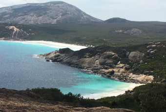
Featuring one of the most picturesque estuaries along WA’s southern coast, Stokes National Park is a great place for fishing, camping, bushwalking and birdwatching.

Day visitors and bushwalkers can enjoy Stokes Inlet, Skippy Rock, Shoal Cape, the Moir Homestead Ruins and Fanny Cove. You can walk to the Estuary Mouth if water levels allow. Abundant bird life frequents the inlet, its shores and associated lakes.

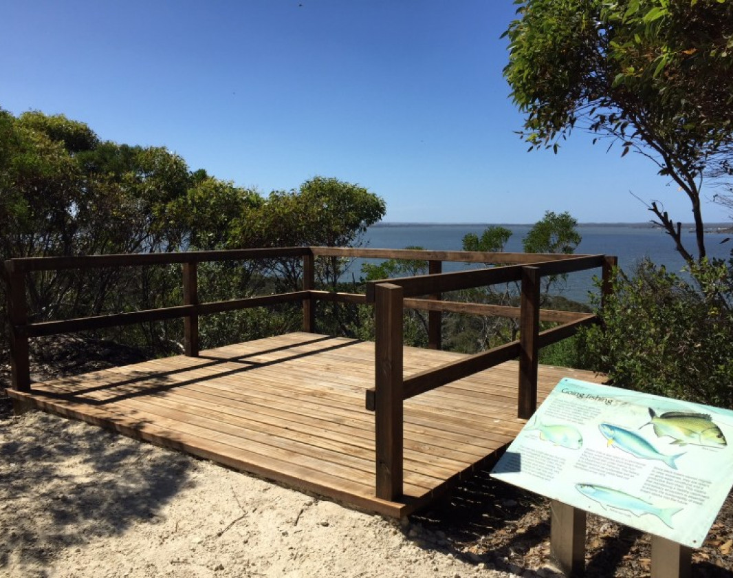
Observation decks along the trail provide sweeping views over the estuary. Walkers may see native fauna such as kangaroos, emus and honey possums. The trail is divided into two sections. It begins in Benwenerup Campground and finishes in Stokes Picnic Area.

It is an easy 1.4 km walk through mallee heath to a small car park. The trail then climbs from the car park to follow a limestone ridge to steps that lead down to the day use area. 

Walkers will see many types of flora including the ancient Zamias in Section 1. There is interpretive signage along the walk trail. The history of the Zamia in Section 1, and the history and formation of Stokes Inlet in Section 2. Section 1 has a bench at the halfway point and is wheelchair accessible (if assisted).

Other Links

Be trail ready

Here is everything you need to know before visiting this trail.

Time / Duration

1.5 hours

Length

6.4km return

Fees

Camping fees

Trail Access

Road 2WD

Trail Start

Stokes National Park is 80kms west of Esperance. Turn onto Stokes Inlet Road and follow the signs.

Get directions

Trail End

Stokes picnic area

Get directions

When to go

September to May

What’s the weather like?

Bush Walk

Class 2

Easy trail with modified or hardened surface, and gentle hills or occasional steps. Clear directional signage. No bushwalking experience required. May be suitable for assisted wheelchair users (if ramps are provided at steps).

What To Pack

Hazards & Warnings

Trail surface is gravel so caution is advised. Stairs may be slippery when wet. Beware of snakes in hotter months (Oct - March).

Prohibited items

No pets, No fires. No bicycles on walk trail.

Biodiversity

The Department of Biodiversity, Conservation and Attractions undertakes 1080 baiting at this location to reduce the impacts of feral cats and foxes on native wildlife. 

Meat baits containing 1080 poison are laid in or around this area on an ongoing basis. 1080 is poisonous to humans and will kill domestic cats and dogs. Please leave your pets at home or prevent them from entering this area.

For further information contact your local Parks and Wildlife Service office or visit Western Shield.

Facilities

  • BBQ Facilities
  • Car Park
  • Picnic Area
  • Public Toilet

Today Apr 11, 12:47am

17°C

Feels like 16°C

Max 24°

Min 14°

Precipitation: 0%

Visibility: 10km

Wind: 6.64km/h E

Weather data provided by:

Complete this trail to earn badges and points!

Earn points and badges and become a "TrailsWA Expert" by completing trails and leaving reviews.

Earn 1 Point

Earn 1 point towards
your TrailsWA level

2 trail goers have rated this trail as 3.5 out of 5!

We love to hear from people who've been on our Western Australian trails, so it would be most appreciated it if you wanted to leave a review.

David Miller

Reviewed 4 Aug 2024, 2:39pm

The camping ground and area is beautiful and the walk is nice but it won’t knock your socks off. It’s worth doing all the same.
Michael Warren

Reviewed 22 Jun 2020, 8:26pm

The views from the 2 lookouts provided were amazing. The Zamia palms along the flat section of the walk are so large they are amazing. the path is well formed and easy to navigate. The signage along the trail provide great details on the natural environment of the inlet.

Like this trail? Explore others nearby

More around Golden Outback

Supporters & Partners

Trails are free and offer countless benefits to our community, from fostering fun and fitness to encouraging social connection, exploration, and personal challenges. These exceptional trail experiences are made possible through the support and collaboration of these great organisations and initiatives: