Statham's Quarry Walk is a 5.9km popular walk trail, looping through Gooseberry Hill National Park in the Perth Hills, 35 minutes (30 kilometres) east of Perth. A fairly strenuous walk with a few loose stony sections, this walk offers spectacular views of the Darling Scarp and the Swan Coastal Plain, and the wildflowers in WA's spring (September to November) are magnificent.
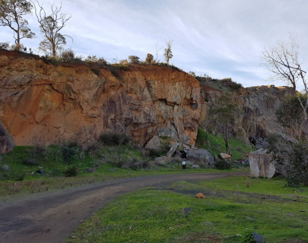
The walk passes the now disused Statham's Quarry, which opened in 1894 and was where some of Perth's street paving originally came from in the early 1900s. Interestingly, the rocks that make up the groyne at Perth's popular City Beach also came from this quarry. Statham's Quarry is now a popular destination for rock climbing and abseiling.
Another historical attraction on this walk is the old Zig Zag railway, originally built to take timber from the hills stations to Midland Junction.
There is a gravel car park at Lascelle's Parade, where the loop walk departs.
The trail markers are grey, however trail markers are hard to locate so make sure to refer to the walk trail map and trail notes, available from the Shire of Kalamunda website
Trail Notes
Start point: The gravel car park on Lascelle’s Parade. This is the first look out that you come to overlooking Gooseberry Hill National Park.
1. Leave the car park and continue along Lascelle’s Parade, past the sealed car park. After another 400 metres, look carefully for the point where the track leaves the sealed road. This point is marked by a sign in a tree. The first bend of the zig zag comes into view about 100 metres ahead.
2. Turn off the zig zag road and head downhill.
3. Cross the sealed road and walk through a white gate.
4. Ignore a track from the left and continue in a general northerly direction.
5. Meet the corner of a mesh fence and continue on.
6. Leave the fence and continue downhill into the Helena Valley.
7. Reach Statham’s Quarry. There is a picnic area with toilets and an informative sign about the quarry. Leave through the gate and walk down the sealed path in a northerly direction.
8. Where the sealed road ends, turn sharply left and continue down an unsealed road between two granite boulders.
9. Go through a white gate and make a sharp left turn onto the sealed road heading uphill.
10. Leave the sealed road and cross through the white gate straight ahead.
11. Leave the remnant of the old railway line and proceed down hill on a straight track. There is a Shire of Kalamunda sign on a tree straight ahead.
12. Ignore a track that comes in from the left. Cross a small water course.
13. Ignore a track that leads to the right and continue straight ahead.
14. Take the branch to the left and continue uphill.
15. Leave the main track and turn left on a narrow footpath.
16. Approach a T junction and turn left at the houses.
17. Approach a Y junction. Ignore a track on the right, and turn left downhill.
18. Cross the water course on a steel pipe bridge. Continue up hill.
19. Turn left and cross a wooden bridge straight ahead.
20. Turn left and walk uphill to the car park.
21. The completion of the walk.


-crop-340x230.png)


