South-western Spotted Scrubwren
Sericornis (Sericornis) frontalis maculatus
Animalia: Aves
Your bookings
Menang Noongar Country
Part of Porongurup National Park network
Earn badges and points by completing this trail.
Trails WA supports the seven principles recommended by Leave No Trace Australia for minimising your impacts when using the trails.
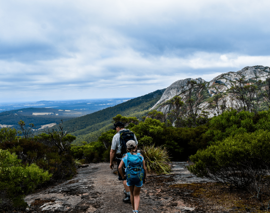
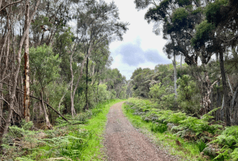
Learn moreRead more about this trail
Commencing from the Porongurup carpark, the trail passes by Karri boya-k (Tree in the Rock) before climbing to the top of the mountain’s ridge. On the way, the trail passes through different ecosystems such as karri forest and moist glades of mosses.
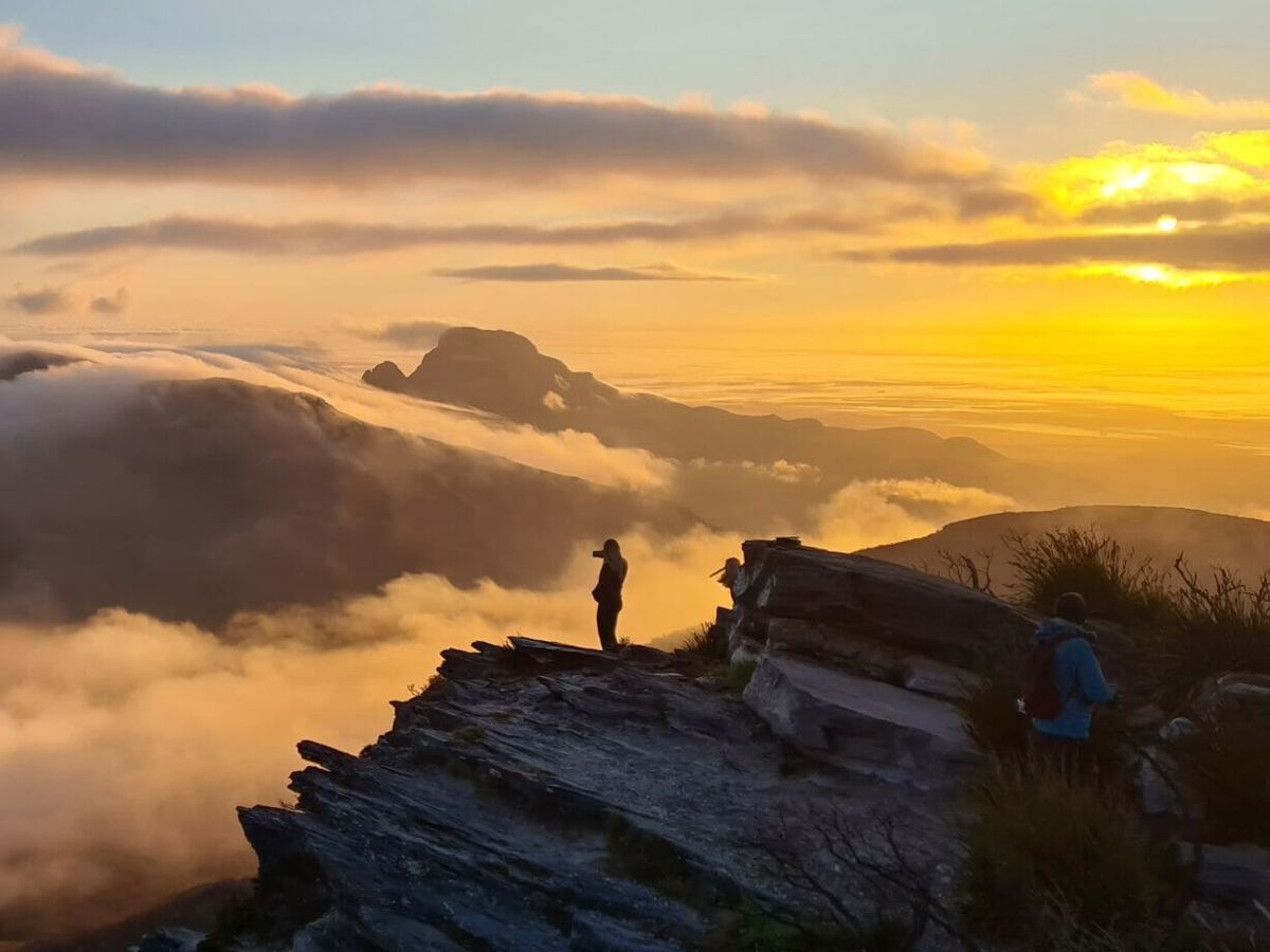
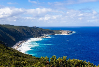
Emerging from the forest on the granite outcrops you will see the views to the Stirling Ranges and the Southern Ocean. Across the outcrops, the trail continues over a few peaks before descending into a pass between Nancy Peak and Devils Slide. Once on the main track between the two, it's a fairly simple karri forest ramble back to the car park.
This is one of many trails in the Porongurup area. Other trails range from the Bolganup Heritage Trail, which is an easy 600 metre circuit, to a three-hour return hike to Marmabup Rock which is recommended for experienced bushwalkers only. The Castle Rock trail takes you past the famous balancing rock and up to stand on Castle Rock.
Comprehensive information on the South West region including destinations, things to see and do, accommodation and tours.
Known as Borongur to Noongar people, the Porongurup Range is one of the most culturally significant landscapes in the Lower Great Southern. Rising from the surrounding plains east of Kinjarling (Albany), these ancient granite peaks hold deep spiritual meaning for the Menang people and neighbouring Noongar groups, including the Goreng, Wirlomun and Pibbulmun peoples.
The range is incredibly ancient, with the granite formations weathered over hundreds of millions of years. Unlike many other parts of the world shaped by recent ice ages and glacial movement, this landscape has remained largely undisturbed for over 250 million years. This stability allowed an extraordinary diversity of plant life to evolve, making the Porongurups a refuge for hundreds of native plant species, wildlife and insects found within a relatively small area.
For Noongar people, however, Borongur is far more than a place of ecological importance. It is a deeply sacred cultural landscape connected to identity, spirituality, learning and transition into adulthood.
Traditionally, young Menang people would journey into the high country of the Porongurups during an important stage of life to seek their second totem. A first totem was inherited through the maternal line, connecting an individual to family, ancestry and Country. The second totem was discovered through personal spiritual experience within the range itself.
Young people would spend time alone in the mountains, quietly waiting and observing Country. The first significant animal, tree or natural feature revealed to them during this experience would become their second totem. This process marked a powerful transition from childhood into adulthood and strengthened a lifelong spiritual connection to the natural world.
Totems carry deep meaning within Noongar culture. They are not simply symbols, but living connections that guide responsibility, identity, behaviour and care for Country. A person’s totem creates an enduring relationship with that species or place, reinforcing respect, protection and cultural obligation.
Today, Borongur remains a place of immense cultural importance, where ancient stories, spiritual connections and the presence of ancestors continue to be felt across the landscape.
The Porongurup Range, located in WA's Great Southern region, is an internationally recognised biodiversity hotspot. The ancient granite range supports over 700 native plant species, including 10 endemic species. The diverse vegetation types provides habitat for a wide range of native animals, including several endangered and vulnerable species.
The unique climate and elevations create a damp, protected environment that sustains a rich mix of towering forests and colorful shrublands. The upper slopes feature magnificent stands of towering Karri forest, an outlier from the main deep-south karri belt. The lower slopes are cloaked in open Jarrah, Marri and Yate woodlands. Spring (August to November) brings the forest floor and shrublands to life with over 55 species of orchids (including the Purple Enamel and Cowslip orchids), mountain bells, flame peas, and banksias. Over 300 macro-fungi species have been identified, making it an incredible destination for fungi enthusiasts.
Porongurup National Park is home to a rich array of wildlife, and visitors can frequently spot Western Grey Kangaroos, Brush Wallabies, and Brushtail Possums. The range is also home to nocturnal marsupials like honey possums, pygmy possums, and quendas. Over 80 bird species have been recorded here. Look out for the Rufous Treecreeper, Scarlet Robins, and Western Yellow Robins. The old-growth trees provide crucial nesting hollows for threatened black cockatoos, including the Carnaby's, Baudin's, and Forest Red-tailed Black Cockatoo. The damp forest floor and moist gullies harbor various skinks, goannas, carpet pythons, and ground frogs.
The Porongurup Range is one of the oldest mountain landscapes in Western Australia. Its towering granite domes are the result of geological processes that began more than 1.2 billion years ago.
Around that time, two enormous land masses were colliding: the Mawson Plate, which later became part of Antarctica, and the ancient Yilgarn Craton, an old block of continental crust that still underlies much of southern Western Australia. As these continental plates pushed together, heat and pressure deep within the Earth helped form a vast body of molten granite. This granite cooled slowly underground, creating the foundations of the Porongurup Range.
The range forms part of a much larger geological belt created during this period of continental collision. Similar ancient rocks extend from east of Manjimup, along the south coast through Albany and Esperance, and north-east toward the border of Western Australia and South Australia.
Geologists describe the Porongurup Range as a batholith: a massive body of granite formed deep underground and later exposed by erosion. Over millions of years, weathering and erosion gradually stripped away softer surrounding rocks, leaving behind the hardest granite peaks and creating the striking domes, boulders and rock formations seen along the walking trails today.
This process of erosion continues today. As granite slowly breaks down, it creates slightly richer soils around the base of the range. Combined with higher rainfall, these soils support tall karri forest, jarrah and marri woodland, and a remarkable diversity of plant and fungi species unusual for this part of Western Australia.
Off The Beaten Track WA (OTBT) is Perth’s leading premier Hiking Experience & Adventure Tour operator, providing guests with over 70 safe, fun, inclusive experiences in a fully supported environment.
Western Australia’s oldest country retreat, nestled in the stunning Porongurup Range. Offering the perfect blend of heritage and modern comfort since the 1900s.
Here is everything you need to know before visiting this trail.
3 - 4 hours
6.7 kilometre loop, not including additional loop north of Karri boya-k (Tree in the Rock)
National Park fees
Road 2WD
Porongorup National Park, 23km from Mt Barker, which is 359km(4 hours) south of Perth
Class 4
Difficult trail with rough surface that may have very steep hills or extensive rock hopping. Directional signage may be limited. Bushwalking experience, navigation and emergency first aid skills, and good fitness required.
Group B - Hiking & Long Distance Trails (Bushwalks and/or longer trails)
Be prepared for sudden weather changes. Wear long trousers and a long-sleeved shirt. Maps available from visitor centres.
No pets
15°C
Feels like 14°C
Max 15°C
Min 7°C
Earn points and badges and become a "TrailsWA Expert" by completing trails and leaving reviews.
Earn 2 points towards
your TrailsWA level
Earn the Tall Peak badge when you complete this trail.
We love to hear from people who've been on our Western Australian trails, so it would be most appreciated it if you wanted to leave a review.
Trails are free and offer countless benefits to our community, from fostering fun and fitness to encouraging social connection, exploration, and personal challenges. These exceptional trail experiences are made possible through the support and collaboration of these great organisations and initiatives:
Join trails wa to add this trail to your favourite. By joining you will also be able to rate and review trails and share your photos with other trail goers!
Sign in to your account to add this trail to your list of favourites, and much more.