

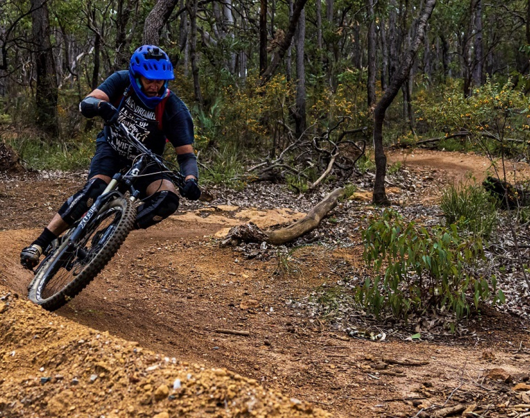
METASOMA, Kalamunda Mountain Bike Trails METASOMA, Kalamunda Mountain Bike Trails
Part of
Kalamunda Trails
network


Trails WA supports the seven principles recommended by Leave No Trace Australia for minimising your impacts when using the trails.
Learn moreAbout METASOMA, Kalamunda Mountain Bike Trails
At the end of your descent you will meet the dual direction Creek Trail. Turn right towards Mundaring Weir Road with a variety of options including Lube me up to Scorpion or turn left to link up with Highway to Dell for another lap of this track.
Kalamunda Mountain Bike Collective
Visitor Information Centres
Other Links
-
Western Australian MTB Guide Book
The WA MTB Guide Book covers over 50 locations from Kununurra to Esperance for all levels of Mountain Biking.
- Westcycle
- Perth Mountain Bike Club
-
Destination Perth
Comprehensive information on the Perth region including destinations, things to see and do, accommodation and tours.
Downloads
Be trail ready for METASOMA, Kalamunda Mountain Bike Trails
Here is everything you need to know before visiting this trail.
Time / Duration
Less than 15 minutes
Length
1.1km one-way
Elevation
Descending 24m
What To Pack
Group C - Mountain Biking & Gravel (Mountain bike, gravel and touring trails.) required.
What To Pack
Group C - Mountain Biking & Gravel (Mountain bike, gravel and touring trails.)
- Always ride with a buddy and ride within your skill level
- Bike tools and spares (E.g. Mini bike-pump, spare tubes, puncture repair kit)
- Helmet, consider a full-face helmet for more difficult trails
- Water
- Snacks/ food
- Sun protection: sunglasses and sunscreen (SPF 30+)
- Additional protective gear: gloves, body armour
- For remote trails consider a PLB (Personal Locator Beacon) or satellite phone
- For longer trails take extra food and water
- Always have a first aid kit (vehicle nearby or on you for longer trails) and check that items are clean, properly sealed, have not exceeded expiry dates and that used items have been replaced
- Extra food and water in case of unexpected delays

Mountain Bike
Moderate
Recommended for moderate intermediate riders with some technical mountain biking experience. Typically narrow trails with loose, soft, rocky or slippery sections and hills with short steep sections. Riders will encounter obstacles and technical trail features.
Visit Trail Tips for further information.
Difficulty Notes
WA MTB Classification: Moderate (Blue) trails are typically narrow trails with loose, soft, rocky or slippery sections and hills with short steep sections. Riders will encounter obstacles and technical trail features. Recommended for intermediate riders with some technical mountain biking experience.
Safety
Mountain biking is a potentially dangerous activity with inherent risks. Ride within your skills and abilities. It should only be undertaken with a full understanding of all the risks.
Facilities
All facilities are available at The Dell Car Park
- Car Park
- Public Toilet
- Visitor Information Centre
Best time of year
March to November
Fees
No Fees Apply
Trail Access
2WD 40km from Perth, 10km from Kalamunda, access on Mundaring Weir Road at the Dell Car Park
Prohibited Items
No pets


Complete METASOMA, Kalamunda Mountain Bike Trails to earn badges and points!
Earn points and badges and become a "TrailsWA Expert" by completing trails and leaving reviews.
Earn 2 points towards
your TrailsWA level
Earn the Mountain Biker badge when you complete this trail.


Be the first to review METASOMA, Kalamunda Mountain Bike Trails
We love to hear from people who've been on our Western Australian trails, so it would be most appreciated it if you wanted to leave a review.
Add your review of METASOMA, Kalamunda Mountain Bike Trails
Like this trail? Explore others nearby
More around Perth & Surrounds


Supported by great organisations
Trails are free and bring so many benefits to our community by providing opportunities to have fun, get fit, socialise, explore and challenge yourself. But they also have to be managed and maintained which only is made possible through terrific sponsors, donations and/or volunteering.


Kalamunda Mountain Bike Network
View 1 Photos of METASOMA, Kalamunda Mountain Bike Trails
Upload your photo of METASOMA, Kalamunda Mountain Bike Trails
Report a Problem
You are reporting a problem for METASOMA, Kalamunda Mountain Bike Trails. Please be as detailed as possible to help us appropriately identify and address the issue.
