Moderate trail that may have short steep hills, rough surface, many steps or some rock hopping. Directional signage. Some bushwalking experience and moderate fitness required.
Len Otte Nature trail is a moderately easy one kilometre loop walk in Cape Arid National Park. This nature trail was designed and established in 1979 by Len Otte, the first resident ranger at Cape Arid National park. It was the first nature trail in any Western Australian national park and following his unexpected death, was dedicated as a fitting tribute to Len’s achievements and life at the park.
The walk winds through woodlands and thickets up Belinup Hill (66 metres), showcasing the tremendous variety of plants in the area. Enjoy seasonal displays of yellow hibbertia, scarlet honeymyrtle and the golden southern plains banksia. There are also views across coastal heathland to Thomas River and Yokinup Bay. Walk trail surface consists of natural pavements made up of rock material including exposed granite and gravel. Sections of the walk were burnt by wildfire in November 2015.
Moderate trail that may have short steep hills, rough surface, many steps or some rock hopping. Directional signage. Some bushwalking experience and moderate fitness required.
Complete Len Otte Nature Trail, Cape Arid NP to earn badges and points!
Earn points and badges and become a "TrailsWA Expert" by completing trails and leaving reviews.
Earn 2 points towards your TrailsWA level
1 trail goers have rated Len Otte Nature Trail, Cape Arid NP as 3 out of 5!
We love to hear from people who've been on our Western Australian trails, so it would be most appreciated it if you wanted to leave a review.
Add your review of Len Otte Nature Trail, Cape Arid NP
Michael Warren rated Len Otte Nature Trail, Cape Arid NP a 3 out of 5
Michael Warren
Reviewed 22 Sep 2022, 5:32pm
Great little track that takes you on a loop around some varied ecosystems. plus also provides great views over the bay. We have located many different wildflowers/orchids on our walks. Has foot cleaning station to prevent spread of dieback.
Trails are free and bring so many benefits to our community by providing opportunities to have fun, get fit, socialise, explore and challenge yourself. But they also have to be managed and maintained which only is made possible through terrific sponsors, donations and/or volunteering.
Emma Rowe
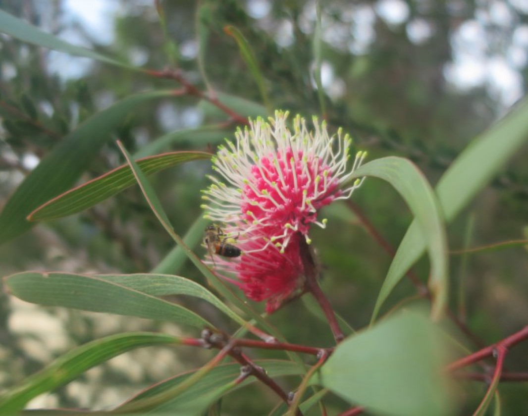
Pincushion Hakea
From April the bright pink flowers of the pincushion hakea are in bloom
Emma Rowe
Len Otte Nature Trail
Beginning of the nature trial loop
Emma Rowe
Len Otte Nature Trail
The beginning of the trail is open granite where kangaroos can be seen feeding on the grass
View 3 Photos
of Len Otte Nature Trail, Cape Arid NP
Upload your photo of Len Otte Nature Trail, Cape Arid NP
Report a Problem
You are reporting a problem for Len Otte Nature Trail, Cape Arid NP. Please be as detailed as possible to help us appropriately identify and address the issue.
Please sign in or join up
Join Trails WA
Join trails wa to add this trail to your favourite. By joining you will also be able to rate and review trails and share your photos with other trail goers!