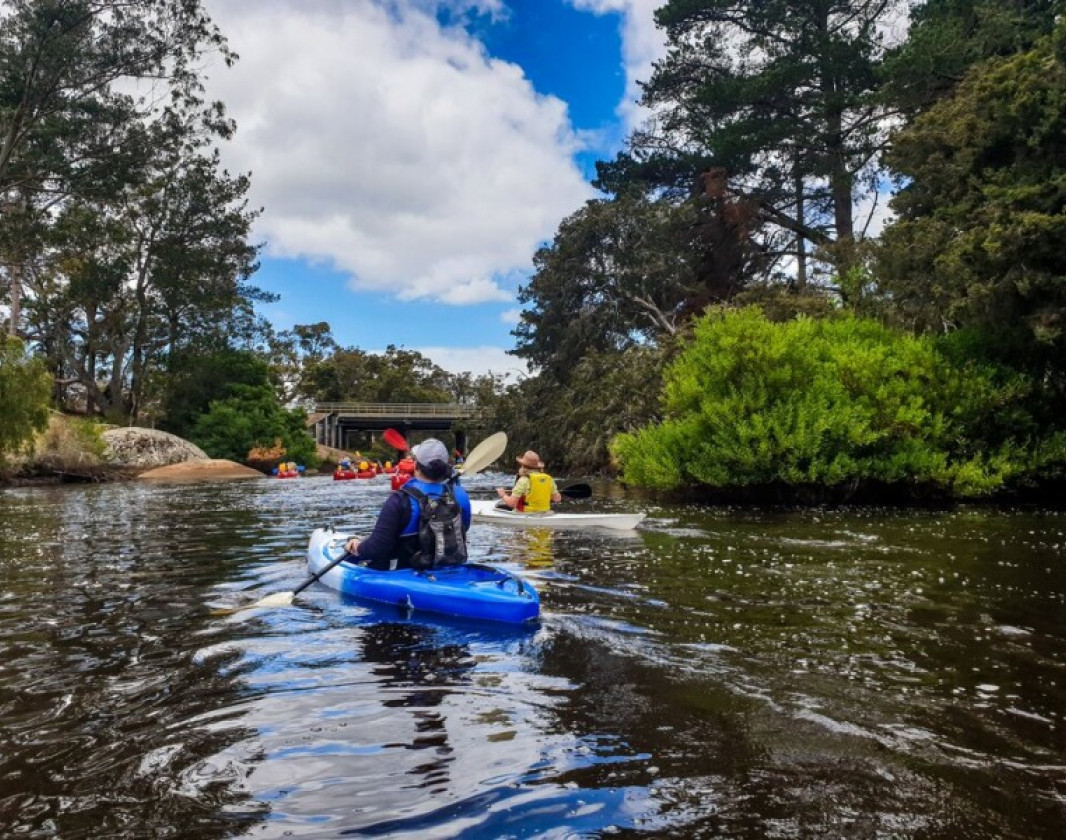
The King River Paddle Trail is a beautiful 8km paddle through a sheltered flat water location with minimal currents, easy entry and exits and never more than 500m from safe landing sites making it a great paddle for all abilities and experiences.
The King River Paddle Trail is a beautiful 8km paddle through a sheltered flat water location with minimal currents, easy entry and exits and never more than 500m from safe landing sites making it a great paddle for all abilities and experiences.
The river flows past picturesque scenery including rocky outcrops, high sandy banks and farmland fringed by paperbark trees. Upstream of Chester Pass Road is an intimate paddling experience with shady trees joining over the river.
Just 1 of 10 Great Paddles in The Amazing South Coast!
Comprehensive information on the South West region including destinations, things to see and do, accommodation and tours.
Be trail ready for King River Paddle Trail
Here is everything you need to know before visiting this trail.
Time / Duration
1-3 hours
Length
8km one way
What To Pack
Group F - Paddling Trails
(Paddling trails)
required.
What To Pack
Group F - Paddling Trails
(Paddling trails)
Plenty of water and food for the duration of trip.
Sun protection: hat, sunglasses and sunscreen (SPF 30+)
Clothes to suit the activity and potential weather conditions
Lifejacket or floatation device
EPIRB, PLB or Flares
Leg or paddle leash if paddling in the ocean
A paddling helmet is recommended for paddling in whitewater and surf
Always refer to the comprehensive safety guidelines found on the individual trail listings
Additional Useful Items
As well as the recommended launch location at Coraki Park next to the Lower King Bridge (stick to the channel to avoid very shallow water and ‘quicksand’), there are also several other suitable launching spots including at Norwood Estate and the Chester Pass Road Bridge.
Trail Start
Coraki Park next to the Lower King Bridge, Lower King
Complete King River Paddle Trail to earn badges and points!
Earn points and badges and become a "TrailsWA Expert" by completing trails and leaving reviews.
Earn 1 point towards your TrailsWA level
Earn the
Paddle
badge when you complete this trail.
1 trail goers have rated King River Paddle Trail as 3 out of 5!
We love to hear from people who've been on our Western Australian trails, so it would be most appreciated it if you wanted to leave a review.
Add your review of King River Paddle Trail
Chelle Fisher rated King River Paddle Trail a 3 out of 5
Chelle Fisher
Reviewed 1 Jun 2022, 8:03pm
The King River Paddle Trail is a beautiful 8km paddle through a sheltered flat water location with minimal currents, easy entry and exits and never more than 500m from safe landing sites making it a great paddle for all abilities and experiences. The river winds past farms and amazing granite boulders providing good photo opportunities especially on calm days when the rocks are reflected on the water surface.
Trails are free and bring so many benefits to our community by providing opportunities to have fun, get fit, socialise, explore and challenge yourself. But they also have to be managed and maintained which only is made possible through terrific sponsors, donations and/or volunteering.
Chelle Fisher
King River Paddle Trail
King River Paddle Trail
Chelle Fisher
King River Paddle Trail
King River Paddle Trail
View 2 Photos
of King River Paddle Trail
Upload your photo of King River Paddle Trail
Report a Problem
You are reporting a problem for King River Paddle Trail. Please be as detailed as possible to help us appropriately identify and address the issue.
Please sign in or join up
Join Trails WA
Join trails wa to add this trail to your favourite. By joining you will also be able to rate and review trails and share your photos with other trail goers!







-crop-340x230.jpg)
 1-3 hours
 4km
4km


-(1680-×-200-px).jpeg)