Skip to Content Skip to Navigation Show Trail Map Show About the Trail Show Important Trail Details Read Trail Reviews

Your bookings

King Jarrah Walk Trail, Lane Poole, Dwellingup

Pindjarup & Wiilman Noongar Country

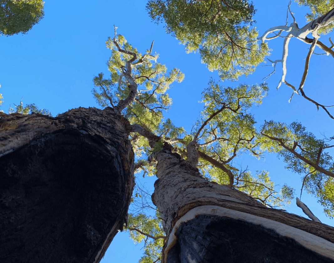
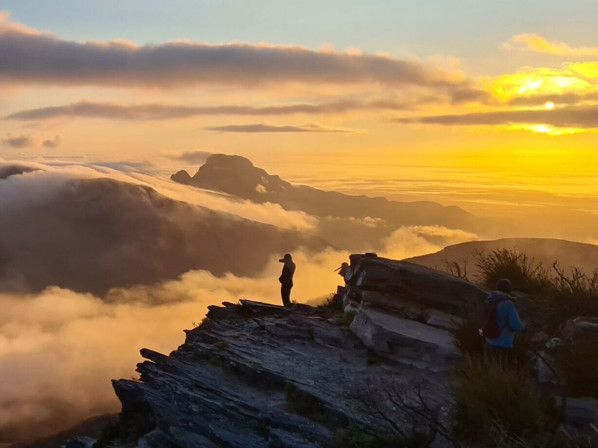
The King Jarrah Walk Trail is a strenuous 18km loop that winds through the scenic Murray River Valley. Once a transportation route of a vibrant timber industry, hikers can now immerse themselves in the jarrah forest, enjoy tranquil river views, and marvel at the 'King Jarrah', a majestic 250-year-old tree.

Trail difficulty
Trail difficulty
  • Length 18km
  • Est. time Half day
  • Dog friendly
  • Circuit / loop
Today

17°C

19°

15°

Earn badges and points by completing this trail.

Earn 3 Points Popular Trail

Trails WA supports the seven principles recommended by Leave No Trace Australia for minimising your impacts when using the trails.

Learn more

Read more about this trail

The King Jarrah Walk Trail begins at Nanga Mill Campground and offers a six-hour walk through the stunning jarrah forest.

This challenging walk provides scenic views of the Murray River Valley and can be undertaken in either direction. Expect steep sections on the western side. The highlight is the ‘King Jarrah’, a statuesque giant standing nearly 50 metres tall and over 2 metres wide.

Following the river for much of its length, the trail grants access to beautiful jarrah forests. Part of the trail utilises an old logging railway formation with cuttings and bridge sites crossing Dawn Creek. Look out for old reference trees, which were numbered to help foresters locate their position in the bush, and some old bridge stringers visible in the water.

If you're looking for a shorter adventure, then learn more about the King Jarrah Short Loop here.

This trail is part of the following destinations:

Dwellingup Trails and Visitor Centre

(08) 9538 1108

Other Links

Flora and Fauna Statistics

500+
Plant species
120+
Bird species
20+
Mammal species

Lane Poole Reserve is a 55,000-hectare conservation area near Dwellingup, Western Australia. It protects the largest remaining block of the northern Jarrah Forest, acting as a crucial sanctuary for approximately 500 native plant species and over 100 native wildlife species. 

The reserve's plant life is defined by its changing elevations, running from deep river valleys to high forest canopies. The forest is dominated by Jarrah and Marri trees. You will also spot Yarri (WA Blackbutt) in the lush valleys and Wandoo woodlands stretching across the drier eastern ridges. Bull Banksia, Sheoak, and the uniquely named Snottygobble are common understorey trees. In spring, the forest comes alive with colour, including orchids, grevilleas and bright acacias.

The dense swamp thickets hide a rare mainland population of the Quokka. Look closely in the undergrowth at dawn or dusk to spot the elusive Chuditch (Western Quoll), the Woylie (Brush-tailed Bettong), and the Western Ringtail Possum. A haven for birdwatchers, the reserve hosts over 120 bird species, inlcuding splendid fairy-wrens, red-tailed black cockatoos, grey fantails, and the elusive noisy scrub-bird. The Murray River weaves through the reserve, supporting native freshwater species like marron (freshwater crayfish), Western Pygmy Perch, as well as introduced species like rainbow trout.


Keep an eye out for these species:

Southwestern Brown Bandicoot

Isoodon fusciventer

Animalia: Mammalia

Conservation status: Priority 4: Rare, Near Threatened

P4

Red-tailed Black Cockatoo

Calyptorhynchus (Calyptorhynchus) banksii

Animalia: Aves

Scarlet Robin

Petroica (Petroica) boodang

Animalia: Aves

Western Splendid Fairy-wren

Malurus (Malurus) splendens splendens

Animalia: Aves

South-western Spotted Scrubwren

Sericornis (Sericornis) frontalis maculatus

Animalia: Aves

Short-beaked Echidna

Tachyglossus aculeatus

Animalia: Mammalia

Black-faced Kangaroo

Macropus fuliginosus melanops

Animalia: Mammalia

Slender Tree Frog

Litoria adelaidensis

Animalia: Amphibia

Silky Blue Orchid

Cyanicula sericea

Plantae: Equisetopsida

Common Clematis

Clematis pubescens

Plantae: Equisetopsida

Grasstree

Xanthorrhoea preissii

Plantae: Equisetopsida

Snottygobble

Persoonia elliptica

Plantae: Equisetopsida

River Banksia

Banksia seminuda

Plantae: Equisetopsida

Expand your trip Browse and book with great businesses nearby.

With many businesses in the local area, planning your trip has never been easier.

Paddy Pallin Perth

Perth

Australia's most experienced and trusted outdoor fitter since 1930

Waypoints Cafe

Dwellingup

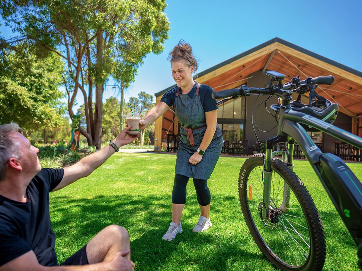
Waypoints Café serves tasty, seasonal food and drinks to nourish the active and adventurous. Overlooking the skate park, pump track, Hotham Valley train and shaded lawn you won't ever need to leave!

Want your business featured here?

We’re always looking to support local businesses and enrich the trailgoer experience.

Be trail ready

Here is everything you need to know before visiting this trail.

Time / Duration

5-6 hours return

Length

18km loop

Fees

National Park fees apply. Camping fees apply (optional).

Trail Access

The trail begins at Nanga Mill, 10.5km from the park entry along the Murray Valley Rd, 100km South of Perth

Trail Start

Nanga Mill Campground, 10.5 kilometres from the Lane Poole entry station, Murray Valley Road, 18km from Dwellingup

Get directions

Trail End

When to go

September to October for wildflower season

What’s the weather like?

Bush Walk

Class 4

Difficult trail with rough surface that may have very steep hills or extensive rock hopping. Directional signage may be limited. Bushwalking experience, navigation and emergency first aid skills, and good fitness required.

Additional information

Steep sections, rough track with many obstacles, limited signage, experienced bushwalkers only.

What To Pack

Safety

Be mindful of vehicles and bicycles as the trail intersects with the Munda Biddi Trail and the four-wheel drive Captain Fawcett Track.

Biodiversity

Keeping your dog safe. Dogs are allowed in the recreation area of Lane Poole Reserve but must be kept in control and on a leash at all times. The Department of Biodiversity, Conservation and Attractions undertakes 1080 baiting at this location to reduce the impacts of feral cats and foxes on native wildlife.

Meat baits containing 1080 poison are laid in or around this area on an ongoing basis. 1080 is poisonous to humans and will kill domestic cats and dogs. Please leave your pets at home or prevent them from entering this area.

For further information contact your local Parks and Wildlife Service office or visit Western Shield.

Facilities

If you plan to camp, make sure you are self-sufficient and have all the necessary equipment, food and water. Bookings at Nanga Mill cannot be made in advanced and is instead on a first in basis. Other sites at Lane Poole Reserve can be booked in advanced.

  • BBQ Facilities
  • Camping
  • Car Park
  • Public Toilet
  • Picnic Area

Trail information updated
15th August 2026

Today Aug 17, 12:48am

17°C

Feels like 16°C

Max 19°

Min 15°

Precipitation: 100%

Visibility: 10km

Wind: 7.18km/h N

Weather data provided by:

Complete this trail to earn badges and points!

Earn points and badges and become a "TrailsWA Expert" by completing trails and leaving reviews.

Earn 3 Points

Earn 3 points towards
your TrailsWA level

Popular Trail

Earn the Popular Trail badge when you complete this trail.

5 trail goers have rated this trail as 3.8 out of 5!

We love to hear from people who've been on our Western Australian trails, so it would be most appreciated it if you wanted to leave a review.

Jordan Brown

Reviewed 23 Mar 2025, 5:15pm

Really nice hike in the first section from the trail head to King Jarrah going from the West. At the King Jarrah it is not clear you should turn right (there is no trail marker), and that trail section until is currently very overgrown and feels similar to bush bashing nearly unfortunately. The second half of the hike is mainly along the munda biddi and partly on roads which is not a great hiking experience honestly.
Daniel Roworth

Reviewed 21 Aug 2021, 1:46pm

Tried this on Friday morning after heavy rain the previous evening. Started clockwise and the first half that follows 4WD access tracks was pleasant with early morning mist and occasional glimpses of the river. Just after the trail joins the Captain Fawcett track I reached the second \u201cstart\u201d point where the trail transitions to single track.

Unfortunately the undergrowth is overhanging the trail and within 100m I was soaked through due to the water still on the undergrowth from the previous evenings rain. Rather than pushing on and spending the next few hours pushing through wet brush I returned via the 4wd trail, falling just short of reaching the king jarrah.

I would not recommend this trail if the weather/vegetation is damp, it's too overgrown (at least from the far end). long sleeved shirts and pants are also recommended to avoid too many scratches from the vegetation.

Could do with a little clearing.
Joseph Andrin

Reviewed 2 Jan 2021, 7:07pm

WOW! Is all I kept saying to myself for the first few hours. This trail is amazing! I LOVE IT!

I went on a hot day, 35C, in January 2021. Not sure when the last bush fire was, but the trail was bursting with green and life. I saw an echidna (who didn't seem to care at all about my presence), and emu, loads of kangaroos, lots of birds. The landscape forever changed, from sparsely forested, to tight, tight, tight, to steep to flat. I hung out with a 300 year old tree, not a bad sort, taught me a lot about my silly behaviour and rushing around, then I rushed off.

The only reason I don't give this a 5 star is it's only the East side, the steep foot path bit around King Jarrah, that I thought was extraordinary. The rest of it is still AMAZING but the trail is on a vehicle road, so is wide and not a hiking specific trail. It just feel different. The bush was still amazing, the views were still great, but it feels so much nicer being on a tiny winding trail through the bush than a wide cleared space. Again, honestly, even that part is great, the forrest here is such a uniquely WA experience.

Enjoy. Oh and when you're on the wide trail, listen out for a running creek and see if you can get to it through the bush. It's only about 30cm deep in the summer but a great spot for a swim and cool off. Also, if heading in the summer I would recommend the mornings, wrapping up in the East bit (heading clockwise from Nanga) as that way you'll be in the cool of the forrest by the time you're done.

Also, it took me about 6 hours but I did it really slowly for my health and fitness. I'm 35 and strong as an ox, but I had quite a few long sits along the way.

Say hi to the King.
Gillian Groom

Reviewed 26 Mar 2018, 12:23pm

Really enjoyed the trail.
Went yesterday (March 25, 2018) on an unseasonably cool, overcast day and completed in 4.5 hrs with a 30 min lunch stop. I'll go slower next time as I know what to expect and hopefully in wildflower season.
I also went anticlockwise and got the climb out of the way first. The entire track was dry so no issue with slipping and sliding in mud. The down hill after the King Jarrah tree was super steep and a bit slippery.
Trail was in good shape, one section has a tree down but there are pink tapes tied to trees to re-orientate you to the trail. Some overgrown segments.
Trailmarkers- 20 of the green and white ones (heaps of yellow and black hiking person ones as well).
Really enjoyed the bush and trees, got down to the Murray. Lots of blackberries!
Saw absolutely no one else, not a single vehicle either.
Recommended.
Mark Dutton

Reviewed 5 Jul 2015, 9:57pm

Completed in just under 4.5hrs (5/July/2015). Weather was good for trail walk like this, nice and cool. Luckily no rain. I wouldn't take this on in Summer.
Probably do-able in under 4 hours if you don't stop to enjoy the scenery and help lost 4WDs.
Take note of the Grade 4 rating. The Western side of the track is rather steep at the North and South ends. The The valleys into Christmas brook and Dawn Creek are steep too but not as bad.
I had intended to walk the East side first as a warm up, then tackle the Western side. I'm glad I didn't. The ascent from Nanga Mill onto the first plateau is 170m and the inclination is murder. However, once you've done that the worst climb is out of the way.
The Western side is far more appealing imo as it's just a thin walk trail. Easily definable, and travelling through some amazing scenery. Very lush and green. Plenty of birds and some amazing fungi at this time of year.
Luckily I had no rain but the decent into Big Brook is slippery and slow going, Add some rain and it would be a tad dangerous.
Eastern side is flat compared with West side. It's rather dull too, basically a single lane 4WD track. Rather muddy after recent rains. Some worthwhile rest points when the road nears the Murray River that have some amazing watery scenery.

Overall: Expect a challenge. Do in Winter when cooler and brooks/creeks are flowing.
Again?: Yes, but only with another person(s). Definitely West then East

Like this trail? Explore others nearby

More around Perth & Surrounds

Supporters & Partners

Trails are free and offer countless benefits to our community, from fostering fun and fitness to encouraging social connection, exploration, and personal challenges. These exceptional trail experiences are made possible through the support and collaboration of these great organisations and initiatives: