Skip to Content Skip to Navigation Show Trail Map Show About the Trail Show Important Trail Details Read Trail Reviews

Your bookings

Deep River Loop Walk, Walpole-Nornalup NP

Trail difficulty
Trail difficulty
  • Length 4.2km
  • Est. time 1-3 hours
  • Circuit / loop
Today

13°C

27°

10°

Earn badges and points by completing this trail.

Earn 3 Points Bibbulmun Track

Trails WA supports the seven principles recommended by Leave No Trace Australia for minimising your impacts when using the trails.

Learn more

Read more about this trail

This trail goes through beautiful tingle and karri forest, descending down to the Deep River. Take the side trip to the summit of Mt Clare, where there are scenic views of the Walpole Wilderness. The trail then follows the Bibbulmun Track as it steeply winds it way down to Deep River. River reflections can be admired from the suspension bridge. After returning to Tinglewood Drive, this gravel road follows along the river before heading back uphill to the Mount Clare picnic area.

The Deep River suspension bridge is the entrance to the Walpole Wilderness area. The Walpole Wilderness area embraces seven National Parks, Forest Conservation Areas and Nature Reserves, totaling 363,000 hectares, including areas of classified wilderness.  About 20,000 hectares within the Walpole Wilderness area are classified as 'wilderness'.

Walpole-Nornalup Visitor Centre

(08) 9840 1111

Other Links

Be trail ready

Here is everything you need to know before visiting this trail.

Time / Duration

Up to 2 hours

Length

4.2km loop

Elevation

Steep descent down to river and ascent back up to carpark

Fees

National Park Fees

Trail Access

Road 2WD

Trail Start

Mount Clare car park, Tinglewood Drive. Walpole-Nornalup National Park, 400km (5hours) south of Perth

Get directions

Trail End

Get directions

When to go

March to November

What’s the weather like?

Bush Walk

Class 4

Difficult trail with rough surface that may have very steep hills or extensive rock hopping. Directional signage may be limited. Bushwalking experience, navigation and emergency first aid skills, and good fitness required.

Additional information

This walk has limited directional signage and a good level of fitness is required.

What To Pack

Prohibited items

No pets or fires

Facilities

There is a Bibbulmun Track campsite on Mt Clare, accessible only by foot.

  • Car Park
  • Picnic Area
  • Public Toilet

Today Apr 11, 1:12am

13°C

Feels like 12°C

Max 27°

Min 10°

Precipitation: 0%

Visibility: 10km

Wind: 2.84km/h SE

Weather data provided by:

Complete this trail to earn badges and points!

Earn points and badges and become a "TrailsWA Expert" by completing trails and leaving reviews.

Earn 3 Points

Earn 3 points towards
your TrailsWA level

Bibbulmun Track

Earn the Bibbulmun Track badge when you complete this trail.

2 trail goers have rated this trail as 3.5 out of 5!

We love to hear from people who've been on our Western Australian trails, so it would be most appreciated it if you wanted to leave a review.

Chelle Fisher

Reviewed 6 Jun 2022, 6:59pm

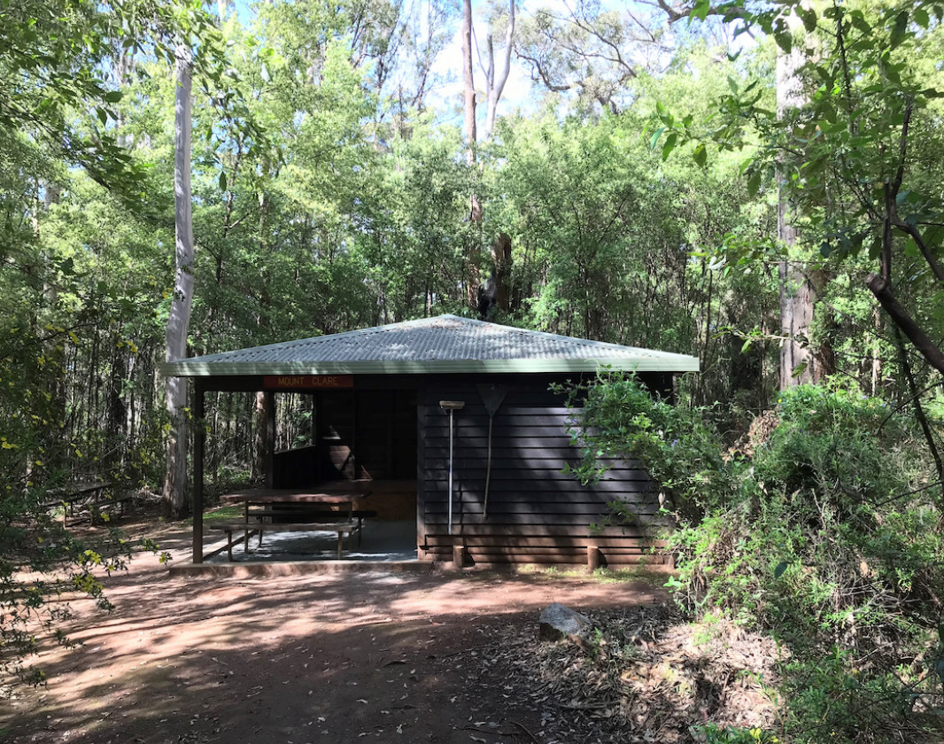
A beautiful walk through the Karri & Tingles. Mount Clare Summit has no views so a bit of a let down but was nice to visit another Bibbulmun Track Hut. The trail down to the suspension bridge is steep and when wet pretty slippery so some care is needed. Of course what goes down must come up, after a nice flat walk across the bottom it's back up a steep 4wd track back to the picnic area.
Drew Graham

Reviewed 17 Dec 2020, 10:42am

There are no views from this trail other than a glimpse through the trees of the ocean and the surrounding wilderness if the short spur trail is taken to the summit of Mt Clare.

Walking anti-clockwise, the section of the Bibbulmun Track down hill from the Mt Clare hut to Deep River is steep, narrow and winding through dense forest undergrowth. I expect it would be slippery when wet. The small suspension bridge over Deep River at the bottom of the descent is a nice attraction and marks the half way point of the loop.

The third quarter of the walk is along a flat, unsealed road which affords a more open view of the Karri forest than the enclosed Bibbulmun section.

The final quarter of the loop through the forest back to the carpark is up a steep, unsealed road.

I enjoyed this walk. It's a loop with a variety of trail conditions and forest experiences. Walk it clockwise instead if you wish to experience the ascent on Mt Clare.

Like this trail? Explore others nearby

More around South West

Supporters & Partners

Trails are free and offer countless benefits to our community, from fostering fun and fitness to encouraging social connection, exploration, and personal challenges. These exceptional trail experiences are made possible through the support and collaboration of these great organisations and initiatives: