Moderate trail that may have short steep hills, rough surface, many steps or some rock hopping. Directional signage. Some bushwalking experience and moderate fitness required.
Built in the 1930's, the Contour Channel in Banyowla Regional Park was created to carry water from Canning Dam to the metro area. The trail is mostly flat following the contour of the hills, however there are two steep sections where the channel was siphoned in to pipes to convey the water to the other side of the valley. Located just 30 minutes drive south of the Perth CBD, the trail offers great views, an abundance of wildflowers during the months of August to November and an insight into some interesting local history.
About Contour Channel Walk, Banyowla Regional Park
The Contour Channel walk follows a series of man-made concrete channels and steel and cast-iron pipelines along the contours of the Darling Scarp through Roleystone and Kelmscott. The project was a Depression era public works scheme and constructed, mostly by manual labour, between July 1935 and December 1936 to carry potable water from just below Canning Dam through the hills to a pumping station near Gosnells by following the natural contours of the Canning Valley and scarp - hence it was entirely gravity-fed. The channel supplied drinking water to the metropolitan area of Perth from 1940 to 1975. The walk trail passes through forests of Marri and Flooded Gums and offers great views over Perth City and the Swan Coastal Plain. The area nearer to Canning Mills Road has a rich and diverse range of wildflowers from July to November. Kangaroos and Black cockatoos can often be seen throughout the woodlands here.
Moderate trail that may have short steep hills, rough surface, many steps or some rock hopping. Directional signage. Some bushwalking experience and moderate fitness required.
Complete Contour Channel Walk, Banyowla Regional Park to earn badges and points!
Earn points and badges and become a "TrailsWA Expert" by completing trails and leaving reviews.
Earn 2 points towards your TrailsWA level
Earn the
Wildflower Wanderer
badge when you complete this trail.
1 trail goers have rated Contour Channel Walk, Banyowla Regional Park as 3 out of 5!
We love to hear from people who've been on our Western Australian trails, so it would be most appreciated it if you wanted to leave a review.
Add your review of Contour Channel Walk, Banyowla Regional Park
Andrew Priest rated Contour Channel Walk, Banyowla Regional Park a 3 out of 5
Andrew Priest
Reviewed 27 May 2023, 5:14pm
It is an enjoyable walk with some history thrown in. It is not marked so it is important to download the KML file for use in your preferred bushwalking app. I use Locus Maps on Android and it did the track.
Trails are free and bring so many benefits to our community by providing opportunities to have fun, get fit, socialise, explore and challenge yourself. But they also have to be managed and maintained which only is made possible through terrific sponsors, donations and/or volunteering.
MWhite
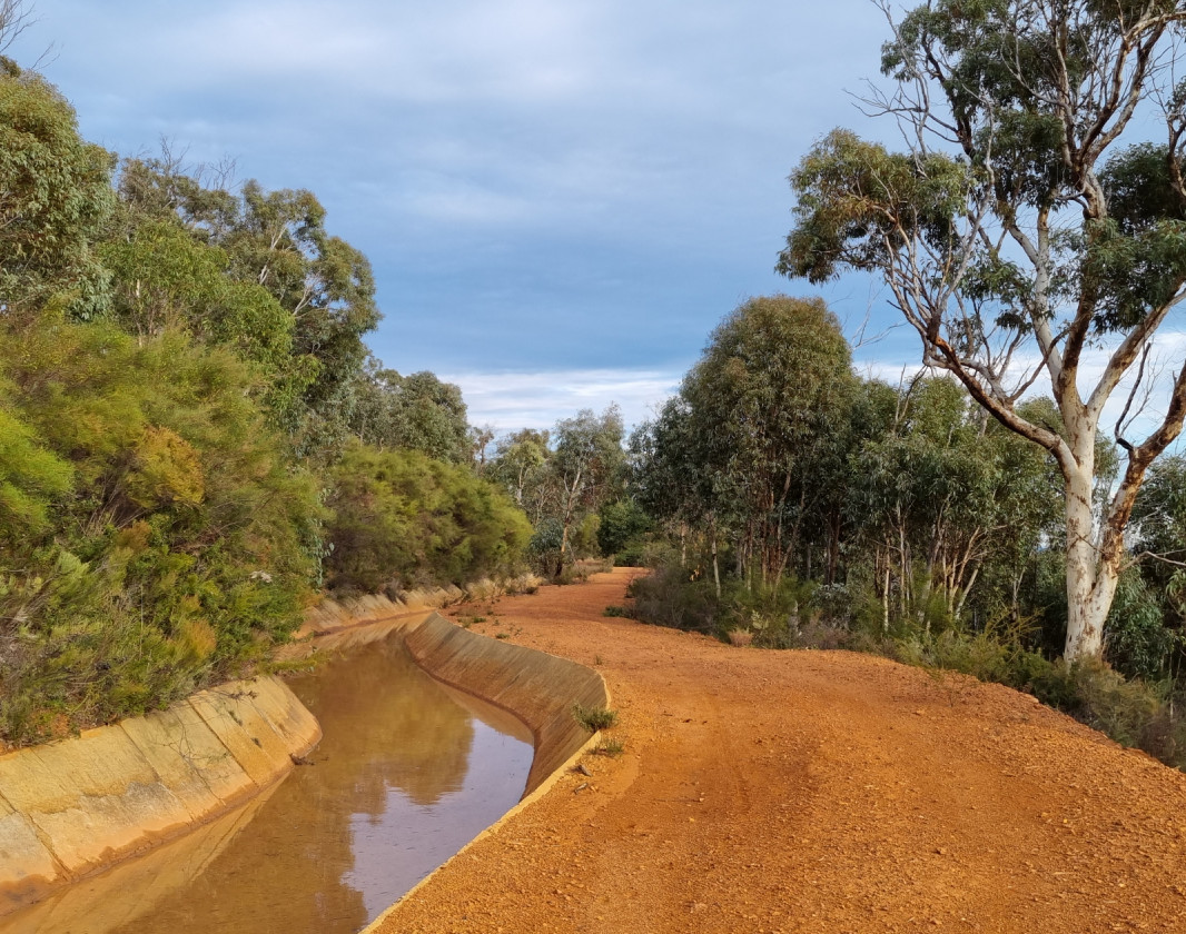
Contour Channel
A concrete section of the Canning Contour Channel.
MWhite
City view, Contour Channel Walk
MWhite
Pipeline
Pipeline used to siphon water from one section of the Channel to the next across the valley.
MWhite
Contour Channel
Part of the old Contour Channel
MWhite
Wildflowers in July
View 5 Photos
of Contour Channel Walk, Banyowla Regional Park
Upload your photo of Contour Channel Walk, Banyowla Regional Park
Report a Problem
You are reporting a problem for Contour Channel Walk, Banyowla Regional Park. Please be as detailed as possible to help us appropriately identify and address the issue.
Please sign in or join up
Join Trails WA
Join trails wa to add this trail to your favourite. By joining you will also be able to rate and review trails and share your photos with other trail goers!