Skip to Content Skip to Navigation Show Trail Map Show About the Trail Show Important Trail Details Read Trail Reviews
Support Our Trails

Echidna Walk - Churchman's Bushland Trails Echidna Walk - Churchman's Bushland Trails

  • Half day
  • 9 km
    • Bush Walk Class 4

      Difficult trail with rough surface that may have very steep hills or extensive rock hopping. Directional signage may be limited. Bushwalking experience, navigation and emergency first aid skills, and good fitness required.

Located in the northern end of the Wungong Regional Park in Roleystone approximately 30 minutes south of the Perth CBD, the Churchman's Bushland Echidna Walk trail is approx 9kms of trail with some steep inclines. Starting in Jarrah forests the trail rises following the Canning River up through the valley towards Churchman Brook, before veering sharply off up the hill towards the Rock Climbing Crag.

A challenging but very rewarding walk. Scenery along the trail consists of rolling pastures, bushland, rocky outcrops and stands of Marri, Yarri, Jarrah and Flooded Gums.

Echidna Trail Churchman Bushland P H A V C 1
Earn 2 Points
Logo for Leave no Trace Initiative

Trails WA supports the seven principles recommended by Leave No Trace Australia for minimising your impacts when using the trails.

Learn more

A walk through Moondyne Joe country... legend has it that Moondyne Joe's cave is located in this park, though it's exact location is unknown.
Part of the Churchman's Bushland trail network, the Echidna Walk is a stunningly diverse walk trail, starting in Jarrah forest and climbing high up the scarp leading to excellent views over the valley and the city before returning back along the Canning River Valley. 

As you reach the top of a rise, the trail veers sharp right, with a hook - back on itself, off the main track. Small orange triangles appear on dead trees either side of the track signalling this direction change and can be easily missed. See Points of Interest for details and picture of trail.
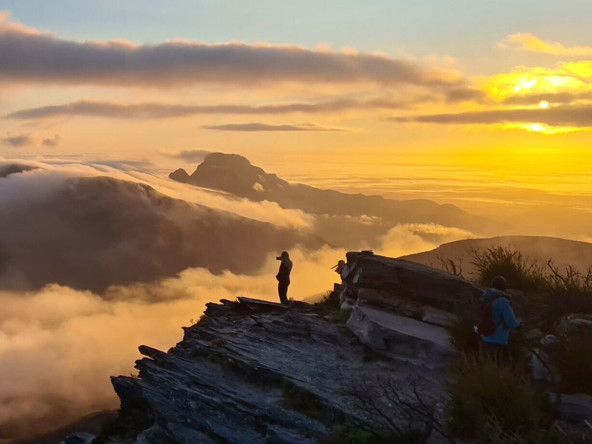
The climb from Stocker Road is very steep, finishing with a bang. The trail leads up to The Wall - a superb natural wall of Dolerite, some 140 metres long and 30 metres high also known as the Churchman Brook Rockclimbing Crag - before looping up to the top of the hill with superb scenery and views along the way.

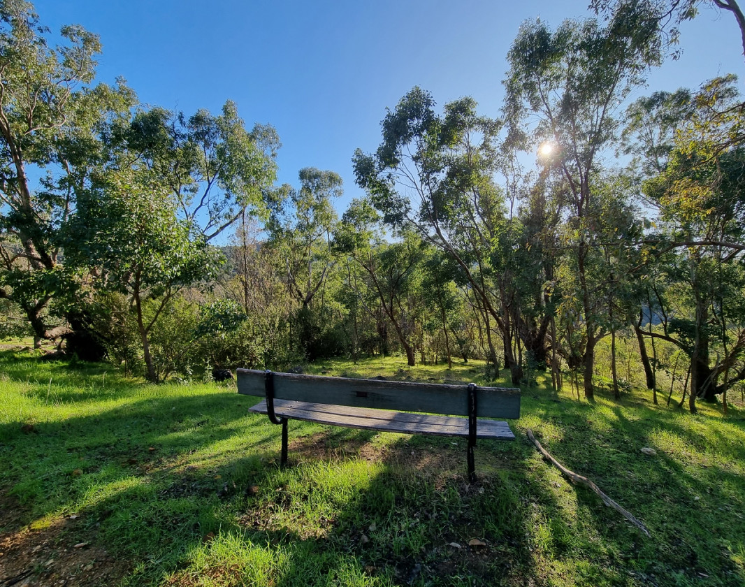
There are seats at some lookout points to enjoy the views or just catch your breath.
It is possible to shorten this walk, returning back down along the Emu Trail. The Emu trail runs down hill at the western end of the old airstrip.

Churchman's Bushland is named after Captain Churchman who owned the parcel of land in 1831. The west side of the park offers breathtaking views of the City, whilst the eastern side follows Churchman's Brook up the valley and affords a lovely vista of the Canning River Valley and Roleystone. 

Visit Armadale

Welcome to Whadjuk Noongar country, where the Perth Hills meet the Swan Coastal Plain.
Hike amongst majestic Jarrah and Marri woodlands, rich with wildlife, wildflowers and history. 
Stroll along ancient gorges, follow cultural trails and take in sweeping valley views. Picnic beneath forest canopies and beside stunning bushland pools.
Hikers and mountainbikers, challenge yourself along winding bush trails inviting you to explore and reconnect with nature. Come and discover for yourself these hidden gems just outside the city.


Explore Armadale
Visit Armadale

Perth Hills Armadale Visitor Centre

(08) 9394 5410

Other Links

Expand your trip and enjoy great businesses nearby

Off The Beaten Track WA

Off The Beaten Track WA (OTBT) is Perth’s leading premier Hiking Experience & Adventure Tour operator, providing guests with over 70 safe, fun, inclusive experiences in a fully supported environment.

Photo of Off The Beaten Track WA

Be trail ready for Echidna Walk - Churchman's Bushland Trails

Here is everything you need to know before visiting this trail.

Time / Duration

3 - 4 hours

Length

9km return

Elevation

Steep trail - elevation gain 372 metres

What To Pack

Group B - Hiking & Long Distance Trails (Bushwalks and/or longer trails) required.

Trail Start

Stocker Road, Roleystone

Get directions

Trail End

Bush Walk

Class 4

Difficult trail with rough surface that may have very steep hills or extensive rock hopping. Directional signage may be limited. Bushwalking experience, navigation and emergency first aid skills, and good fitness required.

Visit Trail Tips for further information.

Difficulty Notes

Very steep sections - up to 1.5kms of hill climb
Few trail markers available
Suitable for experienced hikers only
Sections of loose gravel

Hazards & Warnings

Avoid using the trail on days deemed high or extreme fire danger.
Snakes can be active in this area during the warmer months (August through to April).
Rockfall risk around Rockclimbing Crag - do not proceed past Rockfall Risk sign.

Safety

Beware of unstable and falling rocks near Rockclimbing wall.

Facilities

Unsealed steep and uneven bush walk trails.

  • Car Park
  • Dog Friendly
  • Lookouts

Best time of year

Best for wildflowers during September to November

Trail Access

Access by road or bus 241 from Kelmscott Train Station. Alight bus on Brookton Highway near Stocker Road. Walk down to end of Stocker Road to commencement of walk trail.

Edge shaped like mountain horizon
topography pattern

Complete Echidna Walk - Churchman's Bushland Trails to earn badges and points!

Earn points and badges and become a "TrailsWA Expert" by completing trails and leaving reviews.

Earn 2 Points

Earn 2 points towards
your TrailsWA level

Edge shaped like mountain horizon
Alt text

1 trail goers have rated Echidna Walk - Churchman's Bushland Trails as 4 out of 5!

We love to hear from people who've been on our Western Australian trails, so it would be most appreciated it if you wanted to leave a review.

Profile photo for Stacey Spencer
Stacey Spencer

Reviewed 11 Sep 2022, 3:12pm

The uphill section from the main track to the top is very overgrown with very thick shrubs and low overhanging bushes basically have to push your way through. Steps from the rock are very high and overgrown so not for the faint hearted. The view from the top is unreal and I felt it was well worth the tough climb. The remainder is downhill with some sections very gravely and slippery. In my opinion it is one of the tougher trails due to the overgrown vegetation.
Give it a go

Like this trail? Explore others nearby

More around Perth & Surrounds

Supported by great organisations

Trails are free and bring so many benefits to our community by providing opportunities to have fun, get fit, socialise, explore and challenge yourself. But they also have to be managed and maintained which only is made possible through terrific sponsors, donations and/or volunteering.

topography pattern