Western Rosella
Platycercus (Violania) icterotis
Animalia: Aves
Your bookings
Koi Kyenunu-ruff, Goreng & Menang Noongar Country
This is the traditional Aboriginal name and country for the Stirling Range.
Bluff Knoll is located in the Stirling Range National Park, 4.5 hours south of Perth and 1.5 hours from Albany on the south coast.
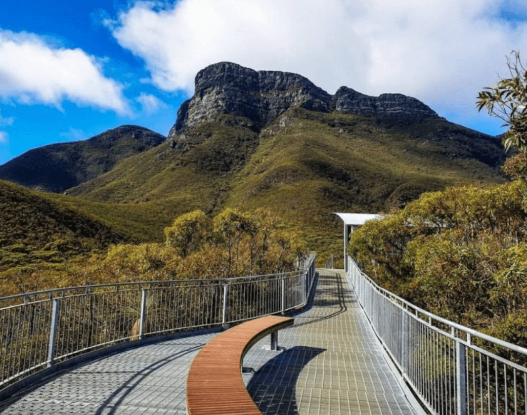
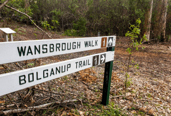
This 6.8km return, Grade 4 trail is well signed and takes you to the top of Bluff Knoll, 1098 metres above sea level, via a steep path with numerous steps to negotiate.
The views from the summit are spectacular and worth the effort to get there.
Part of Stirling Range National Park network
Earn badges and points by completing this trail.
Trails WA supports the seven principles recommended by Leave No Trace Australia for minimising your impacts when using the trails.
Learn moreRead more about this trail
Bluff Knoll is the most popular trail in the Stirling Range NP. Starting from the southern end of the Bluff Knoll car park the trail drops down to a creek, before taking you across a mountain saddle with amazing views over the ridge to the south coast.
From here the trail turns left and follows the ridge all the way to the summit, where you will be rewarded with stunning 360 degree views over the surrounding countryside.
The lower slopes are covered with eucalypt, banksia and grass trees. Over 1000 species of flowering plants thrive within the park including Mountain Bells and the Queen of Sheba Orchid.
It is often much colder and windier at the summit and conditions can change rapidly, so check the weather forecast and go prepared with a warm jacket.
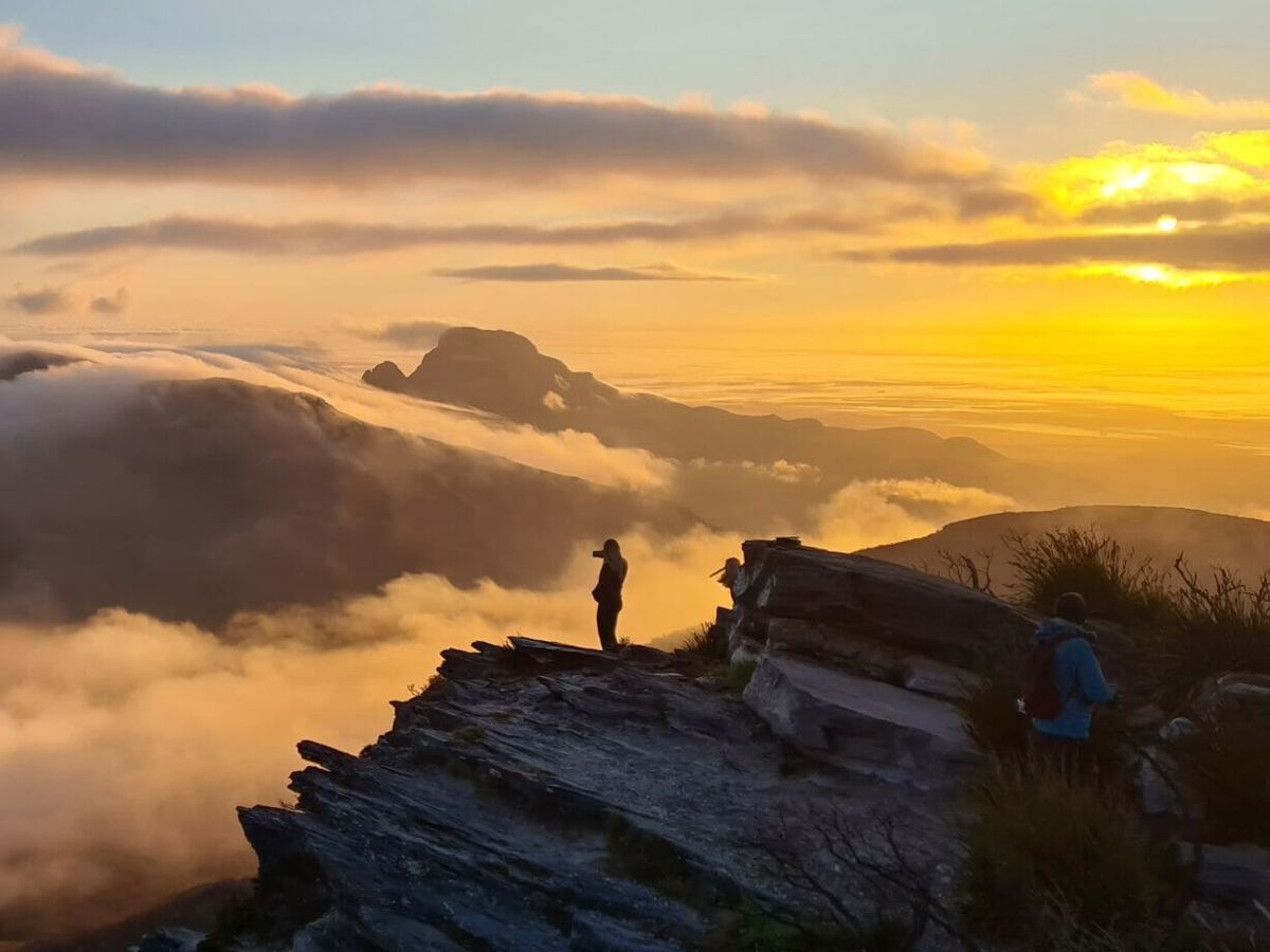
Sunrise and sunset hikes are very popular and if you are lucky you may witness the amazing cloud waterfall that is common in these ranges.
Visit the Explore Parks website for details of other walks in the area.
(08) 6820 3700
Comprehensive information on the South West region including destinations, things to see and do, accommodation and tours.
Stirling Range is also known by its Aboriginal name - Koi Kyenunu-ruff – meaning ‘misty mountains’, owing to the unusual cloud formations that often wreath the higher peaks.
Koi Kyenunu-ruff is part of the traditional country of the Menang and Goreng Noongar people, who have lived in and around the mountains for thousands of years. The surrounding plains and valleys provided important food resources, with women gathering roots, seeds and fruits while men hunted kangaroos, wallabies and other native animals.
Traditionally, Noongar families moved seasonally through the landscape, building small shelters and adapting to the cooler mountain climate by wearing kangaroo skin cloaks.
Following European settlement, much of the surrounding land was cleared for farming and grazing and families were displaced from much of their traditional land. Despite this, Noongar people have maintained strong cultural connections to the Stirling Range, which remains a place of ongoing cultural and spiritual significance today.
Bluff Knoll
Bluff Knoll holds deep cultural and spiritual importance for Noongar people. Depending on language and interpretation, the mountain is known as Bular Mial or Bola Mia, names often translated as “many eyes” or “his eyes”. These names are linked to the belief that the rocks and formations on the mountain resemble faces watching across the landscape.
The peak is frequently wrapped in cloud and mist, especially during cooler weather. For Noongar people, these swirling mists were believed to represent the presence of Noatch, a powerful spiritual being associated with the mountain.
Today, Bluff Knoll remains a place of strong cultural significance and respect for Aboriginal people throughout the south-west, reflecting thousands of years of connection to country, story and tradition.
Aboriginal cultural content on this page has been developed with information sourced from Department of Biodiversity, Conservation and Attractions’ publications. It may not represent all knowledge or perspectives of Aboriginal people.
The Stirling Range National Park is known for its staggering range of wildflowers - more than 1,000 different species, some of which are found no where else.
Located in WA's Great Southern region, the Stirling Range National Park is an internationally recognized biodiversity hotspot. It is home to over 1,000 species of flowering plants - many found nowhere else on Earth. This diverse habitat provides vital refuge for a wide array of native mammals, invertebrates, and abundant birdlife.
The park is home to five major vegetation communities – thicket and mallee-heath on the higher ground, and woodlands, wetlands and salt lake communities on the lower slopes and plains. The higher elevations and cooler, misty conditions allow unique plants to thrive. The park is the exclusive home to several species of the iconic, brilliantly colored Mountain Bells (Darwinia). Over 128 orchid species bloom here, including vibrant varieties like the Cowslip, Purple Enamel, and hard to find Queen Sheba Orchid. Banksias, Dryandras, and Eucalypts, and feather flower species are prolific. Carnivorous plant varieties like the Albany Pitcher Plant (and localized sundews) can be found in moist, nutrient-poor, boggy areas. During spring the park is a breathtaking garden of wildflowers.
This diverse habitat creates a perfect shelter for many mammals, birds and reptiles, including the Western Grey Kangaroo, Western Pygmy Possum, Tammar Wallaby, and various dunnarts. The range hosts nearly 150 bird species, such as the endangered Carnaby’s Black Cockatoo, Emus, Wedge-tailed Eagles, Splendid Fairy-wrens, and Western Spinebills. Reptiles such as bobtails, monitor lizards, and venomous snakes (dugites and tiger snakes) are also native to the park.
Rising dramatically above the plains of Western Australia’s Great Southern region, Koi Kyenunu-ruff (the Stirling Range) is one of the most distinctive mountain landscapes in Australia. For visitors today, the trails within the range offer more than spectacular views and challenging hikes. Every cliff face, rocky summit and folded ridgeline is part of a geological history stretching back hundreds of millions of years.
Koi Kyenunu-ruff owes its existence to immense tectonic forces that shaped the southern edge of Australia. When the supercontinent – Gondwana – broke apart into what is now Australia and Antarctica, a valley developed. As this low point developed, many layers of sedimentary rock were pushed ‘up’ to form a series of hills and mountains known as ‘rift shoulders’.
The range sits on the southern margin of the Yilgarn Craton — one of the oldest pieces of continental crust on Earth. South of the range lies the Albany–Fraser Orogen, a vast belt of deformed rocks formed between 1,200 and 1,400 million years ago.
Unlike the nearby Porongurup Range, which is made of granite, Koi Kyenunu-ruff is composed mainly of ancient sedimentary rocks including sandstone and shale. These sediments were originally laid down in the coastal shallows of an ancient sea, likely in a river delta environment. Over time, the sediments were buried, compressed and altered into the hard rocks seen today.
Evidence of this ancient environment can still be found throughout the range. Ripple marks and bedding layers preserved in the rocks reveal the movement of water and sediment long before the mountains existed.
The rocks of Koi Kyenunu-ruff have attracted scientific interest for many years. The Stirling Range Formation is now generally understood to be around 2.0 to 1.8 billion years old, preserving evidence of an ancient shoreline environment shaped by storms, longshore currents and tidal currents.
Fossil-like impressions found in the rocks have been compared with ancient jellyfish-like forms, but their age and interpretation have been the subject of scientific debate. These findings continue to reshape scientific understanding of the range’s deep geological history.
If we fast forward to around 55 million years ago, during the Eocene period, when sea levels were much higher than present levels, the peaks of Koi Kyenunu-ruff may have resembled a small archipelago. At that time, the shoreline extended close to the southern edge of the range.
The geology of Koi Kyenunu-ruff strongly influences its soils, vegetation and walking experience. Along many slopes, a layer of clay-rich soil slows the movement of water through the ground. These moist conditions can favour the spread of Phytophthora dieback disease, one of the park’s major environmental threats.
The most developed soils occur on valley floors where water collects and conditions are more fertile. This variation in soils and moisture creates a remarkable diversity of plant communities across the park, contributing to the Stirling Range’s reputation as one of Western Australia’s biodiversity hotspots.
Australia's most experienced and trusted outdoor fitter since 1930
Rest, relax and restore at Chimes Spa Retreat with panoramic views over the Wilson Inlet and a picturesque coastline. Stay in one of our ten luxurious suites, explore the cosy corners in our tranquil gardens and soothe your senses at the Chimes Day Spa. Close to the Denmark town centre, several eateries and wineries, Chimes Spa Retreat is the perfect stay to explore the Great Southern.
Off The Beaten Track WA (OTBT) is an award-winning, inclusive hiking and adventure tour business that takes guests beyond the ordinary to discover the awe-inspiring beauty and hidden gems of Western Australia. From the coral coastlines of Exmouth to the rugged wilderness of Esperance and everything in between, our carefully crafted tours showcase the incredible diversity of landscapes, wildlife...
Here is everything you need to know before visiting this trail.
3 - 4 hours
6.8km return
Entry fees to Stirling Range National Park
Road, bus or air to Albany. Road to Stirling Range.
Bluff Knoll car park, Stirling Range National Park, 100km (1 Hour) north-east of Albany, which is 400km (5 hours) south of Perth
Class 4
Difficult trail with rough surface that may have very steep hills or extensive rock hopping. Directional signage may be limited. Bushwalking experience, navigation and emergency first aid skills, and good fitness required.
Group B - Hiking & Long Distance Trails (Bushwalks and/or longer trails)
Weather can change quickly. Always take a warm jumper or jacket with you. The trail surface is a combination of bitumen, gravel and rock, so caution is advised.
No pets permitted. Camping is not allowed in the carpark or anywhere on the mountain/trail.
Information shelters
11°C
Feels like 11°C
Max 15°C
Min 9°C
Earn points and badges and become a "TrailsWA Expert" by completing trails and leaving reviews.
Earn 2 points towards
your TrailsWA level
Earn the Bluff Knoll , Tall Peak , and Popular Trail badges when you complete this trail.
This trail is part of the Stirling Range Peaks badge.

We love to hear from people who've been on our Western Australian trails, so it would be most appreciated it if you wanted to leave a review.
Trails are free and offer countless benefits to our community, from fostering fun and fitness to encouraging social connection, exploration, and personal challenges. These exceptional trail experiences are made possible through the support and collaboration of these great organisations and initiatives:
Join trails wa to add this trail to your favourite. By joining you will also be able to rate and review trails and share your photos with other trail goers!
Sign in to your account to add this trail to your list of favourites, and much more.