Skip to Content Skip to Navigation Show Trail Map Show About the Trail Show Important Trail Details Read Trail Reviews
Support Our Trails

Mt Chudalup Summit Walk Trail, Northcliffe Mt Chudalup Summit Walk Trail, Northcliffe

  • Less than 1 hour
  • 2 km
    • Bush Walk Class 3

      Moderate trail that may have short steep hills, rough surface, many steps or some rock hopping. Directional signage. Some bushwalking experience and moderate fitness required.

Situated 16 km south of Northcliffe just off the Windy Harbour Road.  Mount Chudalup towers over the surrounding karri forest. The climb to the top of this 185 metre granite dome is steep in places but well worth the effort.

The view from Mount Chudalup
Earn 2 Points
Logo for Leave no Trace Initiative

Trails WA supports the seven principles recommended by Leave No Trace Australia for minimising your impacts when using the trails.

Learn more

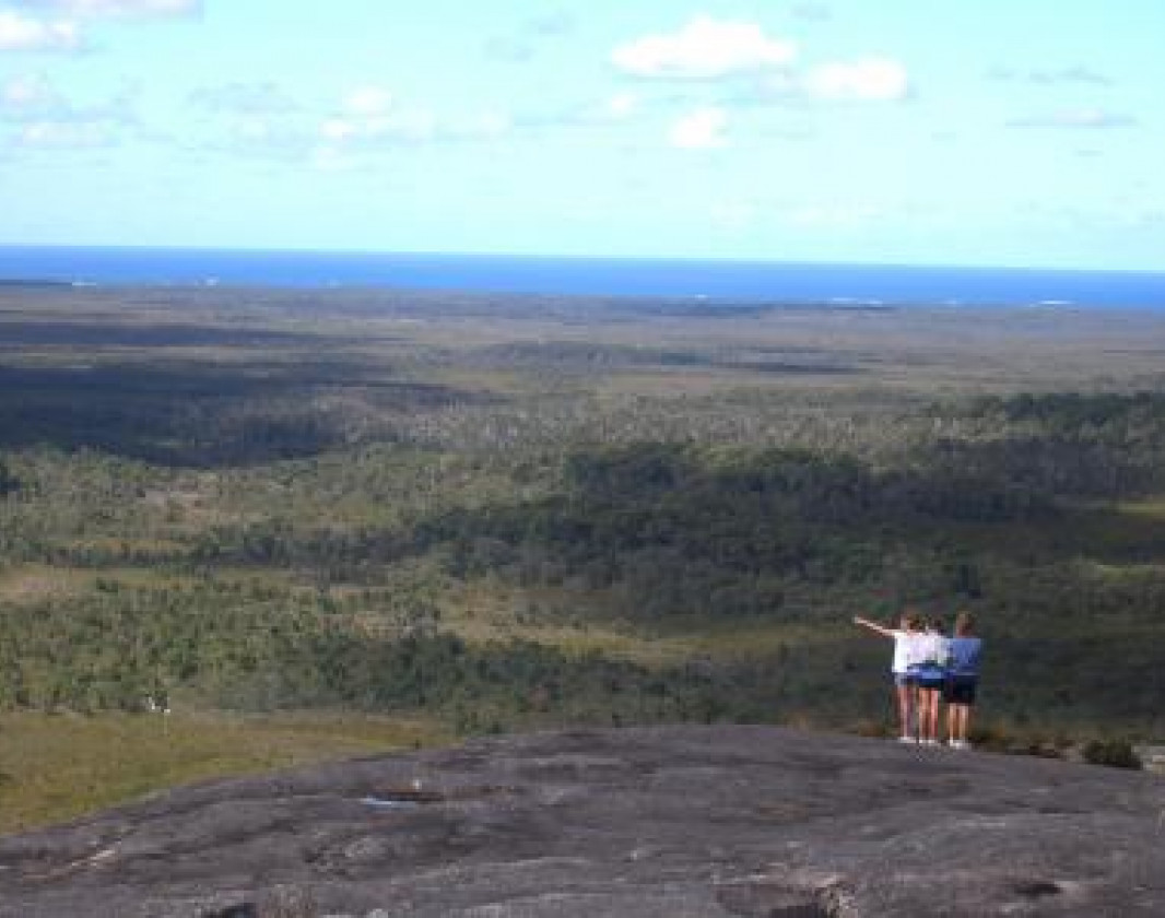
Mt Chudalup is a 187m high granite outcrop in the D'Entrecasteaux National Park, on the way to Windy Harbour 16km south of Northcliffe.

Mt Chudalup, known as a monadnock, rises abruptly from the surrounding sedge and heathlands. This massive block of granite is fringed by Karri and Marri forest. The summit offers magnificent 360 degree views of the surrounding D'Entrecastreaux National Park and the coast beyond.

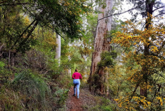
The best way to experience the fantastic views over the National Park and beyond is to take the Summit Walk Trail which leaves the picnic shelter at the carpark and leads up through karri and marri forest which gives way to peppermints, grass trees, snottygobbles, banksias and sheoaks.

One you reach the top of Mount Chudalup, you can enjoy sweeping views of the coast and surrounds, including the Meerup and Doggerup Dunes, the Southern Ocean, D’Entrecasteaux National Park and the Shannon Forest.

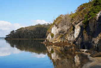
From the top you can see also the patterns of the land that give D’Entrecasteaux National Park its unique character.  It is a transition between the coastal belt and the tall forests.  Continuous lashing by the Southern Ocean winds has created an extensive sand dune system.  These coastal dunes have blocked the flow of streams and creeks trying to empty into the ocean.  Over time this has created a chain of lakes and wetlands extending from the Broke Inlet in the south to Lake Jasper (the largest freshwater lake in the south-west) north-west of Mount Chudalup.

Once you reach the granite section, look out for the amazing diversity of mosses and lichens. This granite outcrop is home to 42 species of moss, 28 species of lichen and 6 species of liverwort. They are an integral part of the complex ecosystem that exists on this "granite island".

Be aware that the granite can be slippery in wet weather and there are steep drop offs on the summit.

Other Links

Be trail ready for Mt Chudalup Summit Walk Trail, Northcliffe

Here is everything you need to know before visiting this trail.

Time / Duration

40 minutes return

Length

2km return

What To Pack

Group B (Bushwalks and/or longer trails) required.

Trail Start

Mount Chudalup car park in D’Entrecasteaux National Park which is 16 km south of Northcliffe on the Windy Harbour Road.

Get directions

Trail End

Mount Chudalup

Get directions

Bush Walk

Class 3

Moderate trail that may have short steep hills, rough surface, many steps or some rock hopping. Directional signage. Some bushwalking experience and moderate fitness required.

Visit Trail Tips for further information.

Difficulty Notes

Steep in sections. The peak of Mount Chudalup has dangerous sheer faces. Exercise caution at all times – especially in windy weather.

Hazards & Warnings

The peak of Mount Chudalup has dangerous sheer faces. Exercise caution at all times – especially in windy weather.

Facilities

  • BBQ Facilities
  • Car Park
  • Coach Parking
  • All accessible parking
  • Picnic Area
  • Public Toilet
  • Shaded Area
  • Sheltered Area
  • All accessible toilet facilities

Best time of year

All year round

Fees

National Park fees

Trail Access

Drive or bus to Northcliffe then drive from Northcliffe 16km to Mt Chudalup.

Prohibited Items

No pets
Edge shaped like mountain horizon
topography pattern

Complete Mt Chudalup Summit Walk Trail, Northcliffe to earn badges and points!

Earn points and badges and become a "TrailsWA Expert" by completing trails and leaving reviews.

Earn 2 Points

Earn 2 points towards
your TrailsWA level

Edge shaped like mountain horizon
Alt text

1 trail goers have rated Mt Chudalup Summit Walk Trail, Northcliffe as 4 out of 5!

We love to hear from people who've been on our Western Australian trails, so it would be most appreciated it if you wanted to leave a review.

Sarah Meredith

Reviewed 19 Apr 2022, 2:11pm

Really nice and simple hike to the top. There is some scrambling over rocks at the end (two different sections) that are a little steep. Most kids would be able to do this, but be careful once at the top, due to the the cliff edges. There's no protection at the top, so be sure to have sun and wind protection with you!

Like this trail? Explore others nearby

More around South West

Supported by great organisations

Trails are free and bring so many benefits to our community by providing opportunities to have fun, get fit, socialise, explore and challenge yourself. But they also have to be managed and maintained which only is made possible through terrific sponsors, donations and/or volunteering.

topography pattern