Skip to Content Skip to Navigation Show Trail Map Show About the Trail Show Important Trail Details Read Trail Reviews
Support Our Trails

Bunker Bay Loop, Dunsborough Bunker Bay Loop, Dunsborough

  • 1-3 hours
  • 3.6 km
    • Bush Walk Class 3

      Moderate trail that may have short steep hills, rough surface, many steps or some rock hopping. Directional signage. Some bushwalking experience and moderate fitness required.

This 3.6 kilometre walk lies at the tip of Cape Naturaliste near Dunsborough.  It offers superb cliff top views and has the option to drop down to Shelley Cove at the eastern end.

Take a tour of Cape Naturaliste Lighthouse
Earn 2 Points
Logo for Leave no Trace Initiative

Trails WA supports the seven principles recommended by Leave No Trace Australia for minimising your impacts when using the trails.

Learn more

Cape Naturaliste is the northernmost point of the Leeuwin-Naturaliste Ridge. Visitors can explore the coastal scenery by taking short walks along the established board walks and lookouts.

Follow the path from the lighthouse buildings which initially is shared with the Lighthouse Loop. The Bunker Bay Loop can then be walked in either a clockwise or anticlockwise direction.

The Bunker Bay walk leads to the cliff edge revealing breathtaking views of the coast. This walk demonstrates the three distinctive types of vegetation on the Cape; woodland in sheltered areas near Bunker Bay, wind-pruned Marri growing higher on the ridge, and coastal heath. The viewing platform overlooking Shelley Cove near Bunkers Bay offers a superb resting site with distant views of Geographe Bay.

The cliffs along the north eastern coast are limestone, but you can also see the basement of much older granite rocks exposed along the shorelione.

Other trails from the lighthouse include:

Whale Lookout Walk Trail
Distance: 2.4km (return)  Class: 2

Cape Naturaliste to Sugarloaf Rock Walk
Distance 3.5km Class: 3

Cape Naturalist Track
Distance 4km Class 2

Margaret River Visitor Centre

(08) 9780 5911

Other Links

Be trail ready for Bunker Bay Loop, Dunsborough

Here is everything you need to know before visiting this trail.

Time / Duration

1.5 hours

Length

3.6km loop

What To Pack

Group B (Bushwalks and/or longer trails) required.

Trail Start

Cape Naturaliste Lighthouse, end of Cape Naturaliste Road, 270km (3 hours) south of Perth

Get directions

Trail End

Bush Walk

Class 3

Moderate trail that may have short steep hills, rough surface, many steps or some rock hopping. Directional signage. Some bushwalking experience and moderate fitness required.

Visit Trail Tips for further information.

Facilities

The Lighthouse has a small museum that’s free to visit, and the tearooms which are a pleasant place to have lunch or a snack at the beginning or end of your walk.
  • Cafe
  • Car Park
  • Coach Parking
  • Interpretive Centre
  • Kiosk
  • Lookouts
  • All accessible parking
  • Picnic Area
  • Public Toilet
  • Shaded Area
  • Sheltered Area
  • Shop
  • All accessible toilet facilities
  • View Platform
  • Visitor Information Centre

Best time of year

September- April

Fees

Trail Access

Road 2WD

Prohibited Items

No pets permitted
Edge shaped like mountain horizon
topography pattern

Complete Bunker Bay Loop, Dunsborough to earn badges and points!

Earn points and badges and become a "TrailsWA Expert" by completing trails and leaving reviews.

Earn 2 Points

Earn 2 points towards
your TrailsWA level

Edge shaped like mountain horizon
Alt text

3 trail goers have rated Bunker Bay Loop, Dunsborough as 4.33 out of 5!

We love to hear from people who've been on our Western Australian trails, so it would be most appreciated it if you wanted to leave a review.

Annique Lee

Reviewed 13 Aug 2021, 3:45pm

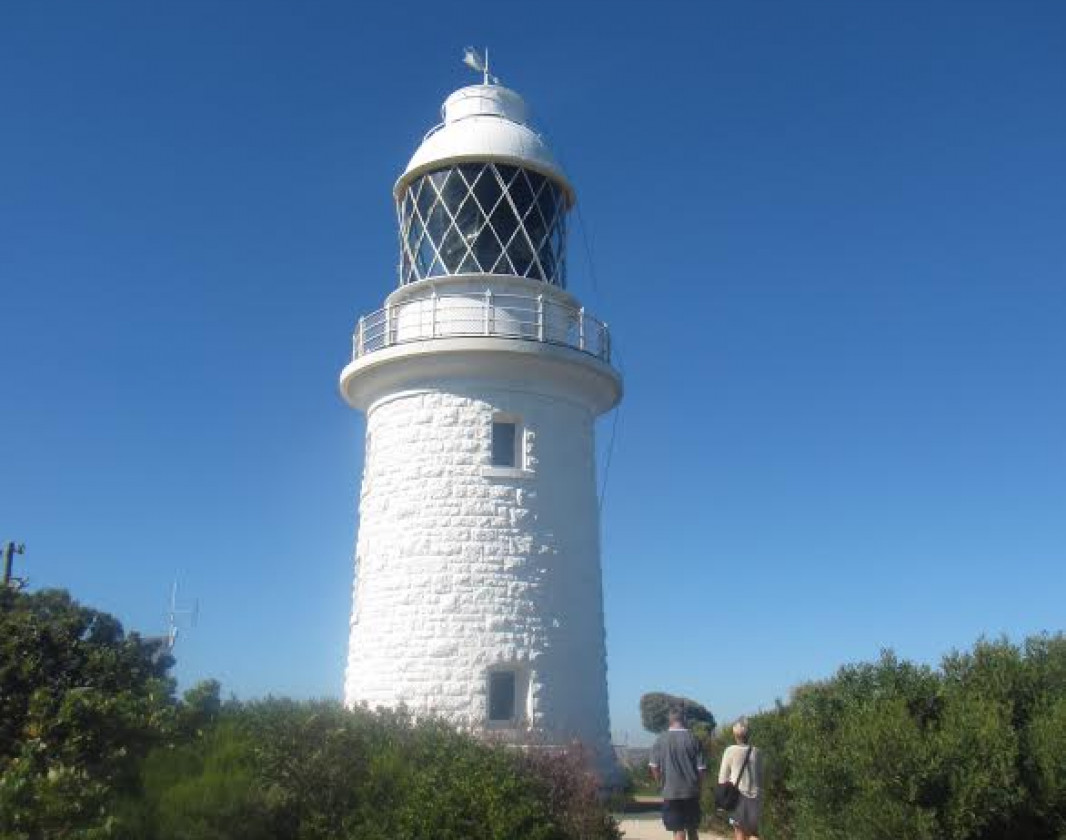
I completed this hike today, weather was not bad, just the occasional drizzle. I parked at the Cape Naturalist car park and headed to the last car park where I began the hike. You can also start at the left side of the pathway from the car park as you enter the shops and cafe. Anyway, the trail was fairly easy, some steep decline with rocks jutting out so it is a matter of being careful as you step in some areas, I headed down to the Shelley Cove platform, stunning! Heading back up I came across the beautiful sea caves along the cliff, breathtaking. I ended up by diverting and joining the Lighthouse Loop. I finished off my hike with a beautiful turmeric latte and a lovely scone at the lighthouse cafe.
Puja Fjeldstad

Reviewed 30 Apr 2020, 9:25pm

Beautiful views and good challenging terrain but the flies bothered my partner quite a bit.
Dave Reid

Reviewed 25 Jun 2018, 10:13am

The trail head is easy to miss. It is diagonally across the RV carpark currently marked by an orange bollard.
Pleasant easy walk that takes you down to the cliff edge lookout. We spent half an hour watching the seals basking on the rock and a mob in the water floating with their fins raised. The track is a bit rough in places and easy to stumble. This track also joins up with the Lighthouse loop that takes you back to the main carpark and the start of the Cape-to-Cape trail.
Finished off with a beer at the Eagle Bay Brewing Company.

Like this trail? Explore others nearby

More around South West

Supported by great organisations

Trails are free and bring so many benefits to our community by providing opportunities to have fun, get fit, socialise, explore and challenge yourself. But they also have to be managed and maintained which only is made possible through terrific sponsors, donations and/or volunteering.

topography pattern